Old Maps of Meeker County, Minnesota for Genealogy
Trace your family roots with 133 historic maps of Meeker County. These high-res maps reveal old neighborhoods, homesites, landmarks, and streets — helping you uncover where your ancestors lived and how the area evolved over time.
- Explore historic neighborhoods: Identify where your relatives may have lived in the 1800s or 1900s.
- Compare maps over time: Trace the changes in streets, buildings, and landmarks for multi-generational research.
- Perfect for genealogy & ancestry research: Used by family historians and researchers to map out lineage and migration.
These maps are an incredible resource for exploring your personal connection to Meeker County's past.
Meeker County, MN maps
(133)- 1953 Map of New Ulm, 1968 Print
 1953 New Ulm1968 Print · USGSSouthern Minnesota in the mid-1950s is defined by its deep river valleys and the expanding reach of the Great Northern and Chicago and North Western railroads. Researchers can trace rural lineages through landmarks like the Milford State Monument, St. John's Ch, and the Upper Sioux Indian Res.3 unique versions available
 - 1953 Map of Saint Cloud, 1968 Print
 1953 Saint Cloud1968 Print · USGSCentral Minnesota's lake country and the Mississippi River valley are caught in a period of steady mid-century growth. Researchers can trace historic rail lines, old granite works, and local landmarks like St. Johns University, Camp Ripley, and the shores of Lake Minnewaska.3 unique versions available
 - 1956 Map of Atwater, 1958 Print
 1956 Atwater1958 Print · USGSMid-century Kandiyohi County is defined here by its lakeland geography and its dependence on the Great Northern railroad. Researchers can trace dozens of rural landmarks, from the Union Cemetery at Atwater to numerous local schoolhouses like School No 78 and School No 44.2 unique versions available
 - 1957 Map of Saint Cloud
 1957 Saint Cloud1957 Print · USGSCentral Minnesota's lake country and rail corridors are meticulously detailed in the mid-1950s. Genealogists and researchers can trace the growth of towns like Alexandria, Willmar, and Saint Cloud along the Great Northern railroad line.
 - 1957 Map of New Ulm
 1957 New Ulm1957 Print · USGSCentral Minnesota in the mid-fifties remains a landscape of river-valley commerce and prairie agriculture defined by its historic mission sites and rail towns. Genealogists and local historians can trace the development of New Ulm and Montevideo, or locate specific landmarks like the Milford State Monument and Minnesota Falls.
 - 1957 Map of Olivia, 1959 Print
 1957 Olivia1959 Print · USGSRenville and Kandiyohi Counties are shown during the late fifties, defined by a dense grid of farm roads and competing rail lines. Genealogists can locate family landmarks like Christina Cem, St Johns Ch, and the village of Olivia.
 - 1958 Map of New Ulm
 1958 New Ulm1958 Print · USGSSouth-central Minnesota’s river valleys and prairie towns are captured here in the mid-fifties, during the height of the region's rail-and-river economy. Genealogists and historians can trace the legacy of the Upper Sioux Indian Mission or locate early rail stops along the Chicago and North Western Ry in towns like Redwood Falls and Glencoe.
 - 1958 Map of Saint Cloud
 1958 Saint Cloud1958 Print · USGSCentral Minnesota in the mid-1950s shows a landscape of growing regional hubs and hundreds of glacial lakes connected by an extensive rail network. Genealogists and historians can trace the early footprints of Saint Cloud, Alexandria, and Willmar along the Great Northern Railway.
 - 1958 Map of Dassel, 1959 Print
 1958 Dassel1959 Print · USGSMeeker and Wright counties are shown here in the late 1950s, a period when rural schoolhouses and family churches still dotted the prairie. You can trace the Great Northern rail line through Dassel or find old family sites at Ostmark Ch and Maynard Lake Sch.2 unique versions available
 - 1958 Map of Hutchinson, 1959 Print
 1958 Hutchinson1959 Print · USGSHutchinson and the surrounding McLeod County townships are captured here in the late fifties at a height of rail-driven agricultural activity. Genealogists can trace family footprints through numerous rural landmarks like Zion Ch, Stahl Lake Sch, and the Immanuel Sch Cem.
 - 1967 Map of New Ulm
 1967 New Ulm1967 Print · USGSSouthern Minnesota in the mid-fifties is captured here as a landscape of river-valley missions and busy prairie rail towns. Researchers can trace the Yellow Medicine Trail and locate historic sites like the Morton Indian Mission and Milford State Monument.
 - 1967 Map of Grove City, 1968 Print
 1967 Grove City1968 Print · USGSThe village of Grove City thrives along the Great Northern rail corridor in the late sixties. Genealogists can locate family landmarks like Bethlehem Cem, Burr Oak Cem, and the Marshall Sch among the numerous lakes of the Meeker County prairie.
 - 1967 Map of Litchfield South, 1968 Print
 1967 Litchfield South1968 Print · USGSMeeker County is shown in the late sixties as a thriving network of lakefront settlements and rural school districts. Genealogists and local historians can trace family locations near landmarks like Ness Ch, Beckville, and the Minnie-Belle Sch.3 unique versions available
 - 1967 Map of Litchfield North, 1968 Print
 1967 Litchfield North1968 Print · USGSMeeker County in the late sixties centers on the growing city of Litchfield and its surrounding wetlands. Genealogists and local historians can trace the town's footprint through the Great Northern rail line, Calvary Cem, and St Phillips Sch.3 unique versions available
 - 1967 Map of Lake Koronis, 1968 Print
 1967 Lake Koronis1968 Print · USGSThe Lake Koronis area at the Stearns and Meeker county line shows a landscape defined by resort living and rural education in the late 1960s. Researchers can trace the grounds of the Lake Koronis Assembly Ground, find the Ebenezer Ch, and locate numerous historic rural schoolhouses.2 unique versions available
 - 1967 Map of Cedar Mills, 1968 Print
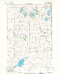 1967 Cedar Mills1968 Print · USGSThe Meeker County prairie in the late 1960s was a landscape of rail-connected villages and lakeside wildlife areas. Genealogists can trace rural roots through landmarks like Spring Grove Cem, St Johns Ch, and the small settlement of Corvuso.
 - 1967 Map of Rosendale, 1968 Print
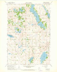 1967 Rosendale1968 Print · USGSMeeker County in the late sixties reveals a prairie landscape transitioning into a complex system of glacial lakes and wetlands. Local researchers can locate community anchors like Arndahl Ch or trace the early boundaries of the Acton State Wildlife Management Area.
 - 1967 Map of Watkins, 1968 Print
 1967 Watkins1968 Print · USGSWatkins and the surrounding central Minnesota prairies are captured here in the late sixties, showing the vital link provided by the Soo Line railroad. Genealogists and local historians can trace rural education at School No 1140 or locate the shoreline of Clear Lake and Island Lake.
 - 1967 Map of Cosmos, 1968 Print
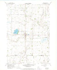 1967 Cosmos1968 Print · USGSThe town of Cosmos and its surrounding agricultural townships are captured here in the late sixties, just as the regional drainage network was fully established. Genealogists and historians can trace rail-side developments along the Chicago and North Western or locate family sites near Peace Cem and Thompson Lake.
 - 1967 Map of Hawick, 1969 Print
 1967 Hawick1969 Print · USGSThe rural landscape of Kandiyohi County is captured here in the late sixties, where the railroad town of Hawick sits amidst a web of glacial lakes. Local historians can locate vanished landmarks like School No 812 and the Roseville Cem or trace the early course of the Middle Fork Crow River.
 - 1967 Map of Kimball, 1969 Print
 1967 Kimball1969 Print · USGSThe village of Kimball and the surrounding prairie lakes are captured here in the late sixties as the region balanced agriculture with growing recreation. Researchers can trace the Soo Line corridor and locate local landmarks like the Drive-in Theater and St Annes Cem.2 unique versions available
 - 1967 Map of Eden Valley, 1969 Print
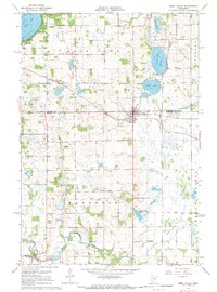 1967 Eden Valley1969 Print · USGSThe Minnesota prairie and lake country around the Stearns and Meeker county line is captured here in the late sixties. Genealogists can trace family footprints across numerous rural landmarks, including the Old Eden Lake Cem, Rice Lake Sch, and the community of Manannah.
 - 1982 Map of Dassel
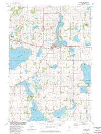 1982 Dassel1982 Print · USGSDassel and the surrounding Minnesota lake country are captured here in the early 1980s as the rail and agricultural economy shaped the region. Researchers can locate family landmarks like Steelsville Cem or trace the shoreline developments of Lake Washington and Collinwood Lake.
 - 1982 Map of Forest City
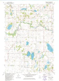 1982 Forest City1982 Print · USGSMeeker County's river valleys and prairie lakes are captured here in the early eighties as the rural landscape of Forest City remained deeply rooted in its local parishes. Genealogists and local historians can locate St Gertrude Ch, the West Kingston Mission, and family landmarks near Richardson Lake.
 - 1982 Map of Darwin
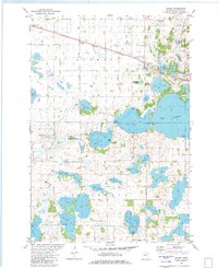 1982 Darwin1982 Print · USGSMeeker County is captured in the early eighties as a hub of lakeside living and rail transit near the village of Darwin. Genealogists and local historians can trace family sites at St Johns Cem, St Peters Ch, and the rural Townhall near Mud Lake.
Showing maps 1-25 of 133
Top cities of Meeker County
- Litchfield historical maps
- Dassel historical maps
- Watkins historical maps
- Greenleaf historical maps
- Forest City historical maps
- Manannah historical maps
See more
Frequently asked questions
- What are the different types of historical maps available for Meeker County?
- What is the oldest map of Meeker County?
- Where can I purchase historical maps of Meeker County for my home or office?
- Where can I download high-res historical maps of Meeker County?
- Are there historical topographic maps available for Meeker County?
- Is there historical aerial imagery available for Meeker County?
- Where are historical maps of Meeker County sourced from?