2020s Maps of Isle, Minnesota
Explore 2 historic maps of Isle from the 2020s. These maps offer a rare glimpse into what life looked like during the 2020s — showing old roads, neighborhoods, homes, and landmarks that have changed or disappeared over time.
Whether you're researching your family's past, planning a metal detecting trip, or studying how Isle's landscape evolved across the 2020s, these high-resolution maps are a powerful tool for exploring the history of this region.
- Focus on a specific era: All maps on this page are from the 2020s, giving you a focused view of this time period.
- See what’s changed: Compare century-old streets, trails, and buildings to today's modern landscape using overlays and satellite layers.
- Research with precision: Use these maps for genealogy, historical research, land use analysis, or educational projects.
- View, download, or print: Maps are fully viewable online in high resolution, and can be downloaded or printed for your own records.
Start exploring Isle's history through authentic maps from the 2020s. This is your window into the past.
Isle, MN maps
(2)- 2022 Map of Isle, 2022 Print
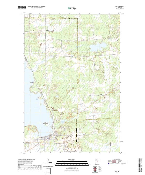 2022 Isle2022 Print · USGSThe southeastern shore of Mille Lacs Lake and the town of Isle are captured here in a period of modern transition. Trace the path of the Soo Line South: Aitkin Trl or locate family roots at Faith Lutheran Cem, Redtop Cem, and Holden Cem.
 - 2022 Map of Isle SW, 2022 Print
 2022 Isle SW2022 Print · USGSMille Lacs and Kanabec counties meet in this wetland landscape during the early 2020s. Genealogists and local historians can trace the meandering Knife River and Little Ann River alongside rural routes like Old Hwy 66 and Co Rd 15.
End of results
Showing maps 1-2 of 2
Top cities near Isle
Frequently asked questions
- What are the different types of historical maps available for Isle?
- What is the oldest map of Isle?
- Where can I purchase historical maps of Isle for my home or office?
- Where can I download high-res historical maps of Isle?
- Are there historical topographic maps available for Isle?
- Is there historical aerial imagery available for Isle?
- Where are historical maps of Isle sourced from?