Old Maps of Cushing, Minnesota
Explore 13 old maps of Cushing, spanning from 1948 to today. These high-resolution historic maps reveal how streets, neighborhoods, landmarks, and natural features evolved over time — perfect for genealogy, metal detecting, research, and local history exploration.
What you can do with these maps:
- See how Cushing changed over time: Compare historical maps to modern-day views to trace roads, homesites, rail lines & more.
- View detailed metadata: Each map includes creators, publishers, year, scale, and archive source.
- Overlay maps with satellite & LiDAR: Visualize the past alongside modern tools to explore terrain & human change.
- Trusted historical sources: Maps sourced from the USGS, Library of Congress, and other archives.
- Access maps your way: View online, download high-res files, or order prints for personal or research use.
Start exploring old maps of Cushing to uncover forgotten places, hidden landmarks, and the deep history beneath your feet.
Cushing, MN maps
(13)- 1948 Map of Cushing, 1972 Print
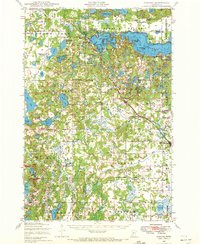 1948 Cushing1972 Print · USGSThe post-war lake country of Morrison and Todd counties comes to life in this mid-century survey, revealing a landscape of small lakeside settlements and one-room schoolhouses. Researchers can trace the roots of rural communities through dozens of local landmarks like Cushing, Betesta Church, and Willis School.2 unique versions available
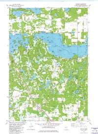
 - 1950 Map of Cushing
 1950 Cushing1950 Print · USGSMorrison and Todd counties come alive in the postwar years, showing a landscape of small farming communities and a vast network of glacial lakes. Genealogists can trace family roots through numerous rural landmarks like Randall Cemetery, Zion Church, and over twenty numbered country schools.
 - 1953 Map of Brainerd, 1966 Print
 1953 Brainerd1966 Print · USGSCentral Minnesota's lake country and iron ranges are detailed in the mid-fifties, showing the intersection of industry and wilderness. Researchers can locate specific local landmarks like the Crow Wing County Courthouse or trace the early paths of the Soo Line Railroad and the Cuyuna Range Iron Mines.3 unique versions available
 - 1957 Map of Brainerd
 1957 Brainerd1957 Print · USGSNorth-central Minnesota's lake-rich landscape is captured in the mid-1950s as a crossroads of rail, river, and forest. Genealogists and historians can trace the paths of the Great Northern and Soo Line railroads through hubs like Brainerd, Wadena, and Detroit Lakes.
 - 1958 Map of Brainerd
 1958 Brainerd1958 Print · USGSCentral Minnesota in the late fifties is a landscape of dense lake chains, rail hubs, and sprawling state forests. Genealogists and local historians can trace old property alignments near the Mississippi River or locate family sites in Brainerd, Little Falls, and Detroit Lakes.
 - 1965 Map of Brainerd
 1965 Brainerd1965 Print · USGSNorth-central Minnesota in the mid-fifties presents a complex landscape of sprawling lake systems and established rail corridors. Genealogists and historians can trace the growth of timber towns along the Northern Pacific RR and explore early borders of the White Earth Indian Reservation or Tamarac National Wildlife Refuge.
 - 1981 Map of Cushing, 1982 Print
 1981 Cushing1982 Print · USGSThis central Minnesota lake country in the early eighties shows a landscape shaped by water and rail. Researchers can locate family roots at Scandia Valley Cem or trace the Burlington Northern line through Cushing and past Fish Trap Lake.
 - 1986 Map of Brainerd
 1986 Brainerd1986 Print · USGSCentral Minnesota's lake country and river junctions are captured here in the mid-1980s. Genealogists and historians can trace the Burlington Northern line through Staples or locate family sites near Brainerd State Hospital and Gull Lake.2 unique versions available
 - 2010 Map of Cushing, 2010 Print
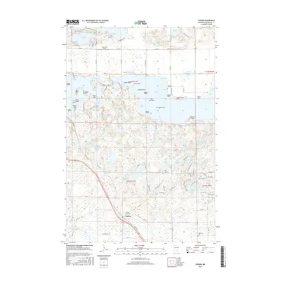
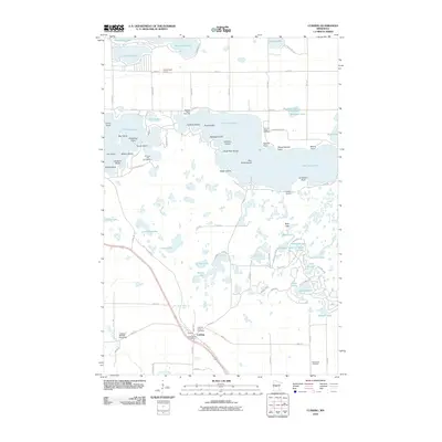 2010 Cushing2010 Print · USGSCovers Cushing, including Morrison County, United States, and other nearby areas
 - 2013 Map of Cushing, 2013 Print
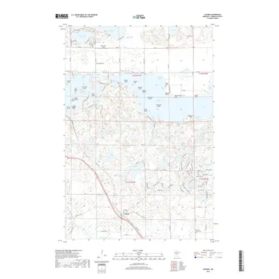
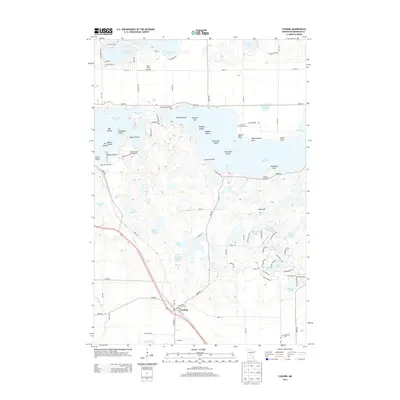 2013 Cushing2013 Print · USGSCovers Cushing, including Morrison County, United States, and other nearby areas
 - 2016 Map of Cushing, 2016 Print
 2016 Cushing2016 Print · USGSCovers Cushing, including Morrison County, United States, and other nearby areas
 - 2019 Map of Cushing, 2019 Print
 2019 Cushing2019 Print · USGSCovers Cushing, including Morrison County, United States, and other nearby areas
 - 2022 Map of Cushing, 2022 Print
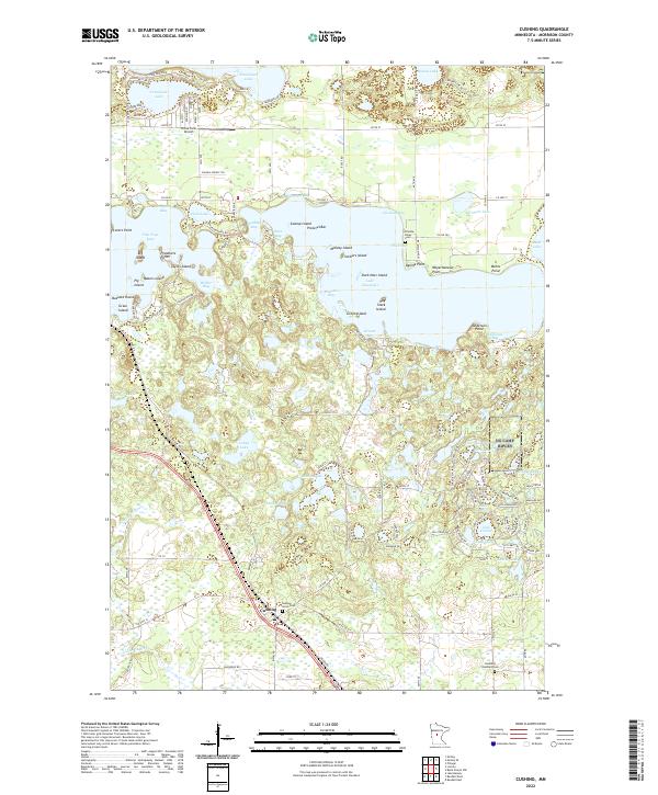 2022 Cushing2022 Print · USGSCushing and the surrounding Scandia Valley appear here in the early twenty-first century, showing a landscape defined by its glacial lakes and rural infrastructure. Researchers can locate Cushing Union Cemetery, the BNSF Railway corridor, and prominent landmarks like Weyerhaeuser Point on Lake Alexander.
End of results
Showing maps 1-13 of 13
Top cities near Cushing
- Little Falls historical maps
- Sylvan historical maps
- Motley historical maps
- Randall historical maps
- Pillager historical maps
- Flensburg historical maps
See more
Frequently asked questions
- What are the different types of historical maps available for Cushing?
- What is the oldest map of Cushing?
- Where can I purchase historical maps of Cushing for my home or office?
- Where can I download high-res historical maps of Cushing?
- Are there historical topographic maps available for Cushing?
- Is there historical aerial imagery available for Cushing?
- Where are historical maps of Cushing sourced from?