Old Maps of Nicollet County, Minnesota for Genealogy
Trace your family roots with 115 historic maps of Nicollet County. These high-res maps reveal old neighborhoods, homesites, landmarks, and streets — helping you uncover where your ancestors lived and how the area evolved over time.
- Explore historic neighborhoods: Identify where your relatives may have lived in the 1800s or 1900s.
- Compare maps over time: Trace the changes in streets, buildings, and landmarks for multi-generational research.
- Perfect for genealogy & ancestry research: Used by family historians and researchers to map out lineage and migration.
These maps are an incredible resource for exploring your personal connection to Nicollet County's past.
Nicollet County, MN maps
(115)- 1951 Map of Mankato West, 1952 Print
 1951 Mankato West1952 Print · USGSMankato and the river valleys of Blue Earth County are captured here in the early fifties during a period of steady post-war growth. Researchers can trace rural life through the Old Grist Mill, dozens of numbered schoolhouses, and landmarks like Minneopa Falls or Good Thunder.3 unique versions available
 - 1953 Map of Morgan, 1955 Print
 1953 Morgan1955 Print · USGSRedwood and Brown Counties are shown at their agricultural peak in the early fifties, anchored by the rail hub at Morgan. Genealogists and historians can trace dozens of rural schoolhouses and country churches like Brookville Church or Immanuel Church.
 - 1953 Map of Saint Paul, 1964 Print
 1953 Saint Paul1964 Print · USGSThe Twin Cities and the Mississippi River valley are captured here at a mid-century turning point. Trace the early growth of Minneapolis and Saint Paul alongside landmarks like Lake Minnetonka and the St Croix River.4 unique versions available
 - 1953 Map of New Ulm, 1968 Print
 1953 New Ulm1968 Print · USGSSouthern Minnesota in the mid-1950s is defined by its deep river valleys and the expanding reach of the Great Northern and Chicago and North Western railroads. Researchers can trace rural lineages through landmarks like the Milford State Monument, St. John's Ch, and the Upper Sioux Indian Res.3 unique versions available
 - 1957 Map of New Ulm
 1957 New Ulm1957 Print · USGSCentral Minnesota in the mid-fifties remains a landscape of river-valley commerce and prairie agriculture defined by its historic mission sites and rail towns. Genealogists and local historians can trace the development of New Ulm and Montevideo, or locate specific landmarks like the Milford State Monument and Minnesota Falls.
 - 1958 Map of New Ulm
 1958 New Ulm1958 Print · USGSSouth-central Minnesota’s river valleys and prairie towns are captured here in the mid-fifties, during the height of the region's rail-and-river economy. Genealogists and historians can trace the legacy of the Upper Sioux Indian Mission or locate early rail stops along the Chicago and North Western Ry in towns like Redwood Falls and Glencoe.
 - 1959 Map of Saint Paul
 1959 Saint Paul1959 Print · USGSThe Twin Cities and southeastern Minnesota appear here in the late fifties, showing the peak of the rail era and post-war suburban growth. Genealogists can trace family footprints near Lake Minnetonka, the Univ Of Minn Rosemount Research Center, or the growing neighborhoods of Richfield.2 unique versions available
 - 1964 Map of Bernadotte, 1965 Print
 1964 Bernadotte1965 Print · USGSSibley and Nicollet Counties are captured here in the mid-sixties, showing a landscape defined by prairie agriculture and drainage engineering. Researchers can trace rural cemetery sites, the crossroads at Bernadotte, and the winding South Branch Rush River.
 - 1964 Map of New Ulm, 1965 Print
 1964 New Ulm1965 Print · USGSThe river confluence at New Ulm was a hub of education and industry in the mid-sixties. Genealogists and researchers can trace the city's development through landmarks like Martin Luther College, the Hermann Monument, and the Lutheran Cemetery.2 unique versions available
 - 1964 Map of Sleepy Eye NW, 1965 Print
 1964 Sleepy Eye NW1965 Print · USGSThe Minnesota River valley in the 1960s reveals a landscape of historic frontier defense and quiet agricultural persistence. Researchers can trace the grounds of Fort Ridgely State Park, find the Golden Gate Cem, and locate rural landmarks like St Johns Ch.
 - 1964 Map of Courtland, 1965 Print
 1964 Courtland1965 Print · USGSThe village of Courtland and the intricate shoreline of Swan Lake are meticulously detailed during the mid-sixties. Researchers can locate family heritage sites like Brighton Cem, Swan Lake Ch, and the Chicago and North Western rail line.
 - 1964 Map of Essig, 1965 Print
 1964 Essig1965 Print · USGSThe rural prairie of Brown County is captured here in the mid-1960s, centered on the railroad siding of Essig. Researchers can trace old family landmarks like Marti Cem, the Milford Monument, and several numbered rural schoolhouses scattered between the river bluffs.2 unique versions available
 - 1964 Map of Lafayette, 1965 Print
 1964 Lafayette1965 Print · USGSThe town of Lafayette and the surrounding prairie are captured here in the mid-sixties as a landscape shaped by rail and drainage. Researchers can trace the Chicago and North Western tracks and find local landmarks like School No 53 and St Gregory Cem.
 - 1964 Map of St George, 1965 Print
 1964 St George1965 Print · USGSThe Minnesota River valley meets the prairie wetlands of Nicollet County in the mid-1960s. Researchers can trace the path of the Old Fort Road and locate family history at West Newton Cem and Clear Lake Ch Cem.
 - 1965 Map of Norseland, 1966 Print
 1965 Norseland1966 Print · USGSNorseland and its surrounding townships are captured in the mid-1960s, showing a well-established agricultural community defined by its prairie roots and water management. Family historians can locate specific sites like the Scandian Grove Cemetery and Church, Traver Cemetery, and Annezstad Lake.
 - 1965 Map of New Sweden, 1966 Print
 1965 New Sweden1966 Print · USGSNicollet and Sibley counties are captured here in the mid-1960s, showing a landscape of fertile farmland shaped by an intricate system of judicial ditches. Genealogists can locate family landmarks such as the Scandinavian Grove Cem, Norwegian Grove Ch, and Trinity Sch.
 - 1965 Map of North Star, 1966 Print
 1965 North Star1966 Print · USGSNicollet County’s agricultural heartland and the Minnesota River bluffs are captured here in the mid-sixties. Local historians can trace early routes like the Old Fort Road and locate rural landmarks such as St Michael Ch and the settlement of Oshawa.2 unique versions available
 - 1965 Map of St Peter, 1966 Print
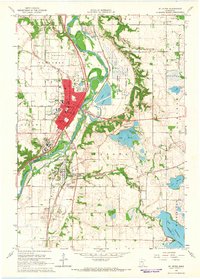 1965 St Peter1966 Print · USGSThe Minnesota River valley comes into sharp focus during the mid-sixties, capturing the institutional and industrial heart of St. Peter and Kasota. Researchers can trace the grounds of Gustavus Adolphus College, the Milwaukee Road rail lines, and local landmarks like Elim Welsh Cem.3 unique versions available
 - 1965 Map of Le Sueur, 1966 Print
 1965 Le Sueur1966 Print · USGSLe Sueur and the Minnesota River valley are captured in the mid-sixties during a period of steady growth and industrial activity. Researchers can trace the Chicago and North Western rail line and locate ancestral sites like Mound Cem and the settlement of Ottawa.4 unique versions available
 - 1965 Map of Cambria, 1966 Print
 1965 Cambria1966 Print · USGSBlue Earth and Nicollet counties are captured here in the mid-1960s, showing the agricultural prairie and the winding Minnesota River valley. Genealogists can locate family landmarks such as Our Saviors Ch, Cambria Cem, and the small settlement of Butternut.
 - 1965 Map of Nicollet, 1967 Print
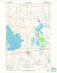 1965 Nicollet1967 Print · USGSNicollet and the surrounding prairie lakes are captured in the mid-1960s as a thriving agricultural and rail hub. Genealogists and historians can trace family ties at Nicollet Cem, follow the Old Fort Road, or locate vanished shoreline landmarks like Poor Farm Landing.
 - 1967 Map of New Ulm
 1967 New Ulm1967 Print · USGSSouthern Minnesota in the mid-fifties is captured here as a landscape of river-valley missions and busy prairie rail towns. Researchers can trace the Yellow Medicine Trail and locate historic sites like the Morton Indian Mission and Milford State Monument.
 - 1974 Map of Mankato West, 1976 Print
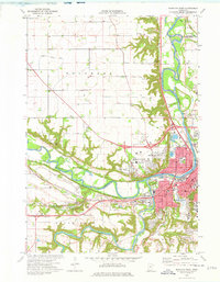 1974 Mankato West1976 Print · USGSThe Minnesota River valley comes alive in the 1970s, showcasing the expansion of Mankato and North Mankato. Genealogists can locate Belgrade Cem and Herns-Oak Grove Cem or trace landmarks like Minneopa Falls.2 unique versions available
 - 1974 Map of Judson, 1976 Print
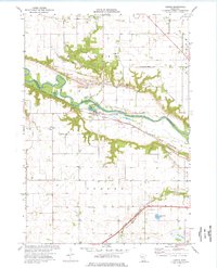 1974 Judson1976 Print · USGSBlue Earth and Nicollet counties are captured here in the mid-seventies as the rail-and-river economy shaped the valley. Genealogists can trace family sites at Jerusalem Ch, Zion Cem, and the small settlement of Judson along the Chicago and North Western line.
 - 1982 Map of Morgan NE, 1983 Print
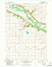 1982 Morgan NE1983 Print · USGSThe Minnesota River valley and its rural townships are captured here in the early 1980s as the agricultural landscape matured. Researchers can locate numerous local landmarks including Mt Hope Cem, Kettners Landing, and the Old Indian Treaty Boundary.
Showing maps 1-25 of 115
Top cities of Nicollet County
- North Mankato historical maps
- Nicollet historical maps
- Courtland historical maps
- Lafayette historical maps
- Oshawa historical maps
- Traverse historical maps
See more
Frequently asked questions
- What are the different types of historical maps available for Nicollet County?
- What is the oldest map of Nicollet County?
- Where can I purchase historical maps of Nicollet County for my home or office?
- Where can I download high-res historical maps of Nicollet County?
- Are there historical topographic maps available for Nicollet County?
- Is there historical aerial imagery available for Nicollet County?
- Where are historical maps of Nicollet County sourced from?