Old Maps of Roosevelt, Minnesota for Genealogy
Trace your family roots with 12 historic maps of Roosevelt. These high-res maps reveal old neighborhoods, homesites, landmarks, and streets — helping you uncover where your ancestors lived and how the area evolved over time.
- Explore historic neighborhoods: Identify where your relatives may have lived in the 1800s or 1900s.
- Compare maps over time: Trace the changes in streets, buildings, and landmarks for multi-generational research.
- Perfect for genealogy & ancestry research: Used by family historians and researchers to map out lineage and migration.
These maps are an incredible resource for exploring your personal connection to Roosevelt's past.
Roosevelt, MN maps
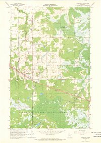
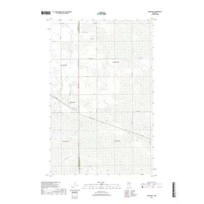
(12)- 1918 Map of Roosevelt
 1918 Roosevelt1918 Print · USGSNorthern Minnesota's wooded frontier is captured here at the end of the Great War, as the railway transformed the lake country. Genealogists and historians can trace early school sites and track the Canadian Northern rail line through Roosevelt and Swift.
 - 1943 Map of Roosevelt
 1943 Roosevelt1943 Print · USGSNear the international boundary in the 1940s, this area shows the early development of Roseau and Beltrami Counties around the Canadian Northern line. Researchers can trace the layout of Roosevelt, Arnesen, and Swift alongside the timbered landscapes of Laona.
 - 1954 Map of Roseau, 1969 Print
 1954 Roseau1969 Print · USGSNorthern Minnesota's borderlands come alive in the 1950s, showing a landscape defined by timber, water, and rail. Trace family roots through old schools and cemeteries near Roseau, Warroad, and the expansive Red Lake Indian Reservation.2 unique versions available
 - 1957 Map of Roseau
 1957 Roseau1957 Print · USGSThe international border and tribal lands define Northern Minnesota in the mid-fifties, from the shores of Lake of the Woods to the Red Lake Indian Reservation. Researchers can trace the path of the Great Northern railroad and locate isolated outposts like the U S Custom House and Ponemah.
 - 1958 Map of Roseau
 1958 Roseau1958 Print · USGSNorthern Minnesota's borderlands and vast lake country are captured here in the late fifties. Researchers can trace the Canadian National rail line through Warroad or find family history in frontier settlements like Baudette, Waskish, and Shotley.
 - 1967 Map of Roosevelt, 1969 Print
 1967 Roosevelt1969 Print · USGSThe village of Roosevelt is shown at a pivotal moment in the late sixties, centered on the border of Roseau and Lake of the Woods counties. Genealogists and historians can trace the Canadian National rail corridor or locate landmarks like Norquist Lake and the Krull Trail.2 unique versions available
 - 1976 Map of Roseau, 1994 Print
 1976 Roseau1994 Print · USGSThe Minnesota-Manitoba borderlands come into focus in the mid-seventies, showing the intersection of lake-shore life and the prairie's edge. Genealogists and historians can trace rail sidings and small settlements from Warroad to Roseau, or locate family landmarks near the Red Lake Indian Reservation and Arnesen.
 - 2010 Map of Roosevelt, 2010 Print
 2010 Roosevelt2010 Print · USGSCovers Roosevelt, including Roseau County, Lake of the Woods County, and other nearby areas
 - 2013 Map of Roosevelt, 2013 Print
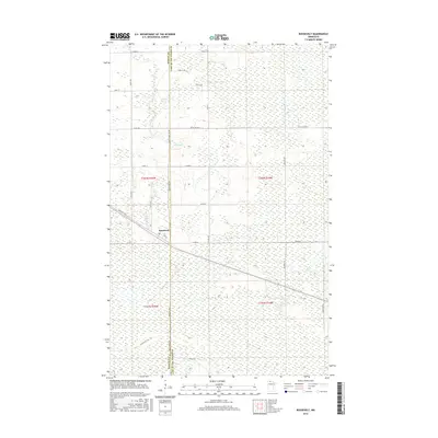
 2013 Roosevelt2013 Print · USGSCovers Roosevelt, including Roseau County, Lake of the Woods County, and other nearby areas
 - 2016 Map of Roosevelt, 2016 Print
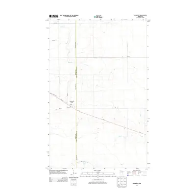
 2016 Roosevelt2016 Print · USGSCovers Roosevelt, including Roseau County, Lake of the Woods County, and other nearby areas
 - 2019 Map of Roosevelt, 2019 Print
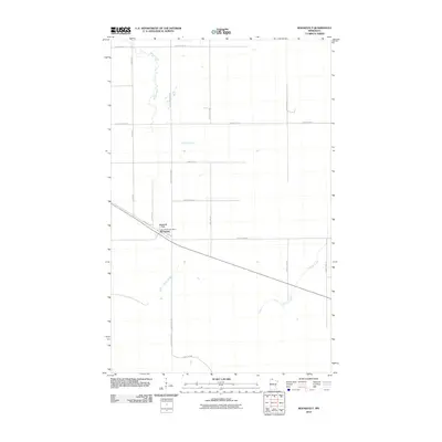
 2019 Roosevelt2019 Print · USGSCovers Roosevelt, including Roseau County, Lake of the Woods County, and other nearby areas
 - 2022 Map of Roosevelt, 2022 Print
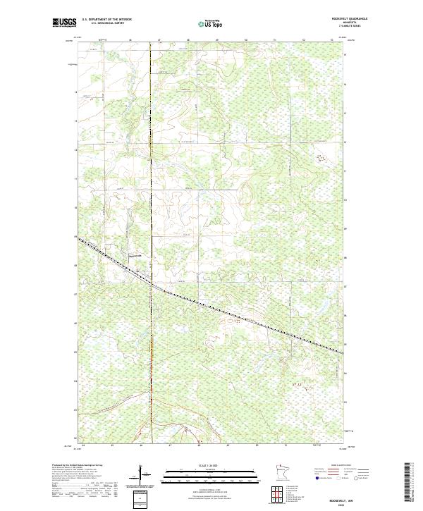 2022 Roosevelt2022 Print · USGSThe borderlands of Roseau and Lake of the Woods counties are captured here in the early 2020s, centered on the small community of Roosevelt. Genealogists and researchers can trace local transit routes like the Warroad/Roseau Trails Trl and forest access via Cole Forest Rd.
End of results
Showing maps 1-12 of 12
Top cities near Roosevelt
Frequently asked questions
- What are the different types of historical maps available for Roosevelt?
- What is the oldest map of Roosevelt?
- Where can I purchase historical maps of Roosevelt for my home or office?
- Where can I download high-res historical maps of Roosevelt?
- Are there historical topographic maps available for Roosevelt?
- Is there historical aerial imagery available for Roosevelt?
- Where are historical maps of Roosevelt sourced from?