Old Maps of Northeast St Louis, Minnesota for Hiking & Exploration
Hike through history with 137 historic maps of Northeast St Louis. Explore old trails, ghost towns, and forgotten backroads — perfect for outdoor adventurers and local explorers.
- Rediscover forgotten places: Map out old mining camps, roads, and footpaths that no longer exist on modern maps.
- Layer with modern tools: Combine with LiDAR or satellite views to plan hikes through historical terrain.
- Made for exploration: Popular among hikers, overlanders, and local history lovers.
Use these maps to find adventure and explore the hidden past of Northeast St Louis.
Northeast St Louis, MN maps
(137)- 1954 Map of Hibbing, 1966 Print
 1954 Hibbing1966 Print · USGSNorthern Minnesota's Iron Range thrives during the mid-1960s, showing the industrial landscape between the Mesabi Range and the Mississippi River. Genealogists and historians can trace the rail lines of the Great Northern RR through mining hubs like Hibbing and Virginia.3 unique versions available
 - 1954 Map of International Falls, 1980 Print
 1954 International Falls1980 Print · USGSThe Minnesota-Ontario borderlands come alive in this mid-century survey of the Rainy River region and the interconnected waterways that now form Voyageurs National Park. Genealogists and local historians can trace the rail-and-timber era through settlements like Littlefork, the Nett Lake Indian Reservation, and the Canadian National rail lines.
 - 1956 Map of Sioux Pine Island, 1958 Print
 1956 Sioux Pine Island1958 Print · USGSThe lake country of St. Louis County is captured here in the mid-fifties, showing a pristine landscape of water and forest before modern development. You can trace historic travel routes like the Canfield Portage and locate named landmarks like Sioux Pine Island or the Five Sisters Islands.5 unique versions available
 - 1956 Map of Vermilion Dam, 1958 Print
 1956 Vermilion Dam1958 Print · USGSThe Lake Vermilion wilderness is captured here in the mid-fifties, showing the intersection of three major state and national forests. Genealogists and local historians can trace the shoreline at Moccasin Point and locate the historic Vermilion Dam Club and Vermilion Dam Lookout Tower.5 unique versions available
 - 1956 Map of Chad Lake, 1958 Print
 1956 Chad Lake1958 Print · USGSSt. Louis County is captured in the mid-1950s as a dense wilderness of interconnected waterways and state forests. Researchers can trace the pristine shorelines of Lake Vermilion and Bass Lake or locate interior landmarks like Indian Point and Rice Bay.3 unique versions available
 - 1956 Map of Crab Lake, 1958 Print
 1956 Crab Lake1958 Print · USGSThe Iron Range lake country of the mid-1950s is captured here in detail, showing a wilderness of water and forest. Researchers can trace the convoluted shorelines of Burntside Lake and Crab Lake or locate islands like Pine Island and Shellman Island.3 unique versions available
 - 1956 Map of Lost Lake, 1958 Print
 1956 Lost Lake1958 Print · USGSSt. Louis County's lake-strewn wilderness is meticulously detailed during the late fifties, showing where multiple state and national forests converge. Genealogists and outdoorsmen can trace early roads and water features like Lehtinen, Lost Lake, and the winding Pike River.4 unique versions available
 - 1957 Map of Hibbing
 1957 Hibbing1957 Print · USGSNorthern Minnesota's Iron Range is shown at its industrial peak in the mid-fifties, dominated by the massive iron pits and rail corridors of the Mesabi Range. Researchers can trace the rail networks of the Duluth Missabe and Iron Range and locate mining hubs like Hibbing, Virginia, and Bovey.
 - 1957 Map of International Falls
 1957 International Falls1957 Print · USGSThe Minnesota-Ontario borderlands come alive in the mid-fifties, showing the industrial nodes of International Falls and Fort Frances. Genealogists and historians can trace rail-tied settlements like Aylsworth and Littlefork or locate ancestral lands within the Nett Lake Indian Reservation.
 - 1957 Map of Quetico, 1967 Print
 1957 Quetico1967 Print · USGSThe Ontario-Minnesota borderlands are captured here in the mid-fifties, showing the vast wilderness of the Boundary Waters before modern development. Genealogists and researchers can trace rail settlements along the Canadian National Railways including Atikokan, Sapawe, and Kashabowie.2 unique versions available
 - 1958 Map of International Falls
 1958 International Falls1958 Print · USGSThe borderlands of northern Minnesota and Ontario are mapped here during the mid-fifties, centered on the river-and-rail hubs of the Northwoods. Researchers can trace the path of the Northern Pacific through Big Falls or locate early settlements like Ericsburg and Ranier.2 unique versions available
 - 1958 Map of Hibbing
 1958 Hibbing1958 Print · USGSThe Mesabi Iron Range reached its mid-century height during this era, defining the landscape between Grand Rapids and Virginia. Genealogists and historians can trace the mining-town networks of Hibbing and Chisholm or locate numerous iron mines and rail spurs.
 - 1963 Map of Coleman Island, 1964 Print
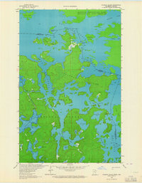 1963 Coleman Island1964 Print · USGSThe Minnesota-Ontario borderlands appear in great detail during the early sixties, showing the complex island-filled waters of Lac La Croix. Researchers can trace old wilderness routes through Fish Stake Narrows and around Coleman Island.2 unique versions available
 - 1963 Map of Echo Lake, 1964 Print
 1963 Echo Lake1964 Print · USGSThe Minnesota-Ontario borderlands are captured here in the early sixties, showing a wilderness of water and timber within the Superior National Forest. Trace the primitive Echo Trail past Echo Lake and discover several Gravel Pits and remote waters like Knute Lake.3 unique versions available
 - 1963 Map of Takucmich Lake, 1964 Print
 1963 Takucmich Lake1964 Print · USGSThe Minnesota-Ontario borderlands are shown in the early 1960s, a time when this wilderness was defined by its interconnected lakes and rivers. Genealogists and historians can locate established campsites and portage trails near Lac La Croix, Takucmich Lake, and Beartrack Lake.2 unique versions available
 - 1963 Map of Snow Bay, 1964 Print
 1963 Snow Bay1964 Print · USGSThe Boundary Waters wilderness of St. Louis County remains a vast network of interconnected lakes and historic portages in the early sixties. Researchers can trace traditional travel routes like Dawson Portage and Beatty Portage between Loon Lake and Snow Bay.3 unique versions available
 - 1963 Map of Astrid Lake, 1964 Print
 1963 Astrid Lake1964 Print · USGSNorthern Minnesota's lake-strewn wilderness is captured in the early sixties within the dual boundaries of the state and national forests. Outdoor enthusiasts and researchers can trace the shorelines and depths of Trout Lake, Astrid Lake, and the remote Gowan Lake.3 unique versions available
 - 1963 Map of Picket Lake, 1965 Print
 1963 Picket Lake1965 Print · USGSNorthern Minnesota's lake and timber country is captured here in the early sixties, showing the overlap of state and federal forest lands. Researchers can trace the winding Vermilion River and find isolated sites like Picket Lake and the Gravel Pit.2 unique versions available
 - 1963 Map of Iron Lake, 1965 Print
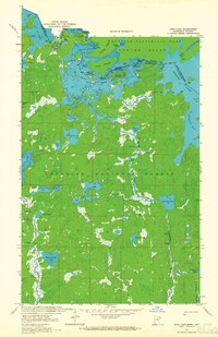 1963 Iron Lake1965 Print · USGSThe international border between Minnesota and Ontario was a roadless expanse of lakes and portages in the 1960s. Outdoor enthusiasts and researchers can trace ancient canoe routes through Curtain Falls, the islands of Iron Lake, and the remote Nibin Lake.2 unique versions available
 - 1963 Map of Lake Jeanette, 1965 Print
 1963 Lake Jeanette1965 Print · USGSThe remote Minnesota-Ontario borderlands are captured here in the early 1960s, showing the intersection of state and national forest lands. Trace the path of the Echo Trail or locate wilderness landmarks like Devils Cascade, Loon Falls, and the Lake Jeanette Campground.3 unique versions available
 - 1963 Map of Lapond Lake, 1965 Print
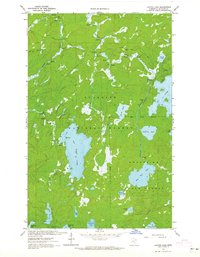 1963 Lapond Lake1965 Print · USGSSt. Louis County's northern wilderness is captured here in the early 1960s, showing a landscape defined by portage routes and forest boundaries. Outdoor historians can trace old camps and waterways like Big Moose Lake, Portage River, and the JEEP TRAIL.2 unique versions available
 - 1963 Map of Shell Lake, 1965 Print
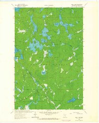 1963 Shell Lake1965 Print · USGSThe northern Minnesota wilderness in the early sixties is revealed through its intricate network of lakes and rivers. Local history enthusiasts can trace the Echo Trail to landmarks like the Sioux River Lookout Tower and the remote Devils Cascade.2 unique versions available
 - 1963 Map of Lake Agnes, 1965 Print
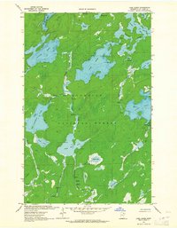 1963 Lake Agnes1965 Print · USGSThe Superior National Forest wilderness is mapped here in the early sixties, showing a landscape defined by portages and primitive trails. Researchers can trace historic water routes through Lake Agnes, Nina Moose Lake, and the many rapids along the Portage River.3 unique versions available
 - 1963 Map of Bootleg Lake, 1965 Print
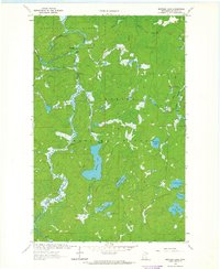 1963 Bootleg Lake1965 Print · USGSNorthern Minnesota's wilderness remains largely untouched in the early sixties, dominated by the dense woods of the Superior National Forest. You can trace the winding paths of the Indian River and Bull Moose River or locate remote landmarks like Sioux Falls and Bootleg Lake.2 unique versions available
 - 1964 Map of Hibbing
 1964 Hibbing1964 Print · USGSNorthern Minnesota’s iron-rich corridor is captured here during a peak era of mid-century industrial activity. Researchers can trace the rail-to-mine connections through Mesabi Range towns like Hibbing and Virginia or locate lakefront settlements near Pokegama Lake.
Showing maps 1-25 of 137
Frequently asked questions
- What are the different types of historical maps available for Northeast St Louis?
- What is the oldest map of Northeast St Louis?
- Where can I purchase historical maps of Northeast St Louis for my home or office?
- Where can I download high-res historical maps of Northeast St Louis?
- Are there historical topographic maps available for Northeast St Louis?
- Is there historical aerial imagery available for Northeast St Louis?
- Where are historical maps of Northeast St Louis sourced from?