Old Maps of Sibley County, Minnesota for Genealogy
Trace your family roots with 146 historic maps of Sibley County. These high-res maps reveal old neighborhoods, homesites, landmarks, and streets — helping you uncover where your ancestors lived and how the area evolved over time.
- Explore historic neighborhoods: Identify where your relatives may have lived in the 1800s or 1900s.
- Compare maps over time: Trace the changes in streets, buildings, and landmarks for multi-generational research.
- Perfect for genealogy & ancestry research: Used by family historians and researchers to map out lineage and migration.
These maps are an incredible resource for exploring your personal connection to Sibley County's past.
Sibley County, MN maps
(146)- 1953 Map of Saint Paul, 1964 Print
 1953 Saint Paul1964 Print · USGSThe Twin Cities and the Mississippi River valley are captured here at a mid-century turning point. Trace the early growth of Minneapolis and Saint Paul alongside landmarks like Lake Minnetonka and the St Croix River.4 unique versions available
 - 1953 Map of New Ulm, 1968 Print
 1953 New Ulm1968 Print · USGSSouthern Minnesota in the mid-1950s is defined by its deep river valleys and the expanding reach of the Great Northern and Chicago and North Western railroads. Researchers can trace rural lineages through landmarks like the Milford State Monument, St. John's Ch, and the Upper Sioux Indian Res.3 unique versions available
 - 1957 Map of New Ulm
 1957 New Ulm1957 Print · USGSCentral Minnesota in the mid-fifties remains a landscape of river-valley commerce and prairie agriculture defined by its historic mission sites and rail towns. Genealogists and local historians can trace the development of New Ulm and Montevideo, or locate specific landmarks like the Milford State Monument and Minnesota Falls.
 - 1957 Map of Belle Plaine, 1958 Print
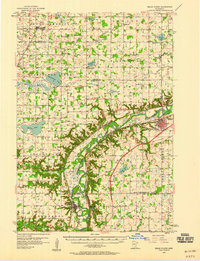 1957 Belle Plaine1958 Print · USGSThe Minnesota River valley serves as a bustling corridor for four counties during the late fifties, defined by its intersecting rail lines and riverside towns. Genealogists can locate family landmarks like West Union Ch, Zion Cem, and the Jessenland Fish Hatchery.2 unique versions available
 - 1958 Map of New Ulm
 1958 New Ulm1958 Print · USGSSouth-central Minnesota’s river valleys and prairie towns are captured here in the mid-fifties, during the height of the region's rail-and-river economy. Genealogists and historians can trace the legacy of the Upper Sioux Indian Mission or locate early rail stops along the Chicago and North Western Ry in towns like Redwood Falls and Glencoe.
 - 1958 Map of Gaylord, 1959 Print
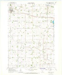
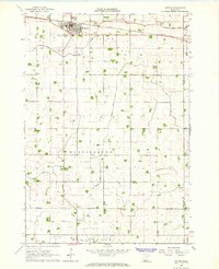
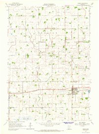
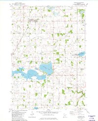
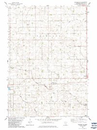
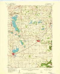 1958 Gaylord1959 Print · USGSSibley County's farming heartland and railroad towns are captured here in the late fifties. Genealogists and local researchers can trace family landmarks like St Johannes Ch, New Auburn, and the Zion Sch & Cem along the Minneapolis and St Louis line.2 unique versions available
 - 1958 Map of Winthrop, 1959 Print
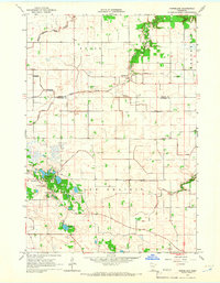
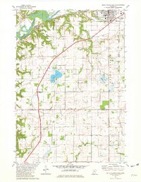
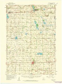 1958 Winthrop1959 Print · USGSMid-century Sibley and McLeod counties are captured here as the rail-centered agricultural landscape reached its peak. Genealogists can trace family roots through several rural landmarks like St Boniface Cem, St John Sch, and the town of Winthrop.
 - 1959 Map of Saint Paul
 1959 Saint Paul1959 Print · USGSThe Twin Cities and southeastern Minnesota appear here in the late fifties, showing the peak of the rail era and post-war suburban growth. Genealogists can trace family footprints near Lake Minnetonka, the Univ Of Minn Rosemount Research Center, or the growing neighborhoods of Richfield.2 unique versions available
 - 1964 Map of Bernadotte, 1965 Print
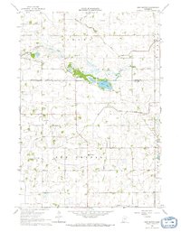
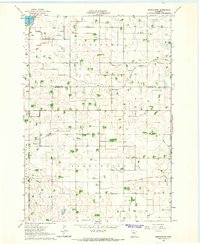 1964 Bernadotte1965 Print · USGSSibley and Nicollet Counties are captured here in the mid-sixties, showing a landscape defined by prairie agriculture and drainage engineering. Researchers can trace rural cemetery sites, the crossroads at Bernadotte, and the winding South Branch Rush River.
 - 1964 Map of Fairfax, 1965 Print
 1964 Fairfax1965 Print · USGSRenville County farmland was undergoing steady development in the mid-1960s as drainage systems transformed the prairie. Researchers can locate the Wellington Sch, trace the Chicago and North Western rail line, and find family names near St Andrews Cem.
 - 1964 Map of Buffalo Lake, 1965 Print
 1964 Buffalo Lake1965 Print · USGSThe prairie of Renville and Sibley Counties is captured here in the mid-1960s as a thriving rail and agricultural corridor. Researchers can trace family sites at the United Brethren Cem, locate the village Townhall, or find the old Drive-in Theater.
 - 1964 Map of Lafayette, 1965 Print
 1964 Lafayette1965 Print · USGSThe town of Lafayette and the surrounding prairie are captured here in the mid-sixties as a landscape shaped by rail and drainage. Researchers can trace the Chicago and North Western tracks and find local landmarks like School No 53 and St Gregory Cem.
 - 1964 Map of Hector, 1965 Print
 1964 Hector1965 Print · USGSRenville County farmland was meticulously managed in the mid-1960s, centered on the rail hub of Hector. Family historians can locate specific plots near the Catholic Cem or trace the drainage networks of Judicial Ditch No 15 and Judicial Ditch No 6.
 - 1964 Map of St George, 1965 Print
 1964 St George1965 Print · USGSThe Minnesota River valley meets the prairie wetlands of Nicollet County in the mid-1960s. Researchers can trace the path of the Old Fort Road and locate family history at West Newton Cem and Clear Lake Ch Cem.
 - 1964 Map of Gibbon, 1965 Print
 1964 Gibbon1965 Print · USGSGibbon was a bustling rail-and-farm hub in the mid-1960s, defined by its grain-hauling rail lines and a vast network of prairie drainage ditches. Genealogists can trace local roots at St Willibrord Cem, Augustana Cem, and the St Peters Sch.3 unique versions available
 - 1965 Map of Norseland, 1966 Print
 1965 Norseland1966 Print · USGSNorseland and its surrounding townships are captured in the mid-1960s, showing a well-established agricultural community defined by its prairie roots and water management. Family historians can locate specific sites like the Scandian Grove Cemetery and Church, Traver Cemetery, and Annezstad Lake.
 - 1965 Map of New Sweden, 1966 Print
 1965 New Sweden1966 Print · USGSNicollet and Sibley counties are captured here in the mid-1960s, showing a landscape of fertile farmland shaped by an intricate system of judicial ditches. Genealogists can locate family landmarks such as the Scandinavian Grove Cem, Norwegian Grove Ch, and Trinity Sch.
 - 1965 Map of Le Sueur, 1966 Print
 1965 Le Sueur1966 Print · USGSLe Sueur and the Minnesota River valley are captured in the mid-sixties during a period of steady growth and industrial activity. Researchers can trace the Chicago and North Western rail line and locate ancestral sites like Mound Cem and the settlement of Ottawa.4 unique versions available
 - 1967 Map of New Ulm
 1967 New Ulm1967 Print · USGSSouthern Minnesota in the mid-fifties is captured here as a landscape of river-valley missions and busy prairie rail towns. Researchers can trace the Yellow Medicine Trail and locate historic sites like the Morton Indian Mission and Milford State Monument.
 - 1981 Map of Hamburg, 1982 Print
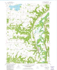
 1981 Hamburg1982 Print · USGSThe prairie and wetlands of Carver and Sibley counties are captured here in the early 1980s, centered on the railroad town of Hamburg. Genealogists and researchers can trace rural life through several burial sites like Snapsburg Cem and the waters of Washington Lake.
 - 1981 Map of Belle Plaine South, 1982 Print
 1981 Belle Plaine South1982 Print · USGSThe Minnesota River valley and the town of Belle Plaine are captured here in the early eighties. Genealogists and local historians can trace rural cemeteries like Schlegel Cem and explore the rail corridor through Blakeley and Belle Plaine.
 - 1981 Map of Belle Plaine North, 1982 Print
 1981 Belle Plaine North1982 Print · USGSThe Minnesota River valley serves as the backdrop for this early 1980s look at rural Scott and Le Sueur counties. Researchers can trace historic local sites like Sacred Heart Cemetery, the Townhall, and the Chicago and North Western rail line.
 - 1981 Map of Henderson, 1982 Print
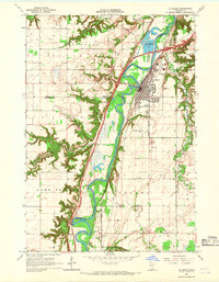
 1981 Henderson1982 Print · USGSThe river valley around Henderson comes to life in the early 1980s as the Minnesota River meanders past fertile bluffs. Researchers can trace family sites at St Joseph Cem, follow the Chicago and North Western line, or locate the historic Jessenland town hall.
 - 1982 Map of Winthrop SW, 1983 Print
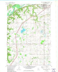
 1982 Winthrop SW1983 Print · USGSSibley County farming life in the early eighties is captured here across the townships of Bismarck and Cornish. Researchers can locate rural landmarks like St John Ch, the Tabor Cem, and the rail corridor of the CHICAGO AND NORTH WESTERN.
 - 1982 Map of Gaylord, 1983 Print
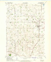
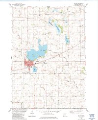 1982 Gaylord1983 Print · USGSGaylord serves as a regional center in Sibley County during the early 1980s, balancing its rail-road economy with an extensive network of prairie wetlands. Researchers can trace family roots at Municipal Cem and Gasow Cem or follow the Chicago and North Western line past Titlow Lake.
Showing maps 1-25 of 146
Top cities of Sibley County
- Gaylord historical maps
- Arlington historical maps
- Winthrop historical maps
- Henderson historical maps
- Gibbon historical maps
- New Auburn historical maps
See more
Frequently asked questions
- What are the different types of historical maps available for Sibley County?
- What is the oldest map of Sibley County?
- Where can I purchase historical maps of Sibley County for my home or office?
- Where can I download high-res historical maps of Sibley County?
- Are there historical topographic maps available for Sibley County?
- Is there historical aerial imagery available for Sibley County?
- Where are historical maps of Sibley County sourced from?