1980s Maps of Sibley County, Minnesota
Explore 16 historic maps of Sibley County from the 1980s. These maps offer a rare glimpse into what life looked like during the 1980s — showing old roads, neighborhoods, homes, and landmarks that have changed or disappeared over time.
Whether you're researching your family's past, planning a metal detecting trip, or studying how Sibley County's landscape evolved across the 1980s, these high-resolution maps are a powerful tool for exploring the history of this region.
- Focus on a specific era: All maps on this page are from the 1980s, giving you a focused view of this time period.
- See what’s changed: Compare century-old streets, trails, and buildings to today's modern landscape using overlays and satellite layers.
- Research with precision: Use these maps for genealogy, historical research, land use analysis, or educational projects.
- View, download, or print: Maps are fully viewable online in high resolution, and can be downloaded or printed for your own records.
Start exploring Sibley County's history through authentic maps from the 1980s. This is your window into the past.
Sibley County, MN maps
(16)- 1981 Map of Hamburg, 1982 Print
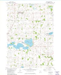 1981 Hamburg1982 Print · USGSThe prairie and wetlands of Carver and Sibley counties are captured here in the early 1980s, centered on the railroad town of Hamburg. Genealogists and researchers can trace rural life through several burial sites like Snapsburg Cem and the waters of Washington Lake.
 - 1981 Map of Belle Plaine South, 1982 Print
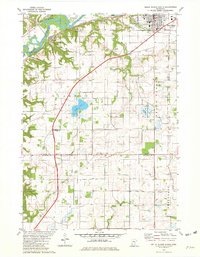 1981 Belle Plaine South1982 Print · USGSThe Minnesota River valley and the town of Belle Plaine are captured here in the early eighties. Genealogists and local historians can trace rural cemeteries like Schlegel Cem and explore the rail corridor through Blakeley and Belle Plaine.
 - 1981 Map of Belle Plaine North, 1982 Print
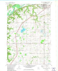 1981 Belle Plaine North1982 Print · USGSThe Minnesota River valley serves as the backdrop for this early 1980s look at rural Scott and Le Sueur counties. Researchers can trace historic local sites like Sacred Heart Cemetery, the Townhall, and the Chicago and North Western rail line.
 - 1981 Map of Henderson, 1982 Print
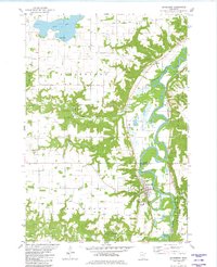 1981 Henderson1982 Print · USGSThe river valley around Henderson comes to life in the early 1980s as the Minnesota River meanders past fertile bluffs. Researchers can trace family sites at St Joseph Cem, follow the Chicago and North Western line, or locate the historic Jessenland town hall.
 - 1982 Map of Winthrop SW, 1983 Print
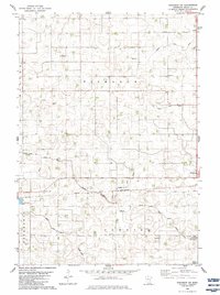 1982 Winthrop SW1983 Print · USGSSibley County farming life in the early eighties is captured here across the townships of Bismarck and Cornish. Researchers can locate rural landmarks like St John Ch, the Tabor Cem, and the rail corridor of the CHICAGO AND NORTH WESTERN.
 - 1982 Map of Gaylord, 1983 Print
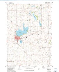 1982 Gaylord1983 Print · USGSGaylord serves as a regional center in Sibley County during the early 1980s, balancing its rail-road economy with an extensive network of prairie wetlands. Researchers can trace family roots at Municipal Cem and Gasow Cem or follow the Chicago and North Western line past Titlow Lake.
 - 1982 Map of Winthrop, 1983 Print
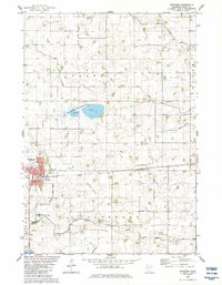 1982 Winthrop1983 Print · USGSSibley County's agricultural heartland is documented here in the early eighties, centered on the rail-served community of Winthrop. You can trace the legacy of local farming through the network of county ditches and historic sites like St Johns Ch and Cornish.
 - 1982 Map of Brownton, 1983 Print
 1982 Brownton1983 Print · USGSMcLeod County farming and rail life are captured here in the early eighties, showing the region's managed waterways and rail corridors. Trace family history at Oak Grove Cem, visit the settlement of Sumter, or explore the wetlands of Bakers Lake.
 - 1982 Map of Arlington, 1983 Print
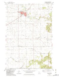 1982 Arlington1983 Print · USGSSibley County was a well-developed agricultural and rail hub in the early 1980s. Researchers can locate numerous family burial sites like Ebenezer Cem and St Johns Cem, or trace the path of the Chicago and North Western railroad through Arlington.
 - 1982 Map of New Auburn, 1983 Print
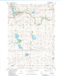
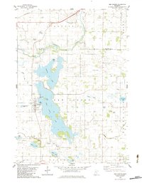 1982 New Auburn1983 Print · USGSSibley County and the town of New Auburn are captured in the early eighties as a landscape of interconnected lakes and managed prairie drainage. Researchers can trace family sites near High Island Cem or follow the old C M St P & P rail line through Buffalo Creek.
 - 1982 Map of Stewart, 1983 Print
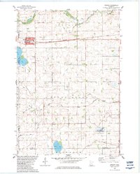 1982 Stewart1983 Print · USGSStewart and the surrounding McLeod County prairie are shown here in the early eighties as the agricultural landscape matured. Genealogists can trace family footprints near Fernando, St Boniface Cem, and the St Pauls Ch parish.
 - 1982 Map of Green Isle, 1983 Print
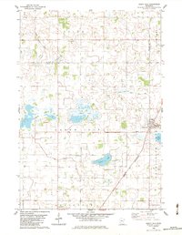 1982 Green Isle1983 Print · USGSThe Sibley County prairie is captured here in the early 1980s, showcasing a landscape of drainage ditches and vanished lakes. Researchers can trace family roots at St Marys Cem or locate rural landmarks like the Townhall and the Chicago and North Western rail corridor.
 - 1985 Map of Saint Paul
 1985 Saint Paul1985 Print · USGSThe Twin Cities metropolitan area and its southern suburbs are captured here in the mid-eighties as the urban landscape expanded toward the Minnesota River. Researchers can trace the layout of the Fort Snelling Military Reservation, find local landmarks like St Benedict Church, and study the rail routes of the Soo Line.2 unique versions available
 - 1985 Map of Faribault, 1986 Print
 1985 Faribault1986 Print · USGSThe Minnesota River valley and the glacial lake country of Rice and Le Sueur counties are shown here in the mid-1980s. Researchers can trace the academic grounds of St Olaf College or find old crossroads like Trondhjem and Little Chicago.2 unique versions available
 - 1986 Map of New Ulm
 1986 New Ulm1986 Print · USGSSouthern Minnesota's river valleys and prairie townships are captured here in the mid-1980s, showcasing a landscape defined by agriculture and transit. Researchers can trace the Chicago and North Western rail lines through historic grain-stop towns like Sleepy Eye, Hanska, and Good Thunder.
 - 1986 Map of Glencoe
 1986 Glencoe1986 Print · USGSThe south-central Minnesota prairie and its glacial lake basins are captured here in the mid-1980s, showcasing a landscape of intensive farming and conservation. Genealogists can locate family-named landmarks and trace the rail lines of the Soo Line and Chicago and North Western through towns like Gaylord, Olivia, and Hutchinson.2 unique versions available
End of results
Showing maps 1-16 of 16
Top cities of Sibley County
- Gaylord historical maps
- Arlington historical maps
- Winthrop historical maps
- Henderson historical maps
- Gibbon historical maps
- New Auburn historical maps
See more
Frequently asked questions
- What are the different types of historical maps available for Sibley County?
- What is the oldest map of Sibley County?
- Where can I purchase historical maps of Sibley County for my home or office?
- Where can I download high-res historical maps of Sibley County?
- Are there historical topographic maps available for Sibley County?
- Is there historical aerial imagery available for Sibley County?
- Where are historical maps of Sibley County sourced from?