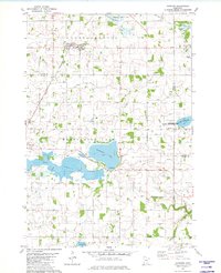
1981 Map of Hamburg
USGS Topo · Published 1982About this map
The agricultural landscape of Young America and Washington Lake townships is defined by a dense network of judicial ditches and small, scattered wetlands typical of south-central Minnesota. The town of Hamburg serves as a local hub along the Chicago and North Western railroad line, which cuts diagonally across the northern terrain. Numerous country institutions, such as Emmanuel Sch and St Pauls Ch, reflect the area's rural settlement patterns, while several small burying grounds like Snapsburg Cem and St Pauls Cem offer points of interest for local historians.
Find a feature on this map
26 named features on this map. Tap any name to fly to it.
Don’t see what you’re looking for? This feature index may not catch every label — zoom into the map to look around manually.
Map Details
Editions of this 1981 Hamburg Map
This is the sole edition of this map. No revisions or reprints were ever made.
Other maps of this area

1953 · Saint Paul
USGS Topo · 1:250,000

1953 · New Ulm
USGS Topo · 1:250,000

1957 · New Ulm
USGS Topo · 1:250,000

1957 · Belle Plaine
USGS Topo · 1:62,500

1957 · Waconia
USGS Topo · 1:62,500

1958 · New Ulm
USGS Topo · 1:250,000

1958 · Gaylord
USGS Topo · 1:62,500

1958 · Glencoe
USGS Topo · 1:62,500

1959 · Saint Paul
USGS Topo · 1:250,000

1967 · New Ulm
USGS Topo · 1:250,000