
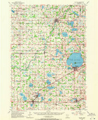
1957 Map of Waconia
USGS Topo · Published 1959About this map
Lake Waconia serves as the central focal point for this Carver County landscape, featuring the distinctively labeled Coney Island and the adjacent settlement of Waconia. The late-1950s geography reveals a high concentration of vanishing rural infrastructure, evidenced by numerous schoolhouses marked as abandoned, including the Mielke Sch, Hydes Lake Sch, and Schaunaman Sch. This pattern suggests a period of rapid school consolidation and shifting rural populations as smaller communities transitioned.
Find a feature on this map
87 named features on this map. Tap any name to fly to it.
Don’t see what you’re looking for? This feature index may not catch every label — zoom into the map to look around manually.
Map Details
Editions of this 1957 Waconia Map
2 editions found
Other maps of this area

1905 · Minnetonka
USGS Topo · 1:62,500

1907 · Minnetonka
USGS Topo · 1:62,500

1909 · Rockford
USGS Topo · 1:62,500

1953 · Saint Paul
USGS Topo · 1:250,000

1953 · New Ulm
USGS Topo · 1:250,000

1953 · Saint Cloud
USGS Topo · 1:250,000

1953 · Stillwater
USGS Topo · 1:250,000

1955 · Stillwater
USGS Topo · 1:250,000

1957 · Saint Cloud
USGS Topo · 1:250,000

1957 · New Ulm
USGS Topo · 1:250,000