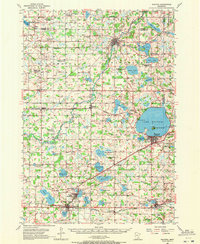
1957 Map of Waconia
USGS Topo · Published 1972About this map
Lake Waconia dominates this mid-century landscape, featuring its prominent Coney Island and the neighboring city of Waconia. The surrounding Carver County countryside is a dense network of rural school districts and small rail towns, many of which were already in transition as indicated by the high number of abandoned school sites like McGrath Sch and Hydes Lake Sch. Three major rail lines, including the Chicago and North Western and the Chicago Milwaukee St Paul and Pacific, cross the terrain to serve agricultural hubs like Young America, Norwood, and Cologne. To the north, the South Fork Crow River meanders toward Watertown, while religious and community life is anchored by landmarks such as Scandia Ch and Zion Ch. This survey provides a distinct record of the region's lakefront development at Camp Manakiki and Rutz Lake Camp before the expansion of the Twin Cities metropolitan area.
Find a feature on this map
102 named features on this map. Tap any name to fly to it.
Don’t see what you’re looking for? This feature index may not catch every label — zoom into the map to look around manually.
Map Details
Editions of this 1957 Waconia Map
2 editions found

Other maps of this area

1905 · Minnetonka
USGS Topo · 1:62,500

1907 · Minnetonka
USGS Topo · 1:62,500

1909 · Rockford
USGS Topo · 1:62,500

1953 · Saint Paul
USGS Topo · 1:250,000

1953 · New Ulm
USGS Topo · 1:250,000

1953 · Saint Cloud
USGS Topo · 1:250,000

1953 · Stillwater
USGS Topo · 1:250,000

1955 · Stillwater
USGS Topo · 1:250,000

1957 · Saint Cloud
USGS Topo · 1:250,000

1957 · New Ulm
USGS Topo · 1:250,000