2020s Maps of Sauk Centre, Minnesota
Explore 2 historic maps of Sauk Centre from the 2020s. These maps offer a rare glimpse into what life looked like during the 2020s — showing old roads, neighborhoods, homes, and landmarks that have changed or disappeared over time.
Whether you're researching your family's past, planning a metal detecting trip, or studying how Sauk Centre's landscape evolved across the 2020s, these high-resolution maps are a powerful tool for exploring the history of this region.
- Focus on a specific era: All maps on this page are from the 2020s, giving you a focused view of this time period.
- See what’s changed: Compare century-old streets, trails, and buildings to today's modern landscape using overlays and satellite layers.
- Research with precision: Use these maps for genealogy, historical research, land use analysis, or educational projects.
- View, download, or print: Maps are fully viewable online in high resolution, and can be downloaded or printed for your own records.
Start exploring Sauk Centre's history through authentic maps from the 2020s. This is your window into the past.
Sauk Centre, MN maps
(2)- 2022 Map of Sauk Lake, 2022 Print
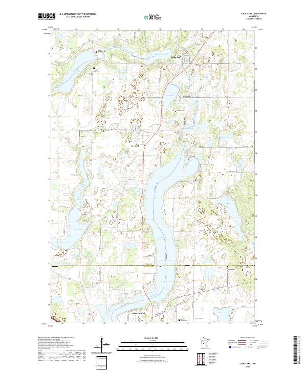 2022 Sauk Lake2022 Print · USGSThe glacial lake country of Todd and Stearns Counties is captured here in the early twenty-first century. Researchers can trace rural roots at Bethel Lutheran Cem or follow the waters of Sauk Lake and Fairy Lake.
 - 2022 Map of Sauk Centre, 2022 Print
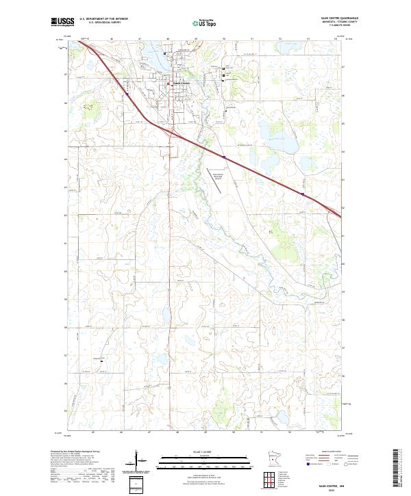 2022 Sauk Centre2022 Print · USGSSauk Centre and its surrounding Stearns County countryside are shown here at the start of the 2020s, centered on the river and lake geography. Genealogists can locate several local burial sites including Oakland Cem and Bohemian Cem, or trace the path of the Sauk River Trl.
End of results
Showing maps 1-2 of 2
Top cities near Sauk Centre
- Melrose historical maps
- Long Prairie historical maps
- Osakis historical maps
- Little Sauk historical maps
- Round Prairie historical maps
- New Munich historical maps
See more
Frequently asked questions
- What are the different types of historical maps available for Sauk Centre?
- What is the oldest map of Sauk Centre?
- Where can I purchase historical maps of Sauk Centre for my home or office?
- Where can I download high-res historical maps of Sauk Centre?
- Are there historical topographic maps available for Sauk Centre?
- Is there historical aerial imagery available for Sauk Centre?
- Where are historical maps of Sauk Centre sourced from?