1900s (20th Century) Maps of Wheaton, Minnesota
Explore 9 historic maps of Wheaton from the 1900s (20th Century). These maps offer a rare glimpse into what life looked like during the 1900s — showing old roads, neighborhoods, homes, and landmarks that have changed or disappeared over time.
Whether you're researching your family's past, planning a metal detecting trip, or studying how Wheaton's landscape evolved across the 1900s, these high-resolution maps are a powerful tool for exploring the history of this region.
- Focus on a specific era: All maps on this page are from the 1900s, giving you a focused view of this time period.
- See what’s changed: Compare century-old streets, trails, and buildings to today's modern landscape using overlays and satellite layers.
- Research with precision: Use these maps for genealogy, historical research, land use analysis, or educational projects.
- View, download, or print: Maps are fully viewable online in high resolution, and can be downloaded or printed for your own records.
Start exploring Wheaton's history through authentic maps from the 1900s. This is your window into the past.
Wheaton, MN maps
(9)- 1915 Map of White Rock, 1954 Print
 1915 White Rock1954 Print · USGSThe tri-state border region of the Dakotas and Minnesota comes alive in the early twentieth century as a hub of rail lines and prairie schools. Trace early settlements like White Rock and Rosholt or locate family landmarks such as Knutson School and Teare School.2 unique versions available
 - 1918 Map of White Rock
 1918 White Rock1918 Print · USGSThe tri-state borderlands of South Dakota, Minnesota, and North Dakota are frozen in time just before the end of the Great War. Researchers can trace the Sisseton and Wahpeton Indian Reservation boundary or locate early schools like Teare School and Knutson School.4 unique versions available
 - 1951 Map of Wheaton
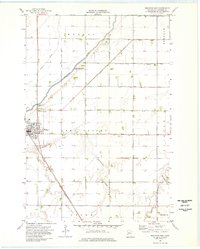
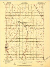 1951 Wheaton1951 Print · USGSTraverse County farming communities and the rail hub of Wheaton are captured here in the early fifties. Genealogists can trace family footprints across dozens of country schools like School No 46 and sacred sites including St Johns Cem.2 unique versions available
 - 1953 Map of Milbank, 1958 Print
 1953 Milbank1958 Print · USGSThe tri-state border region of South Dakota, North Dakota, and Minnesota is shown here during the early fifties, a landscape defined by glacial lakes and the Sisseton Indian Reservation. Researchers can trace the legacy of the western railroads, locating old stops along the Great Northern and settlements like Milbank, Webster, and Sisseton.3 unique versions available
 - 1958 Map of Milbank
 1958 Milbank1958 Print · USGSThe northern Great Plains in the late fifties show a landscape of glacial lakes and reservation lands shaped by the Great Northern railroad. Genealogists and local historians can trace the grid of settlements from Britton to Milbank and locate landmarks like Enemy Swim Lake and the Sisseton Indian Reservation.
 - 1972 Map of Wheaton West, 1974 Print
 1972 Wheaton West1974 Print · USGSThe Minnesota-South Dakota borderlands appear in the 1970s as a landscape of managed waterways and rail-side commerce. Researchers can trace the Chicago Milwaukee St Paul and Pacific line through Wheaton or locate landmarks like Nelson Cem and Larsens Camp.
 - 1974 Map of Wheaton East, 1976 Print
 1974 Wheaton East1976 Print · USGSTraverse County farming communities and water management are captured in the 1970s before modern expansion. Genealogists and local historians can locate St Johns Cem, trace the diagonal Chicago Milwaukee St Paul and Pacific rail line, and find the rural settlement of Dollymount.
 - 1977 Map of Wheaton West, 1978 Print
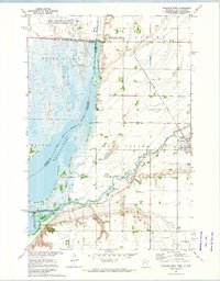
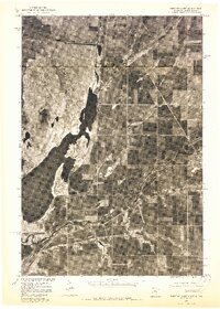 1977 Wheaton West1978 Print · USGSThe agricultural landscape around the Minnesota-South Dakota border is captured here in the late 1970s. Trace the path of the Mustinka River as it flows past Wheaton toward the expansive waters of Mud Lake and Lake Traverse.2 unique versions available
 - 1985 Map of Wheaton
 1985 Wheaton1985 Print · USGSThe tri-state border region of Minnesota and the Dakotas is captured in the mid-1980s, defined by its prairie wetlands and rail-fed farming towns. Researchers can trace the Burlington Northern line through Wheaton and Graceville or locate family-named landmarks like Carlson Island.2 unique versions available
End of results
Showing maps 1-9 of 9
Top cities near Wheaton
Top neighborhoods of Wheaton
Frequently asked questions
- What are the different types of historical maps available for Wheaton?
- What is the oldest map of Wheaton?
- Where can I purchase historical maps of Wheaton for my home or office?
- Where can I download high-res historical maps of Wheaton?
- Are there historical topographic maps available for Wheaton?
- Is there historical aerial imagery available for Wheaton?
- Where are historical maps of Wheaton sourced from?