Old Maps of Waseca County, Minnesota for Academic Research
Study the evolution of Waseca County with 107 high-resolution historic maps. Whether you're teaching, researching, or modeling changes in land use, these maps provide essential visual documentation of urban, environmental, and geographic change.
- Analyze long-term change: Track patterns in development, transportation, and natural features.
- Ideal for environmental or urban studies: Support academic projects with primary historical map data.
- Use in the classroom or lab: Educators and researchers rely on these maps to bring historical context to life.
These maps are a powerful tool for teaching, research, and visualizing how Waseca County has changed over the decades.
Waseca County, MN maps
(107)- 1950 Map of Mankato East
 1950 Mankato East1950 Print · USGSBlue Earth County at mid-century reveals a dense network of rural school districts and rail sidings connecting farm towns to the regional hub. Researchers can trace the legacy of local education and industry through sites like Sugar Grove Sch, Lime Siding, and the St Clair settlement.3 unique versions available
 - 1951 Map of Mankato East
 1951 Mankato East1951 Print · USGSBlue Earth County's landscape in the early fifties is defined by its dense network of rural school districts and winding river valleys. Genealogists and historians can trace the foundations of local life at St Clair, Mankato Springs, and numerous family-named landmarks like Pugh Sch and Eagle Lake Cem.
 - 1953 Map of Saint Paul, 1964 Print
 1953 Saint Paul1964 Print · USGSThe Twin Cities and the Mississippi River valley are captured here at a mid-century turning point. Trace the early growth of Minneapolis and Saint Paul alongside landmarks like Lake Minnetonka and the St Croix River.4 unique versions available
 - 1954 Map of Mason City, 1967 Print
 1954 Mason City1967 Print · USGSSouthern Minnesota and northern Iowa are shown here at the height of the mid-century rail era, centered on the regional hubs of Mason City and Rochester. Researchers can trace the vanished paths of the Chicago Great Western and find local landmarks like Pilot Knob and Bear Lake.2 unique versions available
 - 1957 Map of Mason City
 1957 Mason City1957 Print · USGSThe Minnesota-Iowa border region comes alive in this mid-century survey, from the industrial plants of Mason City to the medical hub of Rochester. Researchers can trace the rail-and-river economy through the Chicago Great Western Railway and the Shell Rock River.
 - 1958 Map of Mason City
 1958 Mason City1958 Print · USGSSouthern Minnesota and northern Iowa are shown during the mid-fifties when railroads still anchored the regional economy. Genealogists and historians can trace the intricate rail networks of the Illinois Central and find local landmarks in Mason City, Albert Lea, and Austin.
 - 1959 Map of Saint Paul
 1959 Saint Paul1959 Print · USGSThe Twin Cities and southeastern Minnesota appear here in the late fifties, showing the peak of the rail era and post-war suburban growth. Genealogists can trace family footprints near Lake Minnetonka, the Univ Of Minn Rosemount Research Center, or the growing neighborhoods of Richfield.2 unique versions available
 - 1962 Map of Morristown, 1963 Print
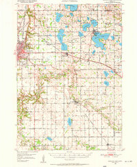
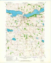
 1962 Morristown1963 Print · USGSRice and Waseca counties in the early sixties reveal a landscape of river-town commerce and rural parish life. Researchers can trace family roots at Riverside Cemetery, locate the Chicago Great Western rail line, or find the Blooming Grove Church.2 unique versions available
 - 1962 Map of Meriden, 1964 Print
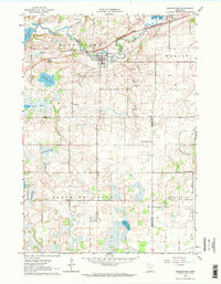
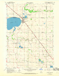
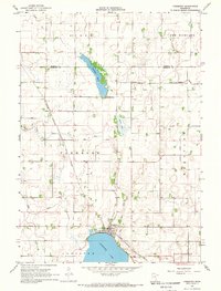
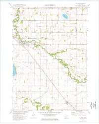
 1962 Meriden1964 Print · USGSWaseca and the surrounding farm townships are seen here in the early sixties, centered on the lakes and rail lines of south-central Minnesota. Genealogists can locate family landmarks like St Paul Ch, Karsten Cem, and rural schoolhouses such as School No 2142.
 - 1966 Map of Waseca, 1967 Print
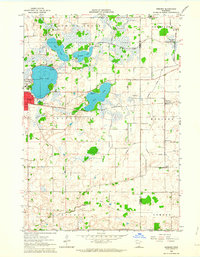
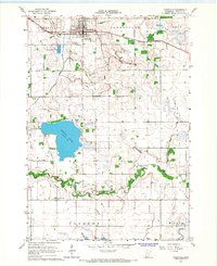
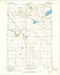
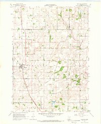
 1966 Waseca1967 Print · USGSMid-century Waseca County comes into focus here during a period of agricultural and institutional growth. Genealogists and local historians can trace the early city grid and rural parish life through sites like Loon Lake, the Southern School of Agriculture, and Wilton Cem.2 unique versions available
 - 1966 Map of Janesville, 1967 Print
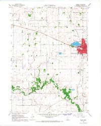
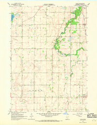
 1966 Janesville1967 Print · USGSThe Waseca County countryside was an established network of rail and river during the mid-sixties. Genealogists and local historians can trace the Chicago and North Western rail line and locate family burial sites at St Anns Cem or Alma City Cem.
 - 1966 Map of Waterville, 1968 Print
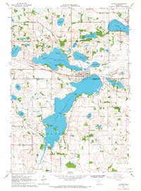
 1966 Waterville1968 Print · USGSWaterville sits at the center of this mid-century survey, where the railroads and the Cannon River system define the local economy. Genealogists can trace rural roots through family-named landmarks like McPete Point and several old graveyards including Iosco Cem and Ebenezer Cem.2 unique versions available
 - 1966 Map of Elysian, 1968 Print
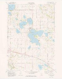
 1966 Elysian1968 Print · USGSThe lakeside communities and rail corridors of south-central Minnesota are captured here in the mid-1960s, showing a landscape shaped by water and the Chicago Great Western railroad. Local historians can trace the early layout of Elysian and Greenland, find family landmarks like Sextons Point, or locate the Cedar Hill Cemetery.2 unique versions available
 - 1967 Map of Minnesota Lake, 1968 Print
 1967 Minnesota Lake1968 Print · USGSMinnesota Lake and its surrounding townships are captured in the late sixties as the local rail and agricultural systems remained firmly established. Genealogists and historians can trace family plots at Peace Cem or Zions Cem and locate landmarks like the Stokman State Wildlife Management Area.2 unique versions available
 - 1967 Map of Waldorf, 1969 Print
 1967 Waldorf1969 Print · USGSWaldorf was a vital rail-side community in the late 1960s, surrounded by the meticulously drained fields of southern Minnesota. Researchers can locate numerous ancestral sites including Freedom Cem, Radloff Cem, and Immanuel Ch along the Chicago Milwaukee St Paul and Pacific line.
 - 1967 Map of Freeborn, 1969 Print
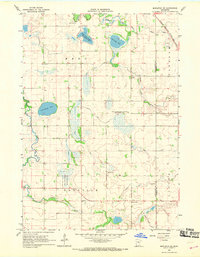
 1967 Freeborn1969 Print · USGSFreeborn and the surrounding lake country appear in this late 1960s survey as a hub for rail transport and agricultural drainage. Genealogists and local researchers can locate Freeborn Cem, Seven Day Cem, and the path of the Chicago Milwaukee St Paul and Pacific railroad.2 unique versions available
 - 1967 Map of Otisco, 1969 Print
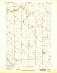
 1967 Otisco1969 Print · USGSWaseca County's agricultural heartland is documented here in the late sixties as drainage projects and rail lines shaped the local economy. Researchers can locate family landmarks like St Peter Cem or trace the Chicago and North Western rail corridor through Otisco.
 - 1967 Map of Matawan, 1969 Print
 1967 Matawan1969 Print · USGSSouthern Minnesota farming communities flourished in the late sixties as the rail lines connected small hubs to larger markets. Genealogists can trace family footprints near St Pauls Ch, the Townhall, and the rural sidings of Matawan and Wells.
 - 1967 Map of Hartland, 1969 Print
 1967 Hartland1969 Print · USGSFreeborn County in the late sixties shows a landscape defined by rail-dependent villages and extensive field drainage. Genealogists can locate family sites near St Aidens Cem or trace the old Chicago and North Western line through Hartland.
 - 1967 Map of Mapleton NE, 1969 Print
 1967 Mapleton NE1969 Print · USGSSouthern Minnesota farmland is captured here in the mid-1960s as the rail lines and river valleys shaped local life. Researchers can trace family roots through landmarks like St Johns Ch, the Danville Cem, and the old Townhall.
 - 1967 Map of New Richland, 1969 Print
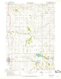 1967 New Richland1969 Print · USGSWaseca and Steele Counties appear at the end of the sixties as a meticulously drained agricultural landscape centered on the rail town of New Richland. Researchers can trace rural lineages through local landmarks like Otisco Cem, School No 2137, and the Le Sueur River Ch.
 - 1974 Map of Madison Lake, 1976 Print
 1974 Madison Lake1976 Print · USGSBlue Earth County’s lake country is captured here in the mid-seventies, showing the lakeside town of Madison Lake at a transitional moment. Genealogists and local historians can trace family locations near Marysburg, Smiths Mill, and the grounds of Calvary Cem.
 - 1974 Map of St Clair, 1976 Print
 1974 St Clair1976 Print · USGSBlue Earth County's agricultural and rail landscape is preserved here during the mid-seventies, showing the towns of St Clair and Pemberton in detail. Researchers can trace the Chicago Milwaukee St Paul and Pacific line and locate family burial sites at McPherson Cem or St Johns Cem.
 - 1985 Map of Albert Lea
 1985 Albert Lea1985 Print · USGSSouthern Minnesota's agricultural heartland is documented here in the mid-1980s, showing a landscape defined by industrial rail lines and managed waterways. Trace the historic routes of the Chicago and North Western and explore settlements like Hollandale, New Richland, and Bricelyn.2 unique versions available
 - 1985 Map of Faribault, 1986 Print
 1985 Faribault1986 Print · USGSThe Minnesota River valley and the glacial lake country of Rice and Le Sueur counties are shown here in the mid-1980s. Researchers can trace the academic grounds of St Olaf College or find old crossroads like Trondhjem and Little Chicago.2 unique versions available
Showing maps 1-25 of 107
Top cities of Waseca County
- Waseca historical maps
- Janesville historical maps
- New Richland historical maps
- Otisco historical maps
- Wilton historical maps
- Waldorf historical maps
Frequently asked questions
- What are the different types of historical maps available for Waseca County?
- What is the oldest map of Waseca County?
- Where can I purchase historical maps of Waseca County for my home or office?
- Where can I download high-res historical maps of Waseca County?
- Are there historical topographic maps available for Waseca County?
- Is there historical aerial imagery available for Waseca County?
- Where are historical maps of Waseca County sourced from?