Old Maps of Monticello Township, Minnesota for Genealogy
Trace your family roots with 52 historic maps of Monticello Township. These high-res maps reveal old neighborhoods, homesites, landmarks, and streets — helping you uncover where your ancestors lived and how the area evolved over time.
- Explore historic neighborhoods: Identify where your relatives may have lived in the 1800s or 1900s.
- Compare maps over time: Trace the changes in streets, buildings, and landmarks for multi-generational research.
- Perfect for genealogy & ancestry research: Used by family historians and researchers to map out lineage and migration.
These maps are an incredible resource for exploring your personal connection to Monticello Township's past.
Monticello Township, MN maps
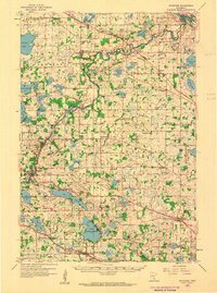
(52)- 1909 Map of Rockford
 1909 Rockford1909 Print · USGSWright and Hennepin counties are shown here in the first decade of the twentieth century as the railroads transformed rural Minnesota. Genealogists can locate family-named features like Berning Mill, Salem Church, and early schools in Burschville or Hassan.2 unique versions available
 - 1953 Map of Stillwater, 1980 Print
 1953 Stillwater1980 Print · USGSThe Twin Cities and the St. Croix Valley are captured in this mid-century survey as the interstate era began to transform the Upper Midwest. Genealogists and historians can trace the rail-and-river geography of Stillwater, locate landmarks in Anoka, or explore the sprawling St Croix State Park.
 - 1955 Map of Stillwater, 1965 Print
 1955 Stillwater1965 Print · USGSThe Upper St. Croix Valley and the growing Twin Cities area are shown here during the mid-fifties, before the interstate era transformed the regional commute. You can trace the lines of the Northern Pacific RR through towns like Rush City or locate the Saint Croix Indian Reservation.
 - 1958 Map of Stillwater
 1958 Stillwater1958 Print · USGSThe Upper Mississippi and St. Croix River valleys appear in the mid-fifties as the Twin Cities expanded north. Genealogists can locate family landmarks like Oak Park Cem, Saint Michael Church, and the Soo Line RR rail corridors.2 unique versions available
 - 1958 Map of Rockford, 1959 Print
 1958 Rockford1959 Print · USGSWright and Hennepin counties are shown here in the late fifties, during a period of steady rural growth and agricultural stability. Researchers can trace ancestral roots at Berning Mill, find small country schoolhouses like Oakdale School, or locate parish centers such as St Michael Church.2 unique versions available
 - 1958 Map of Buffalo, 1959 Print
 1958 Buffalo1959 Print · USGSWright County in the late fifties was a landscape of deep-set lakes and small farming villages connected by the Great Northern rail line. Genealogists and historians can trace local family roots through sites like Swedesburg Ch, St Timothy Cem, and East Maple Lake Sch.2 unique versions available
 - 1961 Map of Big Lake, 1963 Print
 1961 Big Lake1963 Print · USGSSherburne County and the upper Mississippi corridor are shown here in the early sixties as a network of rail and river commerce. Genealogists and local historians can trace the town of Big Lake, the settlement of Bailey, and the old Great Northern rail lines.2 unique versions available
 - 1961 Map of Silver Creek, 1963 Print
 1961 Silver Creek1963 Print · USGSWright County in the early 1960s was a landscape of glacial lakes and small rail-side settlements. Researchers can locate family landmarks like Highland Cem, the Carter Sch, and the local Silver Creek Ch along the Great Northern line.2 unique versions available
 - 1961 Map of Monticello, 1963 Print
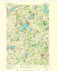
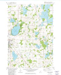
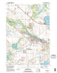
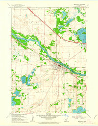 1961 Monticello1963 Print · USGSThe riverfront communities of Monticello and Big Lake are captured in the early sixties as they developed along the Mississippi River. Researchers can trace old family plots at Hillside Cemetery and Helm Cemetery or locate the historic Great Northern rail lines.3 unique versions available
 - 1961 Map of Monticello, 1965 Print
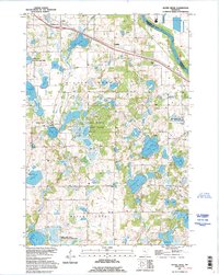
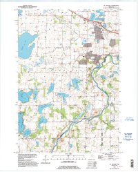
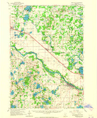 1961 Monticello1965 Print · USGSUpper Mississippi valley river towns and rail corridors thrive here during the early sixties, caught between the prairie and the Big Woods. Researchers can trace family sites at St Henrys Cem, locate the Carter Sch, or follow the twin rail lines of the Great Northern and Northern Pacific.3 unique versions available
 - 1961 Map of Elk River, 1965 Print
 1961 Elk River1965 Print · USGSThe Elk River and Mississippi River valleys in the early 1960s showcase a landscape of shifting industry and conservation. Local researchers can trace family sites at Orrock Cem, find Zimmerman's post office, and locate the Sand Dunes Lookout Tower.
 - 1965 Map of Stillwater
 1965 Stillwater1965 Print · USGSThe Twin Cities and the St. Croix Valley are mapped here during a period of significant post-war growth and industrial transit. Genealogists and historians can trace rail lines like the Northern Pacific RR through towns such as Rush City, Amery, and Balsam Lake.
 - 1975 Map of Stillwater
 1975 Stillwater1975 Print · USGSThe Twin Cities and the St. Croix Valley are captured in the mid-seventies, showing the urban growth of Minneapolis and St Paul. Researchers can trace old rail corridors of the Northern Pacific RR and locate tribal lands at the Mille Lacs Indian Reservation.2 unique versions available
 - 1981 Map of St Michael
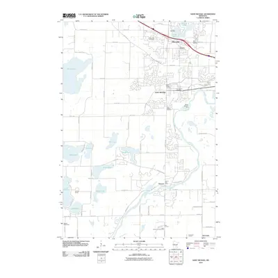
 1981 St Michael1981 Print · USGSIn the early 1980s, the growing communities of St Michael and Albertville were still defined by their local institutions and lakeside geography. Genealogists and historians can trace family locations through St Albert Cem, St Michael Cem, and the historic Berning Mill along the Crow River.
 - 1981 Map of Buffalo East, 1982 Print
 1981 Buffalo East1982 Print · USGSWright County is revealed in the early 1980s as a landscape of interconnected glacial lakes and established township settlements. Local historians can trace the Soo Line rail corridor and find old burial sites like St Marks Cem and Lakeview Cem.
 - 1981 Map of Buffalo West, 1982 Print
 1981 Buffalo West1982 Print · USGSWright County’s lake country is captured in the early eighties as the communities of Buffalo and Maple Lake grew around their namesake waters. Researchers can trace the Old Railroad Grade or locate historic burial sites like Old St Timothy Cem and St Charles Cem.
 - 1985 Map of Anoka
 1985 Anoka1985 Print · USGSThe northern Twin Cities suburbs and the Mississippi River valley are captured here in the mid-eighties as suburban growth began to meet rural conservation lands. Trace the expansion of Anoka and Blaine, or locate family landmarks near the Rum River and Buffalo Lake.
 - 1991 Map of Anoka, 1992 Print
 1991 Anoka1992 Print · USGSThe northern Twin Cities suburbs and the upper Mississippi River valley are captured here in the early nineties during a period of rapid suburban expansion. Trace the rail corridors of the Burlington Northern Railroad or explore the boundaries of the Sherburne National Wildlife Refuge and Lake Maria State Park.
 - 1991 Map of Big Lake, 1995 Print
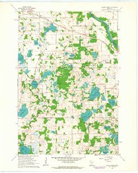
 1991 Big Lake1995 Print · USGSSherburne and Wright counties meet along the Mississippi River in this early 1990s survey of central Minnesota. Genealogists and local historians can trace the lakeside developments of Big Lake and Monticello or locate rural landmarks like the Cem at Bailey.
 - 1991 Map of Silver Creek, 1995 Print
 1991 Silver Creek1995 Print · USGSWright County’s lake-rich interior is captured here in the early nineties, showing a landscape defined by significant conservation and state park lands. Genealogists can locate rural burial grounds like Highland Cem or Lakeview Cem and trace old road networks through Hasty and Enfield.
 - 1991 Map of Monticello, 1995 Print
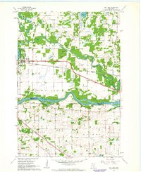
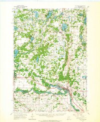
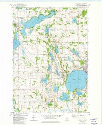
 1991 Monticello1995 Print · USGSThe Mississippi River corridor between Wright and Sherburne counties is documented here in the early nineties as lakeside communities grew. Trace family heritage at Riverside Cem and St Henrys Cem or explore the wetlands around Pelican Lake.
 - 1991 Map of St Michael, 1995 Print
 1991 St Michael1995 Print · USGSWright and Hennepin counties meet at the bend of the Crow River in the early nineties, showing a region transitioning from rural townships to growing suburban centers. Trace local history through landmarks like Berning Mill, St Michael Ch, and the numerous lakes such as Pelican Lake.
 - 2010 Map of Monticello, 2010 Print
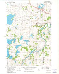
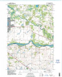
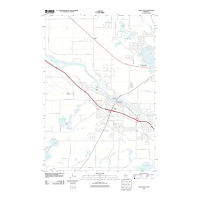 2010 Monticello2010 Print · USGSCovers Monticello Township, including Monticello, Big Lake, and other nearby areas
 - 2010 Map of Big Lake, 2010 Print
 2010 Big Lake2010 Print · USGSCovers Monticello Township, including Elk River, Otsego, and other nearby areas
 - 2010 Map of Saint Michael, 2010 Print
 2010 Saint Michael2010 Print · USGSCovers Monticello Township, including St. Michael, Saint Michael, and other nearby areas
Showing maps 1-25 of 52
Top cities near Monticello Township
- Elk River historical maps
- Saint Michael historical maps
- St. Michael historical maps
- Buffalo historical maps
- Rogers historical maps
- Otsego historical maps
See more
Frequently asked questions
- What are the different types of historical maps available for Monticello Township?
- What is the oldest map of Monticello Township?
- Where can I purchase historical maps of Monticello Township for my home or office?
- Where can I download high-res historical maps of Monticello Township?
- Are there historical topographic maps available for Monticello Township?
- Is there historical aerial imagery available for Monticello Township?
- Where are historical maps of Monticello Township sourced from?