Old Maps of Yellow Medicine County, Minnesota for Academic Research
Study the evolution of Yellow Medicine County with 152 high-resolution historic maps. Whether you're teaching, researching, or modeling changes in land use, these maps provide essential visual documentation of urban, environmental, and geographic change.
- Analyze long-term change: Track patterns in development, transportation, and natural features.
- Ideal for environmental or urban studies: Support academic projects with primary historical map data.
- Use in the classroom or lab: Educators and researchers rely on these maps to bring historical context to life.
These maps are a powerful tool for teaching, research, and visualizing how Yellow Medicine County has changed over the decades.
Yellow Medicine County, MN maps
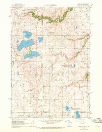
(152)- 1953 Map of Watertown, 1968 Print
 1953 Watertown1968 Print · USGSEastern South Dakota and the Minnesota borderlands are captured here during the mid-twentieth century as the region's agricultural and rail-service centers thrived. Genealogists and local historians can trace family-named sites across the Coteau des Prairies and find landmarks in Watertown, De Smet, and Brookings.3 unique versions available
 - 1953 Map of New Ulm, 1968 Print
 1953 New Ulm1968 Print · USGSSouthern Minnesota in the mid-1950s is defined by its deep river valleys and the expanding reach of the Great Northern and Chicago and North Western railroads. Researchers can trace rural lineages through landmarks like the Milford State Monument, St. John's Ch, and the Upper Sioux Indian Res.3 unique versions available
 - 1957 Map of New Ulm
 1957 New Ulm1957 Print · USGSCentral Minnesota in the mid-fifties remains a landscape of river-valley commerce and prairie agriculture defined by its historic mission sites and rail towns. Genealogists and local historians can trace the development of New Ulm and Montevideo, or locate specific landmarks like the Milford State Monument and Minnesota Falls.
 - 1958 Map of New Ulm
 1958 New Ulm1958 Print · USGSSouth-central Minnesota’s river valleys and prairie towns are captured here in the mid-fifties, during the height of the region's rail-and-river economy. Genealogists and historians can trace the legacy of the Upper Sioux Indian Mission or locate early rail stops along the Chicago and North Western Ry in towns like Redwood Falls and Glencoe.
 - 1958 Map of Watertown
 1958 Watertown1958 Print · USGSThe eastern South Dakota prairie and the Minnesota borderlands are captured here in the late fifties, showcasing a landscape of terminal moraine lakes and burgeoning rail hubs. Genealogists and historians can trace the early paths of the Chicago and North Western railroad or locate family roots in Watertown, Clark, or the Sisseton Indian Reservation.2 unique versions available
 - 1962 Map of Wood Lake NW, 1963 Print
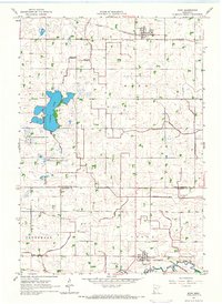
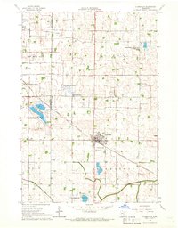
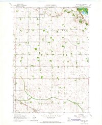
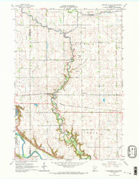
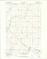
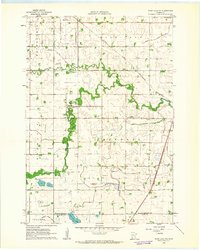 1962 Wood Lake NW1963 Print · USGSYellow Medicine County during the early 1960s shows a landscape of productive prairie and vital rail lines like the Great Northern. Genealogists and local historians can locate Hazel Run, the West Cem, and trace the winding course of the Yellow Medicine River.
 - 1962 Map of School Grove Lake, 1964 Print
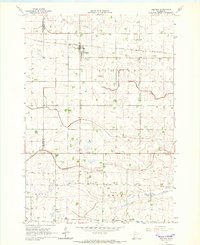
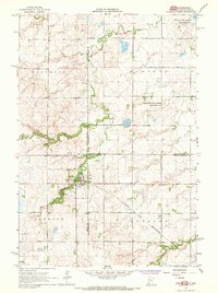
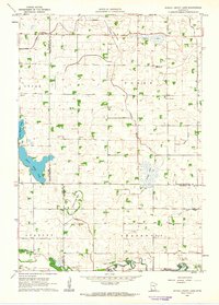 1962 School Grove Lake1964 Print · USGSThe prairie townships of Yellow Medicine and Redwood counties are captured here in the early sixties as drainage networks reshaped the land. Genealogists can locate family farmstead sites near St Lukes Sch, the local Townhall, and along the banks of School Grove Lake.
 - 1962 Map of Wood Lake, 1964 Print
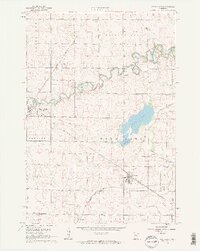 1962 Wood Lake1964 Print · USGSSouthwest Minnesota in the early sixties reveals a landscape of high-prairie agriculture and critical rail junctions. Trace the paths of the Chicago and North Western through Hanley Falls and locate community anchors like the Lutheran Cem and the Gaging Station.2 unique versions available
 - 1965 Map of Montevideo, 1966 Print
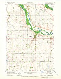
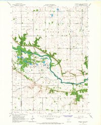
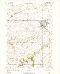
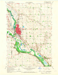 1965 Montevideo1966 Print · USGSThe river confluence at Montevideo flourished in the mid-sixties as a center for rail and river-valley transport. Researchers can trace family history through many local landmarks, including Sunset Memorial Cemetery, St Johns Ch, and the tiny settlement of Wegdahl.2 unique versions available
 - 1965 Map of Echo, 1966 Print
 1965 Echo1966 Print · USGSYellow Medicine and Redwood counties meet here in the mid-sixties, where rail-line towns served a landscape of engineered prairie. Genealogists and local historians can trace the Chicago and North Western tracks to Echo, locate Vesta Cem, or study the wetlands of Curtis Lake.
 - 1965 Map of Clarkfield, 1966 Print
 1965 Clarkfield1966 Print · USGSMid-century Yellow Medicine County is defined here by the diagonal tracks of the Chicago and North Western and a vast network of prairie wetlands. Trace the development of Clarkfield through its cemetery, Storage Bins, and the many wildlife areas like Lake Louie.
 - 1965 Map of Clarkfield NE, 1966 Print
 1965 Clarkfield NE1966 Print · USGSThe confluence of the Minnesota and Chippewa Rivers defines this rural landscape in the mid-1960s. Genealogists can trace family footprints at German American Cem and St Petri Cem, or locate landmarks like School No 839.
 - 1965 Map of Lone Tree Lake, 1966 Print
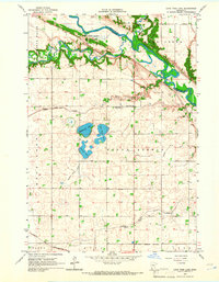 1965 Lone Tree Lake1966 Print · USGSThe Minnesota River valley meets the prairie in the mid-1960s, showing the intersection of Dakota history and early settlement. Trace the grounds of Upper Sioux Agency State Park, Rock Valley Ch, and Hillside Cem.2 unique versions available
 - 1965 Map of Hazel Run, 1966 Print
 1965 Hazel Run1966 Print · USGSHazel Run and the surrounding prairie townships are captured here in the mid-1960s, showing a landscape defined by industrial agriculture and rail. Researchers can trace the intersections of the Chicago and North Western rail line and local landmarks like Bergen Ch and Camp Release Cem.
 - 1965 Map of Boyd, 1966 Print
 1965 Boyd1966 Print · USGSThe rural prairie of Lac qui Parle and Yellow Medicine counties is captured in the mid-1960s as a landscape of structured drainage and rail-side commerce. Researchers can locate specific family history sites like Trinity Cem, the Zion Ch, and the township Townhall.
 - 1965 Map of Belview, 1966 Print
 1965 Belview1966 Print · USGSBelview and the surrounding prairie townships were defined by the rail and agricultural drainage systems of the mid-sixties. Genealogists can locate family landmarks like St Johns Ch and Belview Cem alongside the Chicago and North Western tracks.
 - 1965 Map of Iverson Lake, 1966 Print
 1965 Iverson Lake1966 Print · USGSThe Minnesota River valley in the mid-sixties reveals a landscape of wooded bluffs and agricultural plains along the Renville and Redwood county line. Genealogists and local historians can trace landmarks like Opdal Ch, Middag Knutea, and the Joseph R Brown Wayside Park.
 - 1965 Map of Granite Falls, 1967 Print
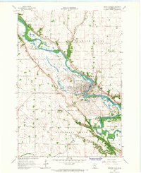 1965 Granite Falls1967 Print · USGSGranite Falls and the Minnesota River valley are captured here in the mid-1960s as the regional rail and agricultural networks reached a point of mature development. Researchers can trace family history at Hillcrest Cem or explore the boundaries of the Upper Sioux Indian Community and the settlement of Minnesota Falls.
 - 1965 Map of Minnesota Falls, 1967 Print
 1965 Minnesota Falls1967 Print · USGSThe river valleys of Renville and Chippewa counties are shown here in the mid-1960s, centered on the settlement of Minnesota Falls. Researchers can trace the path of the Chicago Milwaukee St Paul and Pacific railroad and locate landmarks like the Vesper Song Chapel and Upper Sioux Indian Community.2 unique versions available
 - 1967 Map of New Ulm
 1967 New Ulm1967 Print · USGSSouthern Minnesota in the mid-fifties is captured here as a landscape of river-valley missions and busy prairie rail towns. Researchers can trace the Yellow Medicine Trail and locate historic sites like the Morton Indian Mission and Milford State Monument.
 - 1967 Map of Canby, 1968 Print
 1967 Canby1968 Print · USGSCanby and its surrounding prairie townships are captured here in the mid-sixties, showing a mature agricultural and rail landscape. Researchers can trace family history through numerous rural sites like St Pauls Cem, the settlement at Burr, and the Vocational Sch.
 - 1967 Map of Dawson SW, 1968 Print
 1967 Dawson SW1968 Print · USGSLac qui Parle and Yellow Medicine counties meet here in the late sixties, showing a landscape defined by prairie agriculture and rural townships. Researchers can find deep local roots at the Providence Valley Ch or trace the winding Lazarus Creek.
 - 1967 Map of Gary, 1968 Print
 1967 Gary1968 Print · USGSCrossing the border between South Dakota and Minnesota in the late 1960s, this area centers on the town of Gary and its river-carved landscape. Genealogists and local researchers can trace early rural life through Grandview Cem, the Chicago and North Western rail line, and the Lac qui Parle State Game Refuge.2 unique versions available
 - 1967 Map of Canby NW, 1968 Print
 1967 Canby NW1968 Print · USGSThe prairie borderlands of Minnesota and South Dakota come into focus in the mid-1960s, showing a landscape shaped by glacial lakes and conservation efforts. Researchers can locate the Fortier Cem, School No 111, and the waters of Lake Cochrane and Culver Lake.2 unique versions available
 - 1967 Map of Porter, 1968 Print
 1967 Porter1968 Print · USGSWestern Minnesota prairie life is captured here in the late sixties, centered on the rail-side town of Porter. Genealogists and local historians can trace the paths of the Lac qui Parle River or locate family plots at Wergeland Cem.
Showing maps 1-25 of 152
Top cities of Yellow Medicine County
- Canby historical maps
- Clarkfield historical maps
- Wood Lake historical maps
- Hanley Falls historical maps
- Echo historical maps
- Normania historical maps
See more
Frequently asked questions
- What are the different types of historical maps available for Yellow Medicine County?
- What is the oldest map of Yellow Medicine County?
- Where can I purchase historical maps of Yellow Medicine County for my home or office?
- Where can I download high-res historical maps of Yellow Medicine County?
- Are there historical topographic maps available for Yellow Medicine County?
- Is there historical aerial imagery available for Yellow Medicine County?
- Where are historical maps of Yellow Medicine County sourced from?