2020s Maps of Hazel Run, Minnesota
Explore 2 historic maps of Hazel Run from the 2020s. These maps offer a rare glimpse into what life looked like during the 2020s — showing old roads, neighborhoods, homes, and landmarks that have changed or disappeared over time.
Whether you're researching your family's past, planning a metal detecting trip, or studying how Hazel Run's landscape evolved across the 2020s, these high-resolution maps are a powerful tool for exploring the history of this region.
- Focus on a specific era: All maps on this page are from the 2020s, giving you a focused view of this time period.
- See what’s changed: Compare century-old streets, trails, and buildings to today's modern landscape using overlays and satellite layers.
- Research with precision: Use these maps for genealogy, historical research, land use analysis, or educational projects.
- View, download, or print: Maps are fully viewable online in high resolution, and can be downloaded or printed for your own records.
Start exploring Hazel Run's history through authentic maps from the 2020s. This is your window into the past.
Hazel Run, MN maps
(2)- 2022 Map of Hazel Run, 2022 Print
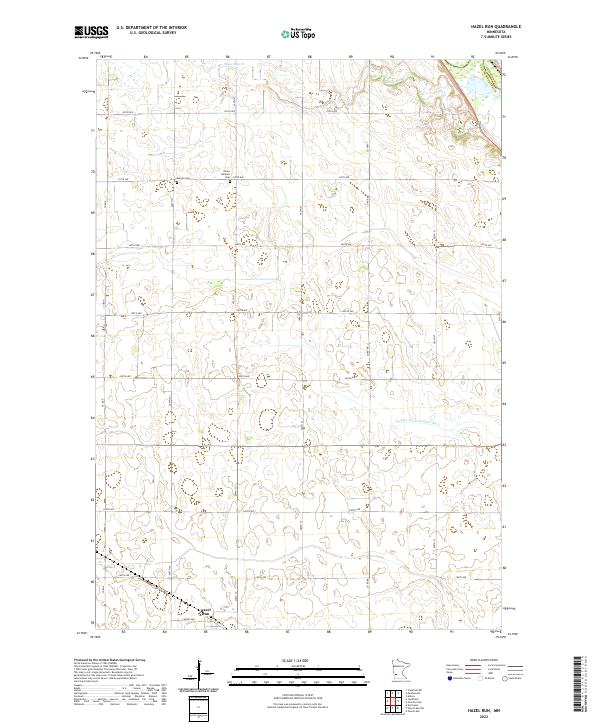 2022 Hazel Run2022 Print · USGSThe prairie landscape around Hazel Run is captured here in the early twenty-first century, showing the enduring grid of family farms. Researchers can locate Bergen Cem, Camp Release Cem, and the path of Stony Run Cr.
 - 2022 Map of Wood Lake NW, 2022 Print
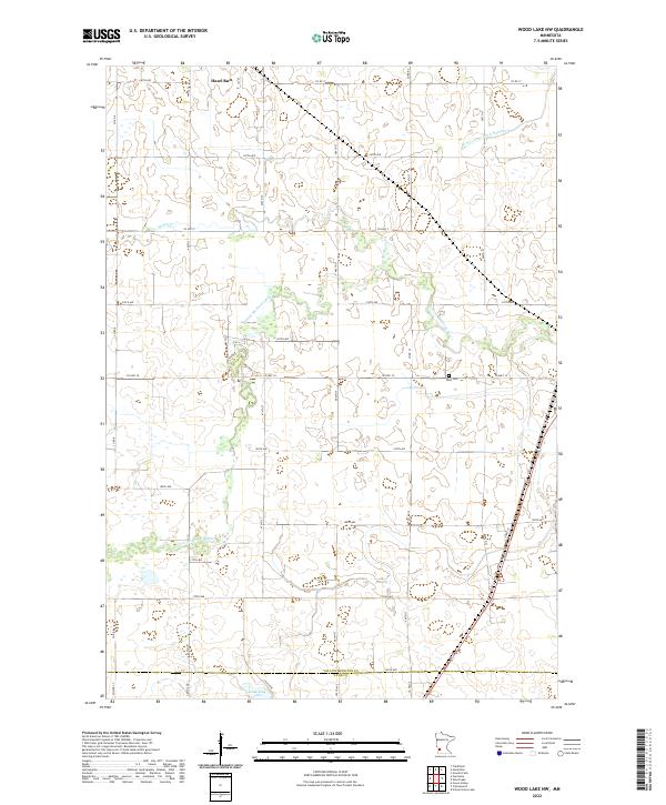 2022 Wood Lake NW2022 Print · USGSThe rural prairie of Yellow Medicine County is captured here in the early 2020s, showing a landscape shaped by the Yellow Medicine River and agricultural grids. Researchers can trace land parcels near Hazel Run or locate the West Cem and Lone Tree Lake.
End of results
Showing maps 1-2 of 2
Top cities near Hazel Run
- Montevideo historical maps
- Granite Falls historical maps
- Cottonwood historical maps
- Clarkfield historical maps
- Wood Lake historical maps
- Hanley Falls historical maps
See more
Frequently asked questions
- What are the different types of historical maps available for Hazel Run?
- What is the oldest map of Hazel Run?
- Where can I purchase historical maps of Hazel Run for my home or office?
- Where can I download high-res historical maps of Hazel Run?
- Are there historical topographic maps available for Hazel Run?
- Is there historical aerial imagery available for Hazel Run?
- Where are historical maps of Hazel Run sourced from?