Old Maps of Houston, Mississippi for Metal Detecting
Plan your next treasure hunt with 20 historic maps of Houston. Find old homesites, ghost towns, trails, and gathering spots that may be lost to time — perfect for identifying promising metal detecting locations.
- Locate forgotten sites: Uncover places like long-lost settlements, abandoned rail lines, or gathering spots.
- Plan better hunts: Use map overlays combined with LiDAR or satellite views to narrow in on historically rich areas.
- Made for detectorists: Thousands of hobbyists use these maps to discover relics, coins, and hidden history.
Use these historic maps to boost your research and find new opportunities beneath the surface of Houston.
Houston, MS maps
(20)- 1953 Map of West Point, 1973 Print
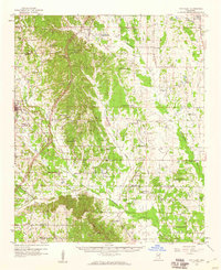
 1953 West Point1973 Print · USGSNorth-Central Mississippi and the Alabama borderlands are captured here during the mid-twentieth century as new reservoirs and national forests transformed the landscape. Researchers can trace the path of the Mississippi & Skuna Valley railroad or locate old landings along the Tombigbee River and Schooner Creek.3 unique versions available
 - 1958 Map of West Point
 1958 West Point1958 Print · USGSNortheastern Mississippi and western Alabama are shown in the late 1950s, highlighting a region defined by its river-and-rail economy. Researchers can trace family roots through numerous settlements like Artesia and Vardaman or explore the corridor of the Tombigbee River.
 - 1959 Map of Van Vleet, 1960 Print
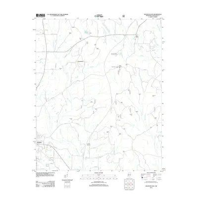
 1959 Van Vleet1960 Print · USGSChickasaw and Clay Counties are shown here in the late fifties as the modern Natchez Trace Parkway was first being cut through the hills. Genealogists can locate dozens of rural landmarks, from Witch Dance Hill to the Asbury Cem and New Zion Sch.3 unique versions available
 - 1963 Map of West Point
 1963 West Point1963 Print · USGSEastern Mississippi and western Alabama are captured in the early sixties as industrial centers and rail lines connected the Black Prairie to the hills. Genealogists and historians can trace family-named watercourses and the early footprints of Starkville, Columbus, and the Noxubee National Wildlife Refuge.2 unique versions available
 - 1972 Map of Houston West, 1974 Print
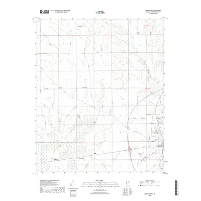
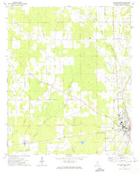 1972 Houston West1974 Print · USGSChickasaw County's western outskirts and rural townships are captured here in the early 1970s. Trace family roots and local history through landmarks like Pearson Chapel, the community of Thorn, and the winding course of the Yalobusha River.
 - 1982 Map of West Point, 1983 Print
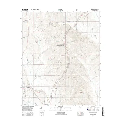
 1982 West Point1983 Print · USGSEastern Mississippi and western Alabama are captured in the early eighties as the river-and-rail economy evolved. Trace family roots and old township lines near West Point, Columbus Air Force Base, and the historic Natchez Trace Parkway.
 - 1984 Map of West Point
 1984 West Point1984 Print · USGSNorth-Central Mississippi in the mid-eighties shows a landscape defined by massive water management projects and dense timberlands. Researchers can trace the legacy of rural settlements like Geeslin Corner or the rail corridors of the Illinois Central Gulf RR near Grenada Lake.3 unique versions available
 - 1984 Map of Grenada, 1990 Print
 1984 Grenada1990 Print · USGSNorth Central Mississippi’s river valleys and conservation lands are captured here in the mid-1980s. Researchers can trace the sprawling Camp Mc Cain, the Illinois Central Gulf rail line, and the historic Treaty Boundary.
 - 1987 Map of Houston East
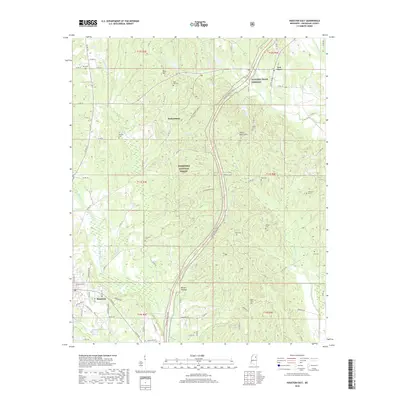
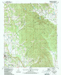 1987 Houston East1987 Print · USGSChickasaw County in the late eighties shows a landscape defined by the Tombigbee National Forest and the growing town of Houston. Researchers can trace old family lines through Ross Hill Cem and Gibbs Cem, or locate landmarks like Bynum Mounds.
 - 2000 Map of Houston East, 2002 Print
 2000 Houston East2002 Print · USGSThe Tombigbee National Forest and the path of the Natchez Trace Parkway define this Chickasaw County landscape at the turn of the century. Researchers can trace rural lineages through family landmarks like Bynum Mounds, Witch Dance Cem, and Van Vleet.
 - 2012 Map of Houston East, 2012 Print
 2012 Houston East2012 Print · USGSCovers Houston, including Parkersburg, Van Vleet, and other nearby areas
 - 2012 Map of Houston West, 2012 Print
 2012 Houston West2012 Print · USGSCovers Houston, including Thorn, Pyland, and other nearby areas
 - 2015 Map of Houston West, 2015 Print
 2015 Houston West2015 Print · USGSCovers Houston, including Thorn, Pyland, and other nearby areas
 - 2015 Map of Houston East, 2015 Print
 2015 Houston East2015 Print · USGSCovers Houston, including Parkersburg, Van Vleet, and other nearby areas
 - 2018 Map of Houston West, 2018 Print
 2018 Houston West2018 Print · USGSCovers Houston, including Thorn, Pyland, and other nearby areas
 - 2018 Map of Houston East, 2018 Print
 2018 Houston East2018 Print · USGSCovers Houston, including Parkersburg, Van Vleet, and other nearby areas
 - 2020 Map of Houston West, 2020 Print
 2020 Houston West2020 Print · USGSCovers Houston, including Thorn, Pyland, and other nearby areas
 - 2021 Map of Houston East, 2021 Print
 2021 Houston East2021 Print · USGSCovers Houston, including Parkersburg, Van Vleet, and other nearby areas
 - 2024 Map of Houston East, 2024 Print
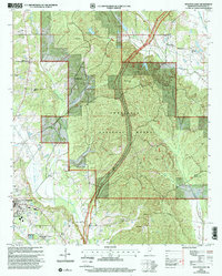
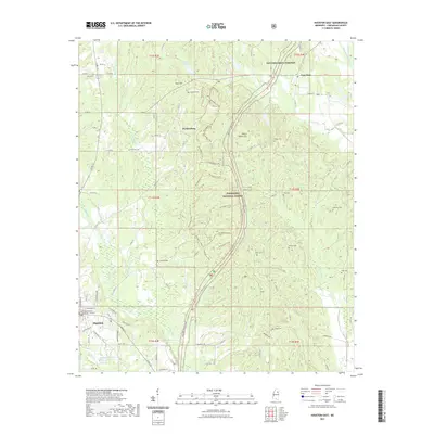
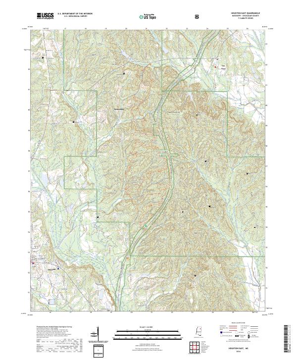 2024 Houston East2024 Print · USGSChickasaw County comes into focus in this recent survey, showcasing the area surrounding the county seat just as it remains a hub of North Mississippi life. Researchers can locate numerous family cemeteries like Reid Cem and Morgan Cem or trace the route of the Natchez Trace Parkway.
 - 2024 Map of Houston West, 2024 Print
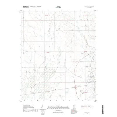
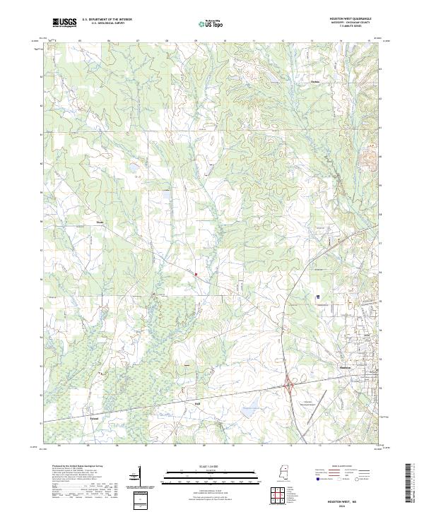 2024 Houston West2024 Print · USGSChickasaw County's western reaches are captured here in the contemporary era, showing the regional hub of Houston and its rural outskirts. Genealogists and local historians can trace the foundations of the county seat at the Chickasaw County Courthouse and locate the historic settlements of Thorn, Thelma, and Pyland.
End of results
Showing maps 1-20 of 20
Top cities near Houston
Frequently asked questions
- What are the different types of historical maps available for Houston?
- What is the oldest map of Houston?
- Where can I purchase historical maps of Houston for my home or office?
- Where can I download high-res historical maps of Houston?
- Are there historical topographic maps available for Houston?
- Is there historical aerial imagery available for Houston?
- Where are historical maps of Houston sourced from?