Old Maps of Collins, Mississippi for Genealogy
Trace your family roots with 17 historic maps of Collins. These high-res maps reveal old neighborhoods, homesites, landmarks, and streets — helping you uncover where your ancestors lived and how the area evolved over time.
- Explore historic neighborhoods: Identify where your relatives may have lived in the 1800s or 1900s.
- Compare maps over time: Trace the changes in streets, buildings, and landmarks for multi-generational research.
- Perfect for genealogy & ancestry research: Used by family historians and researchers to map out lineage and migration.
These maps are an incredible resource for exploring your personal connection to Collins's past.
Collins, MS maps
(17)- 1953 Map of Hattiesburg, 1965 Print
 1953 Hattiesburg1965 Print · USGSSouth Mississippi and western Alabama are shown here during the mid-twentieth century as the timber and rail industries shaped the region. Genealogists and historians can trace rail lines like the Mississippi Central and locate rural centers such as Magee, Richton, and Mount Vernon.4 unique versions available
 - 1958 Map of Hattiesburg
 1958 Hattiesburg1958 Print · USGSSoutheastern Mississippi's timber and rail networks are at their peak during the late fifties, centered on the growing hubs of Hattiesburg and Laurel. Researchers can trace old family landmarks like Sims Chapel, the Busbey Game Refuge, and the vanished stops along the Mississippi Central railroad.2 unique versions available
 - 1974 Map of Williamsburg, 1978 Print
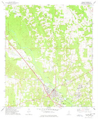
 1974 Williamsburg1978 Print · USGSCovington County in the mid-1970s shows a landscape of creek-side settlements and rural industry before modern expansion. Genealogists can trace family names at Williamson Cem and Hameter Cem or locate community centers like Mt Beulah Ch.
 - 1974 Map of Collins, 1978 Print
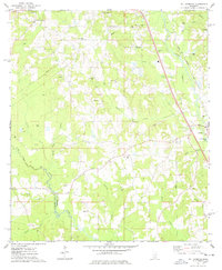
 1974 Collins1978 Print · USGSCovington County shows a mix of rail-based industry and rural community life in the mid-seventies as the Illinois Central Gulf corridor shapes the landscape. Genealogists can trace family names through landmarks like Jones Chapel, Mt Zion Ch, and the Ora Cem.3 unique versions available
 - 1984 Map of Hattiesburg
 1984 Hattiesburg1984 Print · USGSSouth Mississippi’s Pine Belt is seen here in the mid-eighties, showing the region as a hub of timber production and petroleum extraction. Trace the rail lines of the Illinois Central Gulf RR through old settlements like Richton or the energy developments at the Heidelberg Oil Field.2 unique versions available
 - 1984 Map of Laurel
 1984 Laurel1984 Print · USGSCentral Mississippi in the mid-eighties shows a landscape of timberlands and river valleys anchored by the growth of Laurel. Genealogists can trace family names near Oak Grove Ch, rural School sites, and settlements along the Illinois Central Gulf RR.
 - 1994 Map of Laurel
 1994 Laurel1994 Print · USGSThe piney woods of south-central Mississippi come into focus in the 1990s, centered on the timber and industrial hub of Laurel. Genealogists and researchers can trace the rural landscape between Collins and Bay Springs or locate homesites near Ellisville and Magee.
 - 2012 Map of Collins, 2012 Print
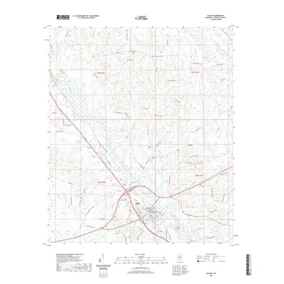
 2012 Collins2012 Print · USGSCovers Collins, including Kola, Blakley Creek, and other nearby areas
 - 2012 Map of Williamsburg, 2012 Print
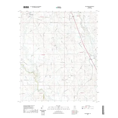
 2012 Williamsburg2012 Print · USGSCovers Collins, including Seminary, Williamsburg, and other nearby areas
 - 2015 Map of Williamsburg, 2015 Print
 2015 Williamsburg2015 Print · USGSCovers Collins, including Seminary, Williamsburg, and other nearby areas
 - 2015 Map of Collins, 2015 Print
 2015 Collins2015 Print · USGSCovers Collins, including Kola, Blakley Creek, and other nearby areas
 - 2018 Map of Williamsburg, 2018 Print
 2018 Williamsburg2018 Print · USGSCovers Collins, including Seminary, Williamsburg, and other nearby areas
 - 2018 Map of Collins, 2018 Print
 2018 Collins2018 Print · USGSCovers Collins, including Kola, Blakley Creek, and other nearby areas
 - 2020 Map of Williamsburg, 2020 Print
 2020 Williamsburg2020 Print · USGSCovers Collins, including Seminary, Williamsburg, and other nearby areas
 - 2020 Map of Collins, 2020 Print
 2020 Collins2020 Print · USGSCovers Collins, including Kola, Blakley Creek, and other nearby areas
 - 2024 Map of Williamsburg, 2024 Print
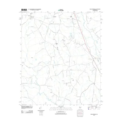
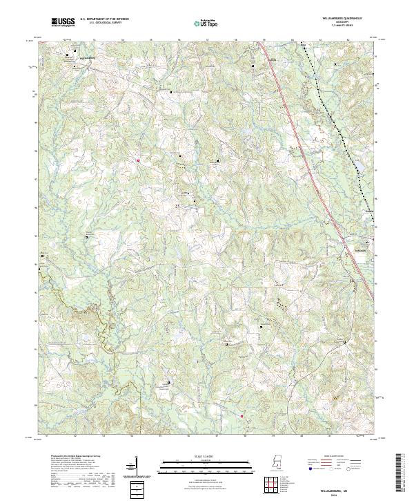 2024 Williamsburg2024 Print · USGSMississippi's rural Covington County landscape is captured here as it appeared recently, centered on the historic crossroads of Williamsburg. Genealogists can trace ancestral sites across a network of family-named landmarks including the Coulter Family Cem, Mount Horeb Cem, and Gandsi.
 - 2024 Map of Collins, 2024 Print
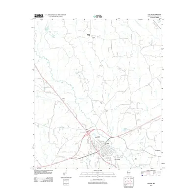
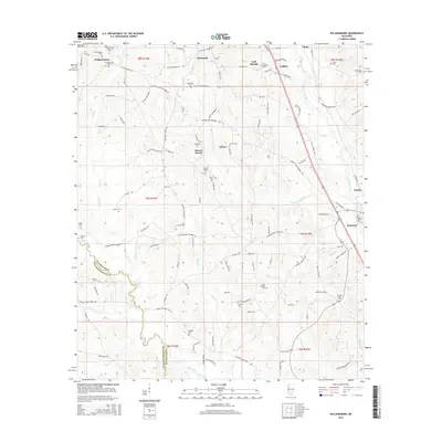
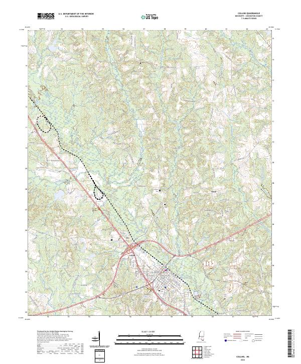 2024 Collins2024 Print · USGSModern Covington County centers on Collins and its civic landmarks. Genealogists and historians can trace family locations along Okatoma Creek and identify local burial sites at Kola Cem, Ora Cem, and Blakely Cem.
End of results
Showing maps 1-17 of 17
Top cities near Collins
- Magee historical maps
- Taylorsville historical maps
- Sumrall historical maps
- Mount Olive historical maps
- Seminary historical maps
- Bassfield historical maps
See more
Top neighborhoods of Collins
Frequently asked questions
- What are the different types of historical maps available for Collins?
- What is the oldest map of Collins?
- Where can I purchase historical maps of Collins for my home or office?
- Where can I download high-res historical maps of Collins?
- Are there historical topographic maps available for Collins?
- Is there historical aerial imagery available for Collins?
- Where are historical maps of Collins sourced from?