1950s Maps of DeSoto County, Mississippi
Explore 6 historic maps of DeSoto County from the 1950s. These maps offer a rare glimpse into what life looked like during the 1950s — showing old roads, neighborhoods, homes, and landmarks that have changed or disappeared over time.
Whether you're researching your family's past, planning a metal detecting trip, or studying how DeSoto County's landscape evolved across the 1950s, these high-resolution maps are a powerful tool for exploring the history of this region.
- Focus on a specific era: All maps on this page are from the 1950s, giving you a focused view of this time period.
- See what’s changed: Compare century-old streets, trails, and buildings to today's modern landscape using overlays and satellite layers.
- Research with precision: Use these maps for genealogy, historical research, land use analysis, or educational projects.
- View, download, or print: Maps are fully viewable online in high resolution, and can be downloaded or printed for your own records.
Start exploring DeSoto County's history through authentic maps from the 1950s. This is your window into the past.
DeSoto County, MS maps
(6)- 1950 Map of Helena
 1950 Helena1950 Print · USGSMid-century Phillips County and the surrounding Delta region are shown at a peak of rail and river commerce. Genealogists and historians can trace family locations through numerous rural communities like Old Austin, Cotton Plant, and West Helena, or follow the routes of the Missouri Pacific RR across Grand Prairie.2 unique versions available
 - 1954 Map of Horseshoe Lake
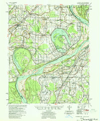 1954 Horseshoe Lake1954 Print · USGSThe Mississippi Delta riverfront in the 1950s was a landscape of expansive plantations and river landings. Genealogists can trace family names and community hubs through features like Snowden Plantation, Rosenwald Sch, and Penton Ch & Cem.2 unique versions available
 - 1955 Map of Helena, 1967 Print
 1955 Helena1967 Print · USGSThe Arkansas Delta and Mississippi floodplains are captured here in the mid-fifties, during a period of expanding flood control and rail commerce. Researchers can trace the extensive Chicago Rock Island and Pacific RR lines and locate sites like the Arkansas State College Experimental Rice Farm or Friars Point.2 unique versions available
 - 1956 Map of Tupelo, 1967 Print
 1956 Tupelo1967 Print · USGSNortheast Mississippi and parts of Tennessee and Alabama are shown here during the mid-fifties, a time of major reservoir construction and forestry management. Researchers can trace the St Louis-San Francisco RR through Tupelo or locate historic sites like Tishomingo State Park and the University.2 unique versions available
 - 1958 Map of Tupelo
 1958 Tupelo1958 Print · USGSNortheast Mississippi and neighboring Alabama and Tennessee appear here during the late fifties as a region defined by new reservoirs and historic rail lines. Genealogists can trace family locations near Sardis Lake, Woodall Mountain, and the St Louis-San Francisco Ry.
 - 1959 Map of Helena
 1959 Helena1959 Print · USGSThe Arkansas and Mississippi Delta regions are captured here in the late fifties, showing a landscape defined by the Mississippi River and the Grand Prairie. Genealogists and researchers can trace the rail networks of the Illinois Central RR and locate community landmarks like Helena and the White River National Wildlife Refuge.
End of results
Showing maps 1-6 of 6
Top cities of DeSoto County
- Southaven historical maps
- Olive Branch historical maps
- Horn Lake historical maps
- Hernando historical maps
- Walls historical maps
Frequently asked questions
- What are the different types of historical maps available for DeSoto County?
- What is the oldest map of DeSoto County?
- Where can I purchase historical maps of DeSoto County for my home or office?
- Where can I download high-res historical maps of DeSoto County?
- Are there historical topographic maps available for DeSoto County?
- Is there historical aerial imagery available for DeSoto County?
- Where are historical maps of DeSoto County sourced from?