Old Maps of Ansley, Mississippi for Academic Research
Study the evolution of Ansley with 17 high-resolution historic maps. Whether you're teaching, researching, or modeling changes in land use, these maps provide essential visual documentation of urban, environmental, and geographic change.
- Analyze long-term change: Track patterns in development, transportation, and natural features.
- Ideal for environmental or urban studies: Support academic projects with primary historical map data.
- Use in the classroom or lab: Educators and researchers rely on these maps to bring historical context to life.
These maps are a powerful tool for teaching, research, and visualizing how Ansley has changed over the decades.
Ansley, MS maps
(17)- 1893 Map of Toulme
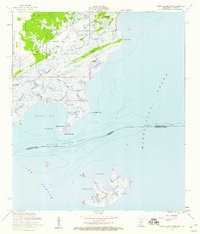
 1893 Toulme1893 Print · USGSThe coastal marshlands of Hancock County are captured in the late 1890s, where the rail line meets the sound. Genealogists and maritime historians can trace the lonely locations of the St. Joseph Island Light, the settlement at Toulme, and the intricate reaches of Heron Bay.4 unique versions available
 - 1935 Map of Grand Island Pass
 1935 Grand Island Pass1935 Print · USGSThe maritime boundary between Mississippi and Louisiana is captured here in the mid-1930s, centering on the tidal marshes of Grand Island. Researchers can trace the winding paths of Gauthier Bayou and West Bayou through the coastal wetlands.2 unique versions available
 - 1949 Map of Grand Island Pass
 1949 Grand Island Pass1949 Print · USGSThe coastal boundary of Louisiana and Mississippi is captured here in the late 1940s, just before significant coastal changes reshaped the marsh. Researchers can trace the mid-century shoreline of Grand Island and locate the Lake Borgne L. H. at the edge of the Mississippi Sound.
 - 1953 Map of Mobile, 1968 Print
 1953 Mobile1968 Print · USGSThe Gulf Coast comes alive in this mid-century survey, from the streets of Mobile to the marshes of New Orleans. Trace family roots in coastal towns like Pass Christian and Bayou La Batre or locate military landmarks including Keesler AFB.3 unique versions available
 - 1956 Map of Grand Island Pass, 1960 Print
 1956 Grand Island Pass1960 Print · USGSCoastal Hancock County and the Mississippi Sound marshes are captured here in the mid-fifties, showing the transition from historic land claims to small shore settlements. Genealogists can locate family landmarks like St Anns Ch, the Bayou Caddy Cem, and the old Nashville and Louisville Road.4 unique versions available
 - 1957 Map of Mobile
 1957 Mobile1957 Print · USGSThe Gulf Coast in the mid-1950s reveals a bustling corridor of rail-and-river commerce connecting Alabama to Louisiana. Genealogists and historians can trace old settlements and military hubs from Keesler Afb to the coastal reaches of Ship Island and Bogalusa.3 unique versions available
 - 1960 Map of Mobile
 1960 Mobile1960 Print · USGSThe Gulf Coast at the dawn of the sixties shows a landscape of busy ports, military airbases, and barrier islands. Trace the rail lines of the Louisville & Nashville through BILOXI and Pascagoula or find family history in towns like Bayou La Batre and Poplarville.
 - 1963 Map of Mobile
 1963 Mobile1963 Print · USGSThe Gulf Coast at the dawn of the sixties shows a thriving maritime and military corridor from Louisiana to Alabama. Genealogists and historians can trace rail lines like the Louisville & Nashville RR and find landmarks from Brookley AFB to Fort Morgan.
 - 1965 Map of Mobile
 1965 Mobile1965 Print · USGSThe Gulf Coast at mid-century reveals a landscape of expanding ports and vital military installations from Louisiana to Alabama. Genealogists and historians can trace the growth of Biloxi, Pascagoula, and Mobile, alongside the sprawling De Soto National Forest.
 - 1982 Map of Gulfport, 1983 Print
 1982 Gulfport1983 Print · USGSThe Gulf Coast between Louisiana and Mississippi appears in the early eighties as a landscape of marshland and maritime industry. Researchers can trace the path of the Louisville and Nashville RR through towns like Waveland and De Lisle, or locate the sprawling National Space Technology Laboratories.2 unique versions available
 - 1984 Map of Mobile
 1984 Mobile1984 Print · USGSThe Gulf Coast at the height of the mid-eighties shows a landscape of rapid industrial growth and military significance. Researchers can trace the sprawling rail lines of the Illinois Central Gulf RR, locate the NASA Test Facility, or study the barrier island chain from Cat Island to Petit Bois Island.3 unique versions available
 - 1994 Map of Saint Joe Pass, 1995 Print
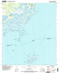 1994 Saint Joe Pass1995 Print · USGSCoastal Hancock County and the watery border with Louisiana appear here in the mid-1990s as a maze of marsh and bayous. You can trace family roots at the Bayou Caddy Cem or explore the remote reaches of Half Moon Island and Ansley.2 unique versions available
 - 2012 Map of Saint Joe Pass, 2012 Print
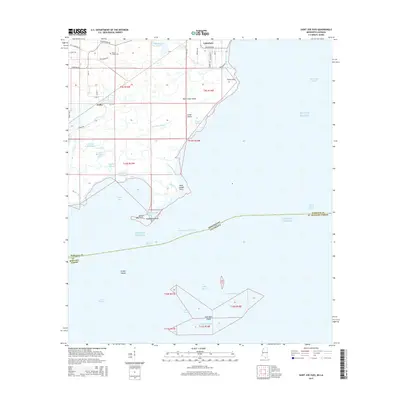
 2012 Saint Joe Pass2012 Print · USGSCovers Ansley, including Lakeshore, St. Tammany Parish, and other nearby areas
 - 2015 Map of Saint Joe Pass, 2015 Print
 2015 Saint Joe Pass2015 Print · USGSCovers Ansley, including Lakeshore, St. Tammany Parish, and other nearby areas
 - 2018 Map of Saint Joe Pass, 2018 Print
 2018 Saint Joe Pass2018 Print · USGSCovers Ansley, including Lakeshore, St. Tammany Parish, and other nearby areas
 - 2021 Map of Saint Joe Pass, 2021 Print
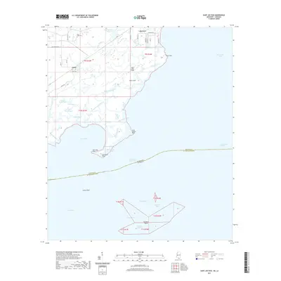 2021 Saint Joe Pass2021 Print · USGSCovers Ansley, including Lakeshore, St. Tammany Parish, and other nearby areas
 - 2024 Map of Saint Joe Pass, 2024 Print
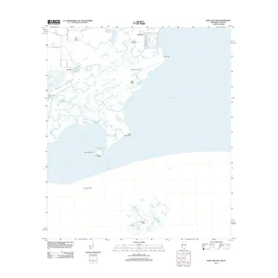
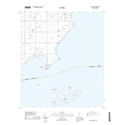
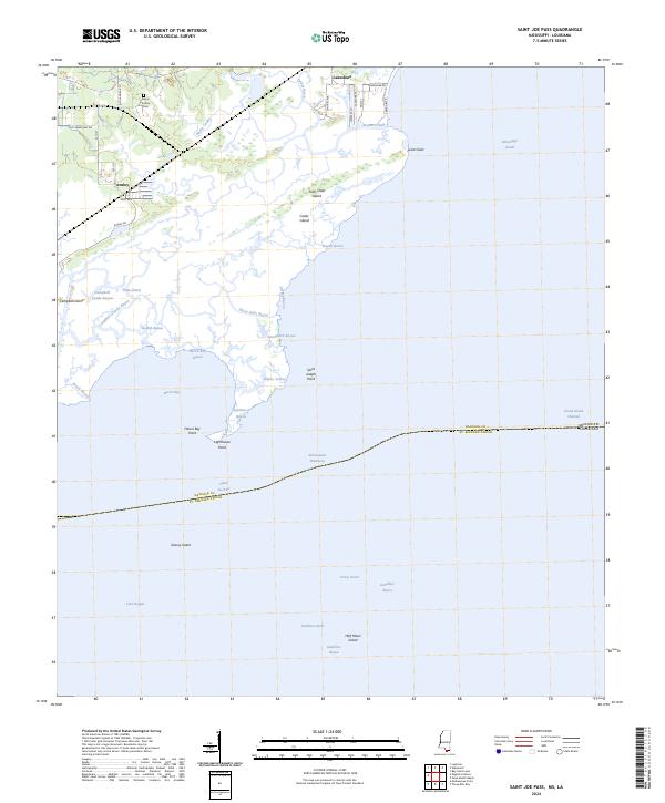 2024 Saint Joe Pass2024 Print · USGSCoastal Hancock County at the edge of the Mississippi Sound is mapped here in fine detail, showing the intricate marshlands and tidal bayous. Genealogists and local historians can locate the Bayou Caddy Cem and trace the small settlements of Lakeshore and Ansley.
End of results
Showing maps 1-17 of 17
Top cities near Ansley
- New Orleans historical maps
- Diamondhead historical maps
- Bay Saint Louis historical maps
- Waveland historical maps
- Pass Christian historical maps
- Pearlington historical maps
Frequently asked questions
- What are the different types of historical maps available for Ansley?
- What is the oldest map of Ansley?
- Where can I purchase historical maps of Ansley for my home or office?
- Where can I download high-res historical maps of Ansley?
- Are there historical topographic maps available for Ansley?
- Is there historical aerial imagery available for Ansley?
- Where are historical maps of Ansley sourced from?