1960s Maps of Jackson Landing, Mississippi
Explore 5 historic maps of Jackson Landing from the 1960s. These maps offer a rare glimpse into what life looked like during the 1960s — showing old roads, neighborhoods, homes, and landmarks that have changed or disappeared over time.
Whether you're researching your family's past, planning a metal detecting trip, or studying how Jackson Landing's landscape evolved across the 1960s, these high-resolution maps are a powerful tool for exploring the history of this region.
- Focus on a specific era: All maps on this page are from the 1960s, giving you a focused view of this time period.
- See what’s changed: Compare century-old streets, trails, and buildings to today's modern landscape using overlays and satellite layers.
- Research with precision: Use these maps for genealogy, historical research, land use analysis, or educational projects.
- View, download, or print: Maps are fully viewable online in high resolution, and can be downloaded or printed for your own records.
Start exploring Jackson Landing's history through authentic maps from the 1960s. This is your window into the past.
Jackson Landing, MS maps
(5)- 1960 Map of Mobile
 1960 Mobile1960 Print · USGSThe Gulf Coast at the dawn of the sixties shows a landscape of busy ports, military airbases, and barrier islands. Trace the rail lines of the Louisville & Nashville through BILOXI and Pascagoula or find family history in towns like Bayou La Batre and Poplarville.
 - 1963 Map of Mobile
 1963 Mobile1963 Print · USGSThe Gulf Coast at the dawn of the sixties shows a thriving maritime and military corridor from Louisiana to Alabama. Genealogists and historians can trace rail lines like the Louisville & Nashville RR and find landmarks from Brookley AFB to Fort Morgan.
 - 1965 Map of Mobile
 1965 Mobile1965 Print · USGSThe Gulf Coast at mid-century reveals a landscape of expanding ports and vital military installations from Louisiana to Alabama. Genealogists and historians can trace the growth of Biloxi, Pascagoula, and Mobile, alongside the sprawling De Soto National Forest.
 - 1968 Map of English Lookout, 1970 Print
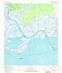 1968 English Lookout1970 Print · USGSThe coastal marshlands of the Louisiana-Mississippi border are captured in the late sixties as the Pearl River delta meets the Gulf. Genealogists and local historians can trace early property boundaries through the John B Doby Claim or follow the path of the Old Railroad Grade near English Lookout.3 unique versions available
 - 1969 Map of Rigolets, 1970 Print
 1969 Rigolets1970 Print · USGSThe Louisiana coast meets the Mississippi line in the late sixties, showing a landscape of tidal passes and railroad outposts. Researchers can trace the tracks of the Louisville and Nashville Railroad past English Lookout or locate the historic Port Pike State Monument.
End of results
Showing maps 1-5 of 5
Top cities near Jackson Landing
- New Orleans historical maps
- Slidell historical maps
- Diamondhead historical maps
- Bay Saint Louis historical maps
- Waveland historical maps
- Pearlington historical maps
Frequently asked questions
- What are the different types of historical maps available for Jackson Landing?
- What is the oldest map of Jackson Landing?
- Where can I purchase historical maps of Jackson Landing for my home or office?
- Where can I download high-res historical maps of Jackson Landing?
- Are there historical topographic maps available for Jackson Landing?
- Is there historical aerial imagery available for Jackson Landing?
- Where are historical maps of Jackson Landing sourced from?