Old Maps of Biloxi, Mississippi
Explore 36 old maps of Biloxi, spanning from 1953 to today. These high-resolution historic maps reveal how streets, neighborhoods, landmarks, and natural features evolved over time — perfect for genealogy, metal detecting, research, and local history exploration.
What you can do with these maps:
- See how Biloxi changed over time: Compare historical maps to modern-day views to trace roads, homesites, rail lines & more.
- View detailed metadata: Each map includes creators, publishers, year, scale, and archive source.
- Overlay maps with satellite & LiDAR: Visualize the past alongside modern tools to explore terrain & human change.
- Trusted historical sources: Maps sourced from the USGS, Library of Congress, and other archives.
- Access maps your way: View online, download high-res files, or order prints for personal or research use.
Start exploring old maps of Biloxi to uncover forgotten places, hidden landmarks, and the deep history beneath your feet.
Biloxi, MS maps
(36)- 1953 Map of Mobile, 1968 Print
 1953 Mobile1968 Print · USGSThe Gulf Coast comes alive in this mid-century survey, from the streets of Mobile to the marshes of New Orleans. Trace family roots in coastal towns like Pass Christian and Bayou La Batre or locate military landmarks including Keesler AFB.3 unique versions available
 - 1954 Map of Gulfport North, 1958 Print
 1954 Gulfport North1958 Print · USGSCoastal Mississippi in the mid-fifties reveals a landscape shaped by growing urban centers and sprawling federal installations. Researchers can trace the development of Gulfport and Mississippi City alongside the Illinois Central tracks and the Veterans Hospital.6 unique versions available
 - 1954 Map of Ocean Springs, 1958 Print
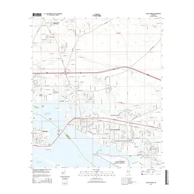
 1954 Ocean Springs1958 Print · USGSThe Mississippi Gulf Coast at mid-century reveals the intricate relationship between growing coastal towns and the surrounding bayous. Genealogists and historians can trace the foundations of Ocean Springs, the early layout of Gulf Hills, and rural landmarks like Antioch Ch.5 unique versions available
 - 1954 Map of Biloxi, 1958 Print
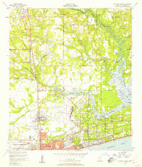
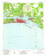
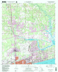
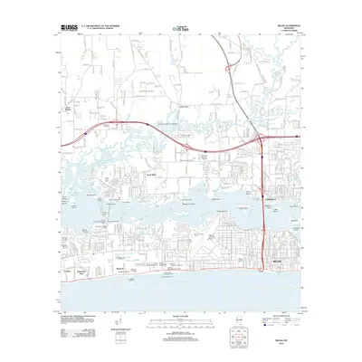
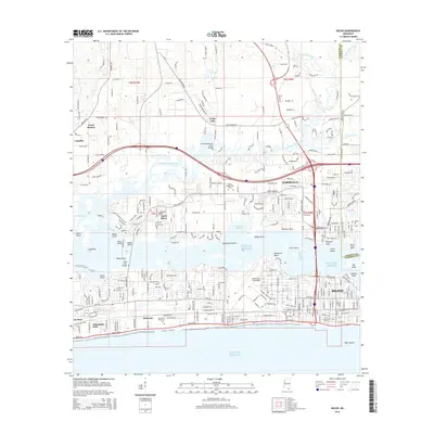
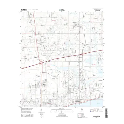
 1954 Biloxi1958 Print · USGSThe Mississippi Gulf Coast is captured here in the mid-fifties, showing the expansion of Biloxi and Keesler Air Force Base. Genealogists and historians can trace coastal landmarks like Beauvoir, the Louisville and Nashville rail line, and the northern woods of the De Soto National Forest.5 unique versions available
 - 1954 Map of Deer Island, 1958 Print
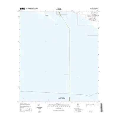
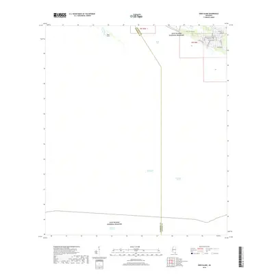
 1954 Deer Island1958 Print · USGSCoastal Mississippi in the mid-1950s is captured here through its shifting shorelines and maritime channels. Researchers can trace the exact position of the Intracoastal Waterway and the inlets of Grand Bayou and Simmons Bayou before later coastal changes.3 unique versions available
 - 1954 Map of Biloxi, 1962 Print
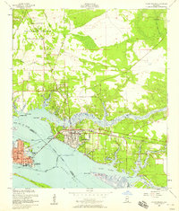
 1954 Biloxi1962 Print · USGSThe Mississippi Gulf Coast is captured here in the mid-fifties, during a decade of rapid expansion for the Biloxi and Ocean Springs area. Researchers can trace the layout of Keesler Air Force Base or locate local landmarks like the Wool Market Sch and Bayou Talla Ch.2 unique versions available
 - 1957 Map of Mobile
 1957 Mobile1957 Print · USGSThe Gulf Coast in the mid-1950s reveals a bustling corridor of rail-and-river commerce connecting Alabama to Louisiana. Genealogists and historians can trace old settlements and military hubs from Keesler Afb to the coastal reaches of Ship Island and Bogalusa.3 unique versions available
 - 1960 Map of Mobile
 1960 Mobile1960 Print · USGSThe Gulf Coast at the dawn of the sixties shows a landscape of busy ports, military airbases, and barrier islands. Trace the rail lines of the Louisville & Nashville through BILOXI and Pascagoula or find family history in towns like Bayou La Batre and Poplarville.
 - 1963 Map of Mobile
 1963 Mobile1963 Print · USGSThe Gulf Coast at the dawn of the sixties shows a thriving maritime and military corridor from Louisiana to Alabama. Genealogists and historians can trace rail lines like the Louisville & Nashville RR and find landmarks from Brookley AFB to Fort Morgan.
 - 1965 Map of Mobile
 1965 Mobile1965 Print · USGSThe Gulf Coast at mid-century reveals a landscape of expanding ports and vital military installations from Louisiana to Alabama. Genealogists and historians can trace the growth of Biloxi, Pascagoula, and Mobile, alongside the sprawling De Soto National Forest.
 - 1982 Map of Biloxi
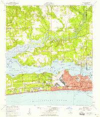
 1982 Biloxi1982 Print · USGSThe Mississippi and Alabama coastlines are captured in the early eighties as industrial hubs and wildlife refuges shaped the shoreline. Trace maritime and military history through Fort Morgan, Keesler Air Force Base, and the barrier islands of Gulf Islands National Seashore.2 unique versions available
 - 1982 Map of Gulfport, 1983 Print
 1982 Gulfport1983 Print · USGSThe Gulf Coast between Louisiana and Mississippi appears in the early eighties as a landscape of marshland and maritime industry. Researchers can trace the path of the Louisville and Nashville RR through towns like Waveland and De Lisle, or locate the sprawling National Space Technology Laboratories.2 unique versions available
 - 1984 Map of Mobile
 1984 Mobile1984 Print · USGSThe Gulf Coast at the height of the mid-eighties shows a landscape of rapid industrial growth and military significance. Researchers can trace the sprawling rail lines of the Illinois Central Gulf RR, locate the NASA Test Facility, or study the barrier island chain from Cat Island to Petit Bois Island.3 unique versions available
 - 1992 Map of Biloxi, 1998 Print
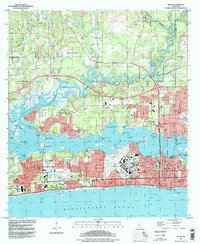 1992 Biloxi1998 Print · USGSMississippi's Gulf Coast comes into focus in the early nineties, showing the vital waterways and urban expansion of the Biloxi area. Researchers can trace military and civic heritage at Keesler Air Force Base, the Veterans Administration Center, and the historic Beauvoir estate.
 - 1992 Map of Ocean Springs, 1998 Print
 1992 Ocean Springs1998 Print · USGSThe Mississippi Gulf Coast at the end of the twentieth century shows a vibrant landscape of tidal bayous and expanding residential communities. Trace the shoreline from Biloxi across the Memorial Bridge to explore the residential streets of Ocean Springs and the protected marshes of the Mississippi Sandhill Crane National Wildlife Refuge.
 - 1994 Map of Gulfport North, 1999 Print
 1994 Gulfport North1999 Print · USGSCoastal Mississippi in the 1990s shows a region of expanding neighborhoods and significant aviation and naval infrastructure. Researchers can trace family ties at the Evergreen Cem or locate community centers like the Orange Grove Sch and Beulah Ch.2 unique versions available
 - 2012 Map of Gulfport North, 2012 Print
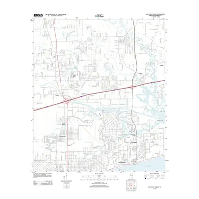 2012 Gulfport North2012 Print · USGSCovers Biloxi, including Gulfport, Landon, and other nearby areas
 - 2012 Map of Deer Island, 2012 Print
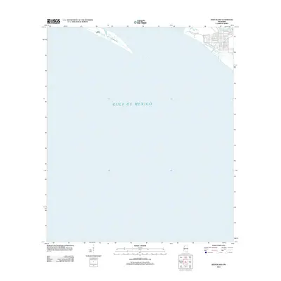 2012 Deer Island2012 Print · USGSCovers Biloxi, including Harrison County, Jackson County, and other nearby areas
 - 2012 Map of Ocean Springs, 2012 Print
 2012 Ocean Springs2012 Print · USGSCovers Biloxi, including Ocean Springs, Martins Pine Hill Estates, and other nearby areas
 - 2012 Map of Biloxi, 2012 Print
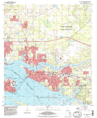
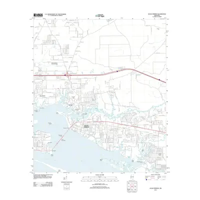
 2012 Biloxi2012 Print · USGSCovers Biloxi, including D'Iberville, Cedar Lake, and other nearby areas
 - 2015 Map of Deer Island, 2015 Print
 2015 Deer Island2015 Print · USGSCovers Biloxi, including Harrison County, Jackson County, and other nearby areas
 - 2015 Map of Biloxi, 2015 Print
 2015 Biloxi2015 Print · USGSCovers Biloxi, including D'Iberville, Cedar Lake, and other nearby areas
 - 2015 Map of Ocean Springs, 2015 Print
 2015 Ocean Springs2015 Print · USGSCovers Biloxi, including Ocean Springs, Martins Pine Hill Estates, and other nearby areas
 - 2015 Map of Gulfport North, 2015 Print
 2015 Gulfport North2015 Print · USGSCovers Biloxi, including Gulfport, Landon, and other nearby areas
 - 2018 Map of Deer Island, 2018 Print
 2018 Deer Island2018 Print · USGSCovers Biloxi, including Harrison County, Jackson County, and other nearby areas
Showing maps 1-25 of 36
Top cities near Biloxi
- Gulfport historical maps
- Long Beach historical maps
- Ocean Springs historical maps
- Gautier historical maps
- D'Iberville historical maps
Top neighborhoods of Biloxi
- Wool Market historical maps
- Beauvoir historical maps
- Coalville historical maps
- Cedar Lake historical maps
- De Buys historical maps
- Edgewater Park historical maps
See more
Frequently asked questions
- What are the different types of historical maps available for Biloxi?
- What is the oldest map of Biloxi?
- Where can I purchase historical maps of Biloxi for my home or office?
- Where can I download high-res historical maps of Biloxi?
- Are there historical topographic maps available for Biloxi?
- Is there historical aerial imagery available for Biloxi?
- Where are historical maps of Biloxi sourced from?