1940s Maps of Lafayette Springs, Mississippi
Explore 2 historic maps of Lafayette Springs from the 1940s. These maps offer a rare glimpse into what life looked like during the 1940s — showing old roads, neighborhoods, homes, and landmarks that have changed or disappeared over time.
Whether you're researching your family's past, planning a metal detecting trip, or studying how Lafayette Springs's landscape evolved across the 1940s, these high-resolution maps are a powerful tool for exploring the history of this region.
- Focus on a specific era: All maps on this page are from the 1940s, giving you a focused view of this time period.
- See what’s changed: Compare century-old streets, trails, and buildings to today's modern landscape using overlays and satellite layers.
- Research with precision: Use these maps for genealogy, historical research, land use analysis, or educational projects.
- View, download, or print: Maps are fully viewable online in high resolution, and can be downloaded or printed for your own records.
Start exploring Lafayette Springs's history through authentic maps from the 1940s. This is your window into the past.
Lafayette Springs, MS maps
(2)- 1942 Map of Denmark, 1973 Print
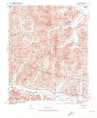 1942 Denmark1973 Print · USGSLafayette County was a landscape of small timber stands and creek-bottom farms during the early 1940s. Genealogists can trace family roots through numerous local landmarks like Lafayette Springs Sch, Bethel Ch, and Jefferson Cem.
 - 1943 Map of Denmark
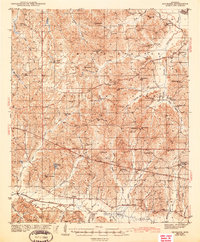 1943 Denmark1943 Print · USGSLafayette County was a landscape of small schools and forest lookouts in the years during the Second World War. Genealogists can trace family roots through numerous rural landmarks like Lafayette Springs, Denmark Sch, and Shiloh Cem.3 unique versions available
End of results
Showing maps 1-2 of 2
Top cities near Lafayette Springs
- Oxford historical maps
- New Albany historical maps
- Pontotoc historical maps
- Ecru historical maps
- Algoma historical maps
- Thaxton historical maps
See more
Frequently asked questions
- What are the different types of historical maps available for Lafayette Springs?
- What is the oldest map of Lafayette Springs?
- Where can I purchase historical maps of Lafayette Springs for my home or office?
- Where can I download high-res historical maps of Lafayette Springs?
- Are there historical topographic maps available for Lafayette Springs?
- Is there historical aerial imagery available for Lafayette Springs?
- Where are historical maps of Lafayette Springs sourced from?