Old Maps of Barton, Mississippi for Metal Detecting
Plan your next treasure hunt with 11 historic maps of Barton. Find old homesites, ghost towns, trails, and gathering spots that may be lost to time — perfect for identifying promising metal detecting locations.
- Locate forgotten sites: Uncover places like long-lost settlements, abandoned rail lines, or gathering spots.
- Plan better hunts: Use map overlays combined with LiDAR or satellite views to narrow in on historically rich areas.
- Made for detectorists: Thousands of hobbyists use these maps to discover relics, coins, and hidden history.
Use these historic maps to boost your research and find new opportunities beneath the surface of Barton.
Barton, MS maps
(11)- 1948 Map of Byhalia
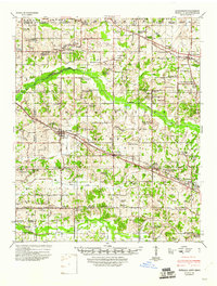 1948 Byhalia1948 Print · USGSMarshall County in the late 1940s is captured here as a thriving network of small settlements and rail-side towns. Genealogists and historians can trace family locations through numerous rural landmarks like Shelby Ch & Cem, Red Banks, and the Marshall Inst Ch.3 unique versions available
 - 1956 Map of Tupelo, 1967 Print
 1956 Tupelo1967 Print · USGSNortheast Mississippi and parts of Tennessee and Alabama are shown here during the mid-fifties, a time of major reservoir construction and forestry management. Researchers can trace the St Louis-San Francisco RR through Tupelo or locate historic sites like Tishomingo State Park and the University.2 unique versions available
 - 1958 Map of Tupelo
 1958 Tupelo1958 Print · USGSNortheast Mississippi and neighboring Alabama and Tennessee appear here during the late fifties as a region defined by new reservoirs and historic rail lines. Genealogists can trace family locations near Sardis Lake, Woodall Mountain, and the St Louis-San Francisco Ry.
 - 1971 Map of Byhalia NW, 1973 Print
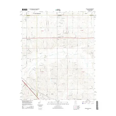
 1971 Byhalia NW1973 Print · USGSThe Tennessee-Mississippi borderlands appear in the early 1970s as a landscape of small rural settlements and winding river bottoms. Genealogists can locate family landmarks like Handy Corner, McGehee Cem, and the St Louis San Francisco rail line.2 unique versions available
 - 1984 Map of Tupelo
 1984 Tupelo1984 Print · USGSNorth Mississippi in the 1980s is defined by its massive river basin reservoirs and the growing regional hubs of Tupelo and Oxford. Researchers can trace the legacy of the Pontotoc Ridge, find the University of Mississippi, and map early Interstate corridors near Sardis Lake.3 unique versions available
 - 2010 Map of Byhalia NW, 2010 Print
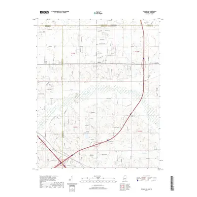
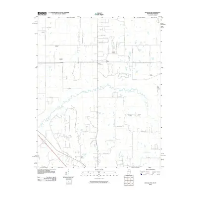 2010 Byhalia NW2010 Print · USGSCovers Barton, including Piperton, Byhalia, and other nearby areas
 - 2012 Map of Byhalia NW, 2012 Print
 2012 Byhalia NW2012 Print · USGSCovers Barton, including Piperton, Byhalia, and other nearby areas
 - 2015 Map of Byhalia NW, 2015 Print
 2015 Byhalia NW2015 Print · USGSCovers Barton, including Piperton, Byhalia, and other nearby areas
 - 2018 Map of Byhalia NW, 2018 Print
 2018 Byhalia NW2018 Print · USGSCovers Barton, including Piperton, Byhalia, and other nearby areas
 - 2021 Map of Byhalia NW, 2021 Print
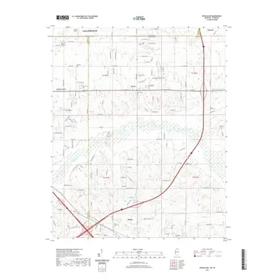 2021 Byhalia NW2021 Print · USGSCovers Barton, including Piperton, Byhalia, and other nearby areas
 - 2024 Map of Byhalia NW, 2024 Print
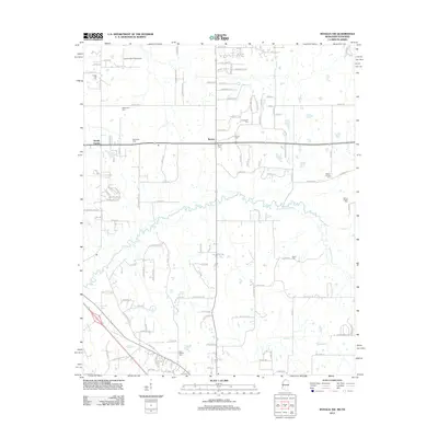
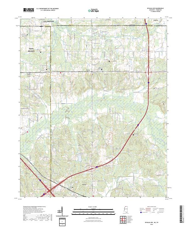 2024 Byhalia NW2024 Print · USGSThe Tennessee-Mississippi borderlands come into focus in this contemporary survey of the expanding region south of Memphis. Researchers can locate numerous family and community burial sites, including Haliburton Cem, McGehee Cem, and Mount Carmel Cem.
End of results
Showing maps 1-11 of 11
Top cities near Barton
- Memphis historical maps
- Bartlett historical maps
- Collierville historical maps
- Germantown historical maps
- Olive Branch historical maps
- Holly Springs historical maps
See more
Frequently asked questions
- What are the different types of historical maps available for Barton?
- What is the oldest map of Barton?
- Where can I purchase historical maps of Barton for my home or office?
- Where can I download high-res historical maps of Barton?
- Are there historical topographic maps available for Barton?
- Is there historical aerial imagery available for Barton?
- Where are historical maps of Barton sourced from?