Old Maps of Montgomery County, Mississippi for Metal Detecting
Plan your next treasure hunt with 89 historic maps of Montgomery County. Find old homesites, ghost towns, trails, and gathering spots that may be lost to time — perfect for identifying promising metal detecting locations.
- Locate forgotten sites: Uncover places like long-lost settlements, abandoned rail lines, or gathering spots.
- Plan better hunts: Use map overlays combined with LiDAR or satellite views to narrow in on historically rich areas.
- Made for detectorists: Thousands of hobbyists use these maps to discover relics, coins, and hidden history.
Use these historic maps to boost your research and find new opportunities beneath the surface of Montgomery County.
Montgomery County, MS maps
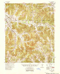
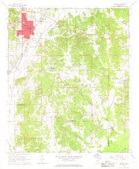
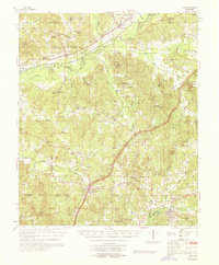
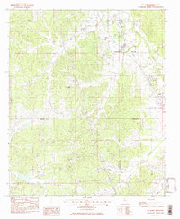
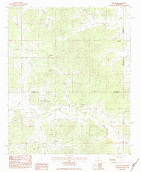
(89)- 1953 Map of West Point, 1973 Print
 1953 West Point1973 Print · USGSNorth-Central Mississippi and the Alabama borderlands are captured here during the mid-twentieth century as new reservoirs and national forests transformed the landscape. Researchers can trace the path of the Mississippi & Skuna Valley railroad or locate old landings along the Tombigbee River and Schooner Creek.3 unique versions available
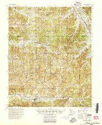
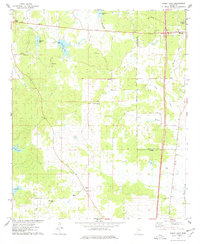
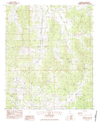
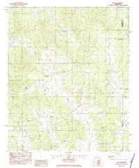
 - 1954 Map of Duck Hill
 1954 Duck Hill1954 Print · USGSThe hills of north-central Mississippi come alive in the 1950s, showing a landscape defined by the Illinois Central and small rural parishes. Researchers can trace the layout of Camp McCain (Abandoned) or find family roots at Hays Creek Ch Sch & Cem and Sweatman.2 unique versions available
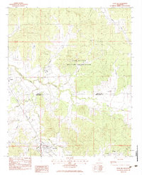
 - 1954 Map of McCarley
 1954 McCarley1954 Print · USGSCarroll County and the surrounding hill country are captured here in the mid-fifties, showing a dense network of rural churches and family cemeteries. Researchers can trace the Illinois Central rail line through Glenwild or locate sites like Camp McCain and Pink Flower Ch & Cem.
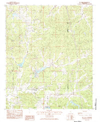
 - 1958 Map of West Point
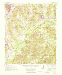
 1958 West Point1958 Print · USGSNortheastern Mississippi and western Alabama are shown in the late 1950s, highlighting a region defined by its river-and-rail economy. Researchers can trace family roots through numerous settlements like Artesia and Vardaman or explore the corridor of the Tombigbee River.
 - 1963 Map of West Point
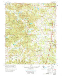
 1963 West Point1963 Print · USGSEastern Mississippi and western Alabama are captured in the early sixties as industrial centers and rail lines connected the Black Prairie to the hills. Genealogists and historians can trace family-named watercourses and the early footprints of Starkville, Columbus, and the Noxubee National Wildlife Refuge.2 unique versions available
 - 1966 Map of Kilmichael, 1967 Print
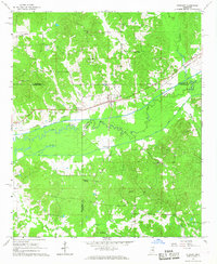
 1966 Kilmichael1967 Print · USGSThe town of Kilmichael and the surrounding Montgomery County countryside are captured here in the mid-sixties, anchored by the Columbus and Greenville railroad. Genealogists and local historians can trace rural family legacies through Nations Poplar Creek Ch, Stinson Cem, and the Vocational High Sch.2 unique versions available
 - 1966 Map of Poplar Creek, 1967 Print
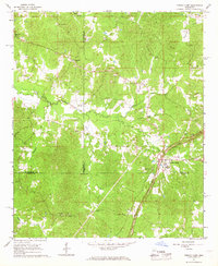
 1966 Poplar Creek1967 Print · USGSMontgomery and Attala Counties are captured in the mid-sixties, showing a rural landscape defined by community-centered churches and family cemeteries. Genealogists can trace deep local roots at Poplar Springs Union Ch, Old Pine Bluff Cem, and Joe Walker Cem.2 unique versions available
 - 1966 Map of Winona, 1967 Print
 1966 Winona1967 Print · USGSMid-century Winona thrives at the junction of the Illinois Central and Columbus and Greenville railroads. Researchers can trace family sites at Oakwood Cem or locate rural landmarks like Campbell Hill Ch and Milligan Springs Lake.2 unique versions available
 - 1966 Map of Stewart, 1967 Print
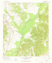
 1966 Stewart1967 Print · USGSIn the mid-1960s, the rural borderlands of Webster and Montgomery counties were defined by the Big Black River and the Columbus and Greenville rail line. Researchers can trace family roots through numerous sites like Reeds Chapel, Jopkins Cem, and the settlement at Stewart.2 unique versions available
 - 1966 Map of French Camp, 1967 Print
 1966 French Camp1967 Print · USGSChoctaw and Attala Counties are mapped here in the mid-sixties, showing the rural landscape as the modern Natchez Trace Parkway bypasses older settlements. Researchers can locate family landmarks such as Huntsville Cem, Covenant Ch, and several Sandpits along the timbered creek bottoms.
 - 1966 Map of Vaiden, 1967 Print
 1966 Vaiden1967 Print · USGSThe town of Vaiden and its surrounding Carroll County hill country are captured here in the mid-1960s, centered on the Big Black River. Genealogists and historians can trace the exact locations of Vaiden Hill Ch, Tuckersville Cem, and the old Illinois Central rail line.2 unique versions available
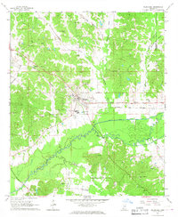
 - 1968 Map of Weir
 1968 Weir1968 Print · USGSChoctaw and Montgomery counties come alive in this late-sixties study of the Mississippi hill country. Genealogists and local historians can trace family locations near French Camp, Weir, and numerous rural landmarks like Serepta Cem and Millsprings Sch.
 - 1968 Map of Winona
 1968 Winona1968 Print · USGSMontgomery County in the late sixties shows a landscape of tight-knit rural communities connected by the Illinois Central railroad and the Big Black River. Genealogists and local historians can trace family roots at Wilmont Cem, Bethlehem Ch, and the old settlement of Poplar Creek.
 - 1975 Map of Bailey Lake, 1978 Print
 1975 Bailey Lake1978 Print · USGSThe hills of Carroll and Montgomery counties are documented here in the mid-seventies, showing the rural landscape just west of the county seat. Genealogists can trace family landmarks like Marvin Cem, Ebenezer Ch, and the many small lakes including Booths Lake.2 unique versions available
 - 1978 Map of Coila
 1978 Coila1978 Print · USGSCentral Mississippi in the late seventies is shown here as a landscape of crossroads communities and historic treaty boundaries. Researchers can trace family roots through numerous rural landmarks like Hopewell Cem, St Johns Chapel, and the small settlement of Coila.
 - 1983 Map of Tie Plant
 1983 Tie Plant1983 Print · USGSRailroad history and rural community life intersect in 1980s Mississippi where three counties meet. Genealogists can trace family names at Old Salem Cem and Wesley Chapel or follow the Illinois Central Gulf corridor through Tie Plant.
 - 1983 Map of Eskridge
 1983 Eskridge1983 Print · USGSMontgomery County in the early eighties shows a landscape of rail-connected hamlets and quiet country crossroads. Genealogists can locate family burial sites at Collins and Wilson Cem or trace the old Illinois Central Gulf through Eskridge and Sawyer.
 - 1983 Map of Duck Hill
 1983 Duck Hill1983 Print · USGSThe town of Duck Hill and the surrounding hills of Montgomery and Grenada Counties are captured here in the early 1980s. Researchers can trace the vast boundaries of the Camp Mc Cain Military Reservation or locate family sites near Bethlehem Cem and Mt Pisgah Ch.2 unique versions available
 - 1983 Map of McCarley, 1984 Print
 1983 McCarley1984 Print · USGSCarroll and Montgomery counties are captured in the early eighties as rural life centered around the Columbus and Greenville rail line. Genealogists can trace family roots through several small burial grounds and country churches like Primitive Cem, Big Zion Ch, and Hickory Grove Ch.
 - 1983 Map of Sweatman, 1984 Print
 1983 Sweatman1984 Print · USGSNorth-central Mississippi rural life in the early eighties is preserved here at the crossroads of four counties. Genealogists can trace family names and early congregations at Wells Cem, Blackjack Ch, and the settlement of Sweatman.
 - 1983 Map of Lodi, 1984 Print
 1983 Lodi1984 Print · USGSThe rural borderlands of Montgomery and Webster counties are captured here in the early eighties. Researchers can trace family history through numerous remote sites like Old Northern Grocery, Purnell Cem, and the settlement of Minerva.
 - 1984 Map of Kosciusko
 1984 Kosciusko1984 Print · USGSCentral Mississippi in the mid-eighties shows a landscape of timberlands and rural crossroads anchored by Kosciusko. Genealogists can trace family roots through numerous country parishes like Bethany Ch and Zion Ch or the path of the Illinois Central Gulf railroad.3 unique versions available
 - 1984 Map of West Point
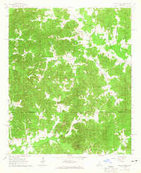
 1984 West Point1984 Print · USGSNorth-Central Mississippi in the mid-eighties shows a landscape defined by massive water management projects and dense timberlands. Researchers can trace the legacy of rural settlements like Geeslin Corner or the rail corridors of the Illinois Central Gulf RR near Grenada Lake.3 unique versions available
 - 1984 Map of Grenada, 1990 Print
 1984 Grenada1990 Print · USGSNorth Central Mississippi’s river valleys and conservation lands are captured here in the mid-1980s. Researchers can trace the sprawling Camp Mc Cain, the Illinois Central Gulf rail line, and the historic Treaty Boundary.
 - 2012 Map of Eskridge, 2012 Print
 2012 Eskridge2012 Print · USGSCovers Montgomery County, including Winona, Duck Hill, and other nearby areas
Showing maps 1-25 of 89
Top cities of Montgomery County
Frequently asked questions
- What are the different types of historical maps available for Montgomery County?
- What is the oldest map of Montgomery County?
- Where can I purchase historical maps of Montgomery County for my home or office?
- Where can I download high-res historical maps of Montgomery County?
- Are there historical topographic maps available for Montgomery County?
- Is there historical aerial imagery available for Montgomery County?
- Where are historical maps of Montgomery County sourced from?