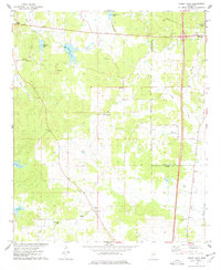
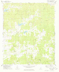
1975 Map of Bailey Lake
USGS Topo · Published 1978About this map
The rolling borderlands of Carroll and Montgomery counties are captured in this mid-1970s survey, showing a landscape defined by small rural congregations and numerous small water bodies. The northeastern corner contains the western edge of Winona, where major highway intersections meet before branching into the surrounding timber and pasture land. This area is notably dense with community focal points, including Ebenezer Ch, Nebo Ch, and New Salem Ch, often paired with family or community burial grounds like Nebo Cem and Marvin Cem.
Find a feature on this map
31 named features on this map. Tap any name to fly to it.
Don’t see what you’re looking for? This feature index may not catch every label — zoom into the map to look around manually.
Map Details
Editions of this 1975 Bailey Lake Map
2 editions found
Other maps of this area

1953 · West Point
USGS Topo · 1:250,000

1954 · Duck Hill
USGS Topo · 1:62,500

1954 · McCarley
USGS Topo · 1:62,500

1958 · West Point
USGS Topo · 1:250,000

1963 · West Point
USGS Topo · 1:250,000

1966 · Winona
USGS Topo · 1:24,000
1966 · Vaiden
USGS Topo · 1:24,000

1968 · Winona
USGS Topo · 1:62,500
1975 · Peachahala Creek
USGS Topo · 1:24,000
1975 · Murdock Lake
USGS Topo · 1:24,000