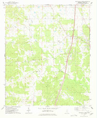
1975 Map of Peachahala Creek
USGS Topo · Published 1978About this map
Vaiden and the small community of Hocutt anchor this mid-1970s topographical record of Carroll County. The landscape is defined by the winding course of Peachahala Creek and its many tributaries, including Hurricane Creek, Self Creek, and Hudson Creek. This period captures the region's established rural infrastructure, where family and community heritage is centered around numerous country churches and burial grounds. Genealogists will find many significant sites documented, such as Hairston Cem, McEachern Cem, and Shiloh Cem, alongside local landmarks like Lively Stone Ch and Mt Zion Ch. The transportation corridor is dominated by the modern path of Interstate 55 and the older industrial line of the Illinois Central Gulf railroad, which runs parallel to the Vaiden corporate boundary. A local Sandpit and a Roadside Park north of town provide glimpses into the local economy and traveler services of the era.
Find a feature on this map
23 named features on this map. Tap any name to fly to it.
Don’t see what you’re looking for? This feature index may not catch every label — zoom into the map to look around manually.
Map Details
Editions of this 1975 Peachahala Creek Map
This is the sole edition of this map. No revisions or reprints were ever made.
Other maps of this area

1953 · West Point
USGS Topo · 1:250,000

1958 · West Point
USGS Topo · 1:250,000

1963 · West Point
USGS Topo · 1:250,000

1964 · West
USGS Topo · 1:24,000
1964 · Bowling Green
USGS Topo · 1:24,000

1964 · Hesterville
USGS Topo · 1:24,000

1966 · Winona
USGS Topo · 1:24,000

1966 · Kosciusko
USGS Topo · 1:62,500
1966 · Durant
USGS Topo · 1:62,500
1966 · Vaiden
USGS Topo · 1:24,000