
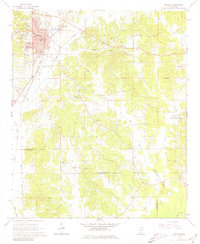
1966 Map of Winona
USGS Topo · Published 1967About this map
Winona serves as a significant central hub in the mid-1960s, defined by the crossing of the Illinois Central and the Columbus and Greenville railroads. The town's civic core is clearly marked by its Courthouse, Library, and Hospital, reflecting its role as a county seat. Surrounding the urban center, the landscape shifts into a network of small rural congregations and burial grounds, including Campbell Hill Ch and Oakwood Cem, which anchor the local community history.
Find a feature on this map
37 named features on this map. Tap any name to fly to it.
Don’t see what you’re looking for? This feature index may not catch every label — zoom into the map to look around manually.
Map Details
Editions of this 1966 Winona Map
2 editions found
Other maps of this area

1953 · West Point
USGS Topo · 1:250,000

1954 · Duck Hill
USGS Topo · 1:62,500

1954 · McCarley
USGS Topo · 1:62,500

1958 · West Point
USGS Topo · 1:250,000

1963 · West Point
USGS Topo · 1:250,000

1966 · Kilmichael
USGS Topo · 1:24,000

1966 · Poplar Creek
USGS Topo · 1:24,000
1966 · Vaiden
USGS Topo · 1:24,000

1968 · Winona
USGS Topo · 1:62,500
1975 · Peachahala Creek
USGS Topo · 1:24,000