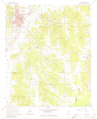
1966 Map of Winona
USGS Topo · Published 1981About this map
Winona serves as a central hub in north-central Mississippi, where the Illinois Central and Columbus And Greenville railroad lines intersect. This mid-1960s survey captures the city as a thriving county seat, featuring its Courthouse, Library, and major educational centers like High Sch and Knox High Sch. The landscape is defined by the winding course of Hays Creek and the notable rise of Campbell Hill, while the municipal footprint extends south to the Winona-Montgomery Co Airport.
Find a feature on this map
38 named features on this map. Tap any name to fly to it.
Don’t see what you’re looking for? This feature index may not catch every label — zoom into the map to look around manually.
Map Details
Editions of this 1966 Winona Map
2 editions found
Other maps of this area

1953 · West Point
USGS Topo · 1:250,000

1954 · Duck Hill
USGS Topo · 1:62,500

1954 · McCarley
USGS Topo · 1:62,500

1958 · West Point
USGS Topo · 1:250,000

1963 · West Point
USGS Topo · 1:250,000

1966 · Kilmichael
USGS Topo · 1:24,000

1966 · Poplar Creek
USGS Topo · 1:24,000

1966 · Winona
USGS Topo · 1:24,000
1966 · Vaiden
USGS Topo · 1:24,000

1968 · Winona
USGS Topo · 1:62,500