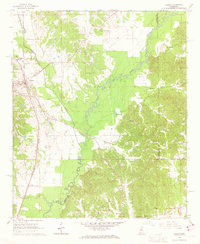
1966 Map of Vaiden
USGS Topo · Published 1967About this map
Vaiden serves as the focal point of this mid-1960s Mississippi survey, situated along the Illinois Central railroad. The landscape is defined by the winding course of the Big Black River, which flows through the center of the sheet, separating the town from the more rural eastern hills. Numerous rural landmarks suggest a landscape of tight-knit communities, particularly evident in the concentration of educational and religious sites like the North Vaiden High Sch and Vaiden Hill Ch.
Find a feature on this map
32 named features on this map. Tap any name to fly to it.
Don’t see what you’re looking for? This feature index may not catch every label — zoom into the map to look around manually.
Map Details
Editions of this 1966 Vaiden Map
2 editions found
Other maps of this area

1953 · West Point
USGS Topo · 1:250,000

1958 · West Point
USGS Topo · 1:250,000

1963 · West Point
USGS Topo · 1:250,000

1964 · West
USGS Topo · 1:24,000

1964 · Kosciusko NE
USGS Topo · 1:24,000

1964 · Hesterville
USGS Topo · 1:24,000

1966 · Kilmichael
USGS Topo · 1:24,000

1966 · Poplar Creek
USGS Topo · 1:24,000

1966 · Winona
USGS Topo · 1:24,000

1966 · Kosciusko
USGS Topo · 1:62,500