Old Maps of Onward, Mississippi for Hiking & Exploration
Hike through history with 12 historic maps of Onward. Explore old trails, ghost towns, and forgotten backroads — perfect for outdoor adventurers and local explorers.
- Rediscover forgotten places: Map out old mining camps, roads, and footpaths that no longer exist on modern maps.
- Layer with modern tools: Combine with LiDAR or satellite views to plan hikes through historical terrain.
- Made for exploration: Popular among hikers, overlanders, and local history lovers.
Use these maps to find adventure and explore the hidden past of Onward.
Onward, MS maps
(12)- 1939 Map of Onward
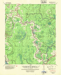 1939 Onward1939 Print · USGSThe Mississippi Delta in the late 1930s shows a landscape of river-bend settlements and bayou-side commerce before modern infrastructure took hold. You can trace the Illinois Central railroad through Smedes and Kelso or locate family landmarks like Haynes Bluff and the Lumber Yard at Valley Park.3 unique versions available
 - 1955 Map of Jackson
 1955 Jackson1955 Print · USGSThe Lower Mississippi Valley at the middle of the century reveals a landscape of deep river meanders and growing rail hubs. Genealogists and historians can trace the mid-century footprints of Vicksburg National Military Park, old river landings at Port Gibson, and the rail corridors of the Illinois Central Railroad.3 unique versions available
 - 1961 Map of Jackson
 1961 Jackson1961 Print · USGSThe Lower Mississippi Delta and the state capital area are captured here during the post-war era of infrastructure expansion. Researchers can trace the complex river oxbows and rail lines connecting Vicksburg, Yazoo City, and the Illinois Central Railroad network.
 - 1962 Map of Jackson
 1962 Jackson1962 Print · USGSThe Mississippi Delta and the state capital region are mapped here in the early sixties, showing a landscape defined by the great river and the growing city of JACKSON. Genealogists can trace family roots through numerous landmarks like Cedar Hill Cem, rural stops on the Illinois Central RR, and historic sites like Champion Hill.2 unique versions available
 - 1963 Map of Onward, 1965 Print
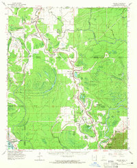 1963 Onward1965 Print · USGSThe Mississippi Delta lowlands appear in detail in the early sixties, showing the rail-and-river network before modern land-use changes. Genealogists can trace family names through rural landmarks like Rock of Mt Zion Ch, Valley Park, and the Cement Plant at Haynes Bluff.3 unique versions available
 - 1984 Map of Yazoo City
 1984 Yazoo City1984 Print · USGSThe Mississippi Delta and loess bluffs meet in the mid-eighties as the Yazoo River snakes through a dense network of wildlife areas and rail lines. Researchers can trace rural life and drainage history through small communities like Holly Bluff, Mechanicsburg, and Satartia.2 unique versions available
 - 1988 Map of Onward
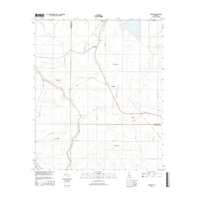
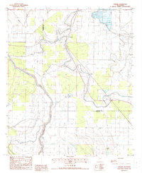 1988 Onward1988 Print · USGSThe Mississippi Delta in the late eighties reveals a landscape of winding waterways and rural hamlets like Onward and Kelso. Researchers can trace the legacy of local commerce through the Old RR Grade and the sprawling Fish Farm near Blanton.
 - 2012 Map of Onward, 2012 Print
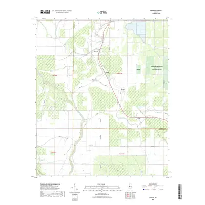
 2012 Onward2012 Print · USGSCovers Onward, including Kelso, Blanton, and other nearby areas
 - 2015 Map of Onward, 2015 Print
 2015 Onward2015 Print · USGSCovers Onward, including Kelso, Blanton, and other nearby areas
 - 2018 Map of Onward, 2018 Print
 2018 Onward2018 Print · USGSCovers Onward, including Kelso, Blanton, and other nearby areas
 - 2020 Map of Onward, 2020 Print
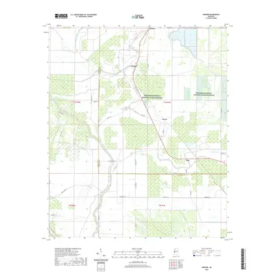 2020 Onward2020 Print · USGSCovers Onward, including Kelso, Blanton, and other nearby areas
 - 2024 Map of Onward, 2024 Print
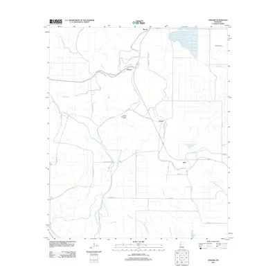
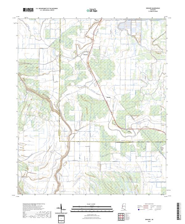 2024 Onward2024 Print · USGSThe lower Mississippi Delta's intricate network of bayous and wildlife lands is shown in this contemporary study of Issaquena and Sharkey counties. Local researchers can trace the roads and waterways connecting Onward, Kelso, and the Theodore Roosevelt National Wildlife Refuge.
End of results
Showing maps 1-12 of 12
Top cities near Onward
- Lake Providence historical maps
- Rolling Fork historical maps
- Mayersville historical maps
- Cary historical maps
Frequently asked questions
- What are the different types of historical maps available for Onward?
- What is the oldest map of Onward?
- Where can I purchase historical maps of Onward for my home or office?
- Where can I download high-res historical maps of Onward?
- Are there historical topographic maps available for Onward?
- Is there historical aerial imagery available for Onward?
- Where are historical maps of Onward sourced from?