Old Maps of Simpson County, Mississippi for Metal Detecting
Plan your next treasure hunt with 112 historic maps of Simpson County. Find old homesites, ghost towns, trails, and gathering spots that may be lost to time — perfect for identifying promising metal detecting locations.
- Locate forgotten sites: Uncover places like long-lost settlements, abandoned rail lines, or gathering spots.
- Plan better hunts: Use map overlays combined with LiDAR or satellite views to narrow in on historically rich areas.
- Made for detectorists: Thousands of hobbyists use these maps to discover relics, coins, and hidden history.
Use these historic maps to boost your research and find new opportunities beneath the surface of Simpson County.
Simpson County, MS maps
(112)- 1903 Map of Jackson
 1903 Jackson1903 Print · USGSCentral Mississippi at the dawn of the new century shows a landscape transformed by expanding rail lines and river commerce. Genealogists and researchers can trace family roots through early settlements like Pocahontas, Ridgeland, and Clinton or locate the historic Asylum grounds.
 - 1906 Map of Florence, 1965 Print
 1906 Florence1965 Print · USGSThe rural landscapes of Rankin and Hinds Counties are captured here at the start of the century, centered on the growing rail hub of Florence. Genealogists can trace old family locales through numerous landmarks like Hickory Ridge School, Ebenezer Church, and the winding Pearl River.
 - 1908 Map of Florence
 1908 Florence1908 Print · USGSCentral Mississippi at the dawn of the twentieth century shows a landscape of rail-dependent villages and rural schoolhouses. Genealogists can trace family roots through sites like Monterey, Poplar Springs Church, and Steepbank School.2 unique versions available
 - 1935 Map of White Oak
 1935 White Oak1935 Print · USGSPrentiss County in the mid-1930s is captured in this Tennessee Valley Authority advance sheet. Genealogists and local historians can trace the rural landscape around White Oak and the Snowdown Sch or follow the path of Glausel Creek.
 - 1953 Map of Hattiesburg, 1965 Print
 1953 Hattiesburg1965 Print · USGSSouth Mississippi and western Alabama are shown here during the mid-twentieth century as the timber and rail industries shaped the region. Genealogists and historians can trace rail lines like the Mississippi Central and locate rural centers such as Magee, Richton, and Mount Vernon.4 unique versions available
 - 1953 Map of Meridian, 1966 Print
 1953 Meridian1966 Print · USGSEast Central Mississippi and the Alabama borderlands are captured here during a period of steady growth and infrastructure expansion. Genealogists and historians can trace rail-town development along the Gulf Mobile & Ohio Railroad and find early settlements like Scooba, Pelahatchie, and De Kalb.2 unique versions available
 - 1953 Map of Natchez, 1966 Print
 1953 Natchez1966 Print · USGSSouthwest Mississippi and the Louisiana border country come alive in this mid-century survey of the river valley and forest lands. Researchers can trace the rail lines of the Illinois Central RR and locate rural hubs like Gloster and Ferriday.3 unique versions available
 - 1955 Map of Jackson
 1955 Jackson1955 Print · USGSThe Lower Mississippi Valley at the middle of the century reveals a landscape of deep river meanders and growing rail hubs. Genealogists and historians can trace the mid-century footprints of Vicksburg National Military Park, old river landings at Port Gibson, and the rail corridors of the Illinois Central Railroad.3 unique versions available
 - 1956 Map of Natchez
 1956 Natchez1956 Print · USGSThe Mississippi River borderlands and the Pine Hills come alive in this mid-fifties study of the Natchez region. Genealogists and historians can trace rail-era towns along the Illinois Central RR and explore the oxbows of Lake Bruin and Lake Concordia.
 - 1957 Map of Meridian
 1957 Meridian1957 Print · USGSEast Central Mississippi and parts of Western Alabama come alive in the mid-1950s, centered on the transit hub of Meridian. Researchers can trace old rail lines like the Illinois Central and find historic sites such as the Choctaw Indian Reservation and Roosevelt State Park.
 - 1958 Map of Hattiesburg
 1958 Hattiesburg1958 Print · USGSSoutheastern Mississippi's timber and rail networks are at their peak during the late fifties, centered on the growing hubs of Hattiesburg and Laurel. Researchers can trace old family landmarks like Sims Chapel, the Busbey Game Refuge, and the vanished stops along the Mississippi Central railroad.2 unique versions available
 - 1959 Map of Natchez
 1959 Natchez1959 Print · USGSSouthwestern Mississippi and eastern Louisiana are captured in the late fifties, showing a landscape defined by the winding Mississippi River and the timbered Homochitto National Forest. Researchers can trace the sprawling Illinois Central RR and find rural landmarks like Union Church and Camp Van Dorn (Abandoned).
 - 1961 Map of Jackson
 1961 Jackson1961 Print · USGSThe Lower Mississippi Delta and the state capital area are captured here during the post-war era of infrastructure expansion. Researchers can trace the complex river oxbows and rail lines connecting Vicksburg, Yazoo City, and the Illinois Central Railroad network.
 - 1962 Map of Jackson
 1962 Jackson1962 Print · USGSThe Mississippi Delta and the state capital region are mapped here in the early sixties, showing a landscape defined by the great river and the growing city of JACKSON. Genealogists can trace family roots through numerous landmarks like Cedar Hill Cem, rural stops on the Illinois Central RR, and historic sites like Champion Hill.2 unique versions available
 - 1965 Map of Meridian
 1965 Meridian1965 Print · USGSEast Mississippi and West Alabama are mapped here in the mid-sixties as the region's modern highway and reservoir systems began to take shape. Researchers can trace rural lineages through local landmarks like Prince Chapel and Tuscahoma Landing, or follow the historic Gulf Mobile & Ohio rail lines.
 - 1968 Map of White Oak, 1970 Print
 1968 White Oak1970 Print · USGSSmith and Simpson counties meet along the Strong River in the late sixties as the timber and oil industries shaped the land. Genealogists can locate family landmarks like Miley Cem and Merchant Cem or trace the Old Indian Treaty Boundary.3 unique versions available
 - 1968 Map of Puckett, 1970 Print
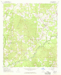 1968 Puckett1970 Print · USGSThe Rankin and Simpson County border area comes alive in this late 1960s survey, showing the agricultural and timbered landscapes of central Mississippi. Genealogists can trace family names at Burnham Cem and Everett Cem or locate community landmarks like Rose Hill Ch.2 unique versions available
 - 1968 Map of Braxton, 1970 Print
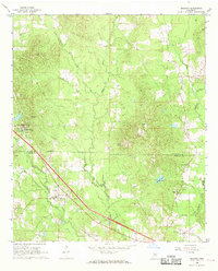 1968 Braxton1970 Print · USGSThe Rankin and Simpson County line comes into focus in the late sixties, centering on the historic town of Braxton. Genealogists and historians can locate rural landmarks like the Piney Woods Country Life School and family-named burial grounds like Calhoun Cem.2 unique versions available
 - 1970 Map of Hopewell, 1972 Print
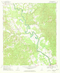 1970 Hopewell1972 Print · USGSThe Pearl River valley at the start of the seventies serves as a preserved record of rural life along the Copiah-Simpson county line. Genealogists and local historians can trace the foundations of communities like Gatesville and Reno or locate family sites at Zion Hill Cem and Brushy Creek Ch.2 unique versions available
 - 1970 Map of Mendenhall East, 1972 Print
 1970 Mendenhall East1972 Print · USGSIn the early 1970s, the area around Mendenhall remained a landscape of rural communities and railroad stops along the Illinois Central. Trace family history through landmarks like State Sanatorium, Zion Hill Ch, and Finley Cem.
 - 1970 Map of Harrisville, 1972 Print
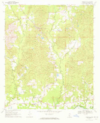 1970 Harrisville1972 Print · USGSSimpson County rural life in the late sixties is centered around the village of Harrisville and the winding Strong River. Researchers can trace the path of the Old Railroad Grade and locate historic landmarks like Mt Olive Ch and the Lookout Tower.
 - 1970 Map of Mendenhall West, 1972 Print
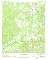 1970 Mendenhall West1972 Print · USGSThe Strong River valley in the early seventies shows Simpson County's rail-and-river geography. Genealogists can trace family sites at Bishop Cem, find rural hubs like Westville, and locate the Harper Sch near the county seat.2 unique versions available
 - 1971 Map of Schley, 1973 Print
 1971 Schley1973 Print · USGSThe confluence of the Strong and Pearl Rivers defined rural life in Simpson County during the early seventies. Genealogists can locate family landmarks like Armstrong-Buckley Cem and rural centers such as Schley or Bridgeport.2 unique versions available
 - 1971 Map of Shivers, 1973 Print
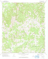 1971 Shivers1973 Print · USGSSouthern Mississippi's Piney Woods are captured here in the early 1970s, where rural industry meets historic county lines. Trace the OLD INDIAN TREATY BOUNDARY near Shivers or locate family roots at Pilgrim Rest Cem and Rose Hill Ch.2 unique versions available
 - 1971 Map of Whites, 1973 Print
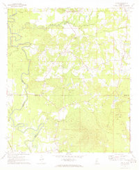 1971 Whites1973 Print · USGSThe rural borders of Rankin, Simpson, Hinds, and Copiah counties come together here in the early seventies. Researchers can trace the legacy of small communities through landmarks like Sinai, the Gulf Mobile and Ohio railroad, and Mt Zion Ch.2 unique versions available
Showing maps 1-25 of 112
Top cities of Simpson County
Frequently asked questions
- What are the different types of historical maps available for Simpson County?
- What is the oldest map of Simpson County?
- Where can I purchase historical maps of Simpson County for my home or office?
- Where can I download high-res historical maps of Simpson County?
- Are there historical topographic maps available for Simpson County?
- Is there historical aerial imagery available for Simpson County?
- Where are historical maps of Simpson County sourced from?