2000s (21st Century) Maps of Myrtle, Mississippi
Explore 12 historic maps of Myrtle from the 2000s (21st Century). These maps offer a rare glimpse into what life looked like during the 2000s — showing old roads, neighborhoods, homes, and landmarks that have changed or disappeared over time.
Whether you're researching your family's past, planning a metal detecting trip, or studying how Myrtle's landscape evolved across the 2000s, these high-resolution maps are a powerful tool for exploring the history of this region.
- Focus on a specific era: All maps on this page are from the 2000s, giving you a focused view of this time period.
- See what’s changed: Compare century-old streets, trails, and buildings to today's modern landscape using overlays and satellite layers.
- Research with precision: Use these maps for genealogy, historical research, land use analysis, or educational projects.
- View, download, or print: Maps are fully viewable online in high resolution, and can be downloaded or printed for your own records.
Start exploring Myrtle's history through authentic maps from the 2000s. This is your window into the past.
Myrtle, MS maps
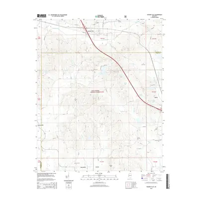
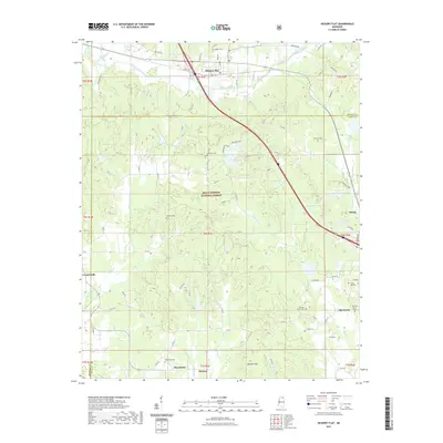
(12)- 2000 Map of Myrtle, 2003 Print
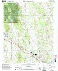 2000 Myrtle2003 Print · USGSNorthern Mississippi's rural landscape is captured here at the millennium, centered on Myrtle and the Heipsy Hills. Genealogists can trace family names at Graves Myrtle Cem, McAllister Cem, and the Bois D'Arc Ch.
 - 2000 Map of Hickory Flat, 2003 Print
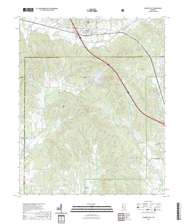
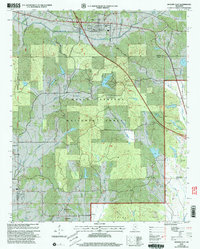 2000 Hickory Flat2003 Print · USGSBenton and Union County at the turn of the millennium show a landscape deeply integrated with the Holly Springs National Forest. Researchers can trace old family sites and rural centers like Hickory Flat, Cornersville, and the McKay Cem.
 - 2012 Map of Myrtle, 2012 Print
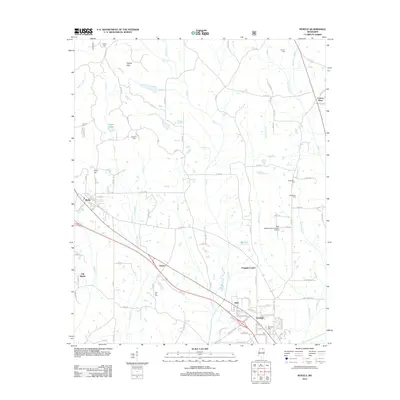 2012 Myrtle2012 Print · USGSCovers Myrtle, including New Albany, Cotton Plant, and other nearby areas
 - 2012 Map of Hickory Flat, 2012 Print
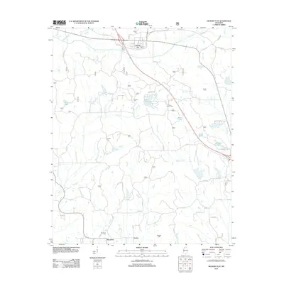 2012 Hickory Flat2012 Print · USGSCovers Myrtle, including Hickory Flat, Darden, and other nearby areas
 - 2015 Map of Hickory Flat, 2015 Print
 2015 Hickory Flat2015 Print · USGSCovers Myrtle, including Hickory Flat, Darden, and other nearby areas
 - 2015 Map of Myrtle, 2015 Print
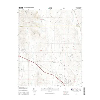 2015 Myrtle2015 Print · USGSCovers Myrtle, including New Albany, Cotton Plant, and other nearby areas
 - 2018 Map of Myrtle, 2018 Print
 2018 Myrtle2018 Print · USGSCovers Myrtle, including New Albany, Cotton Plant, and other nearby areas
 - 2018 Map of Hickory Flat, 2018 Print
 2018 Hickory Flat2018 Print · USGSCovers Myrtle, including Hickory Flat, Darden, and other nearby areas
 - 2021 Map of Hickory Flat, 2021 Print
 2021 Hickory Flat2021 Print · USGSCovers Myrtle, including Hickory Flat, Darden, and other nearby areas
 - 2021 Map of Myrtle, 2021 Print
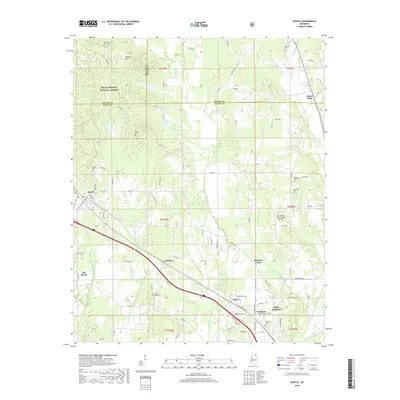
 2021 Myrtle2021 Print · USGSCovers Myrtle, including New Albany, Cotton Plant, and other nearby areas
 - 2024 Map of Hickory Flat, 2024 Print
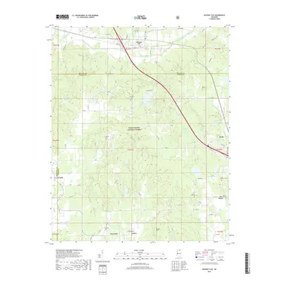
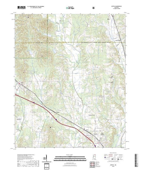
 2024 Hickory Flat2024 Print · USGSNorthern Mississippi's hill country comes into focus in this recent survey of the Benton and Union County border. Family historians can trace the locations of many local burial grounds, including Mckay Cem, Barnett Cem, and the Old Oak Grove Cem near Old Myrtle.
 - 2024 Map of Myrtle, 2024 Print
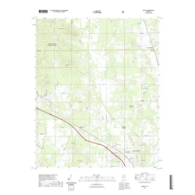
 2024 Myrtle2024 Print · USGSUpper Mississippi in the modern era reveals a complex network of rural settlements and family burial grounds. Researchers can trace the path of the BNSF Railway through Smalco and find old local landmarks like Cotton Plant and Old Myrtle.
End of results
Showing maps 1-12 of 12
Top cities near Myrtle
- New Albany historical maps
- Ripley historical maps
- Ecru historical maps
- Blue Mountain historical maps
- Hickory Flat historical maps
- Potts Camp historical maps
Frequently asked questions
- What are the different types of historical maps available for Myrtle?
- What is the oldest map of Myrtle?
- Where can I purchase historical maps of Myrtle for my home or office?
- Where can I download high-res historical maps of Myrtle?
- Are there historical topographic maps available for Myrtle?
- Is there historical aerial imagery available for Myrtle?
- Where are historical maps of Myrtle sourced from?