Old Maps of Redbone, Mississippi for Genealogy
Trace your family roots with 12 historic maps of Redbone. These high-res maps reveal old neighborhoods, homesites, landmarks, and streets — helping you uncover where your ancestors lived and how the area evolved over time.
- Explore historic neighborhoods: Identify where your relatives may have lived in the 1800s or 1900s.
- Compare maps over time: Trace the changes in streets, buildings, and landmarks for multi-generational research.
- Perfect for genealogy & ancestry research: Used by family historians and researchers to map out lineage and migration.
These maps are an incredible resource for exploring your personal connection to Redbone's past.
Redbone, MS maps
(12)- 1939 Map of Yokena, 1942 Print
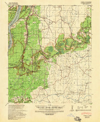 1939 Yokena1942 Print · USGSThe Mississippi riverfront south of Vicksburg was a complex landscape of engineering and rural community just before the Second World War. Researchers can trace the Yazoo and Mississippi Valley RR and find local landmarks like Rocky Springs and the Hardscrabble Sch.2 unique versions available
 - 1955 Map of Jackson
 1955 Jackson1955 Print · USGSThe Lower Mississippi Valley at the middle of the century reveals a landscape of deep river meanders and growing rail hubs. Genealogists and historians can trace the mid-century footprints of Vicksburg National Military Park, old river landings at Port Gibson, and the rail corridors of the Illinois Central Railroad.3 unique versions available
 - 1961 Map of Jackson
 1961 Jackson1961 Print · USGSThe Lower Mississippi Delta and the state capital area are captured here during the post-war era of infrastructure expansion. Researchers can trace the complex river oxbows and rail lines connecting Vicksburg, Yazoo City, and the Illinois Central Railroad network.
 - 1962 Map of Jackson
 1962 Jackson1962 Print · USGSThe Mississippi Delta and the state capital region are mapped here in the early sixties, showing a landscape defined by the great river and the growing city of JACKSON. Genealogists can trace family roots through numerous landmarks like Cedar Hill Cem, rural stops on the Illinois Central RR, and historic sites like Champion Hill.2 unique versions available
 - 1963 Map of Yokena, 1964 Print
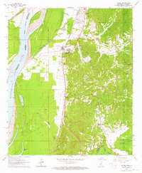 1963 Yokena1964 Print · USGSWarren County in the early 1960s reveals a landscape shaped by the Mississippi River and the busy Illinois Central rail line. Researchers can trace family sites at Glass Cem and Sadler Cem or locate old landmarks like Morning Star Ch.4 unique versions available
 - 1966 Map of Yokena, 1968 Print
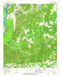 1966 Yokena1968 Print · USGSWarren and Claiborne counties come alive in the mid-1960s, showing a riverfront landscape defined by the winding Big Black River. Genealogists can trace family names and small congregations at Morning Star Ch, Beulah Cem, and the historic settlement of Rocky Springs.2 unique versions available
 - 1984 Map of Jackson
 1984 Jackson1984 Print · USGSCentral Mississippi in the mid-eighties shows a landscape defined by the growing suburbs of Jackson and the riverfront legacy of Vicksburg. Researchers can trace the Natchez Trace Parkway or locate local landmarks like Utica College and Mississippi State Hospital.
 - 2012 Map of Yokena, 2012 Print
 2012 Yokena2012 Print · USGSCovers Redbone, including Vicksburg, Yokena, and other nearby areas
 - 2015 Map of Yokena, 2015 Print
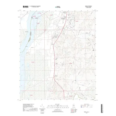
 2015 Yokena2015 Print · USGSCovers Redbone, including Vicksburg, Yokena, and other nearby areas
 - 2018 Map of Yokena, 2018 Print
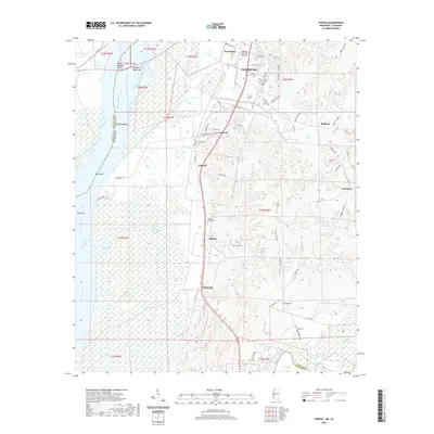
 2018 Yokena2018 Print · USGSCovers Redbone, including Vicksburg, Yokena, and other nearby areas
 - 2020 Map of Yokena, 2020 Print
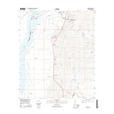
 2020 Yokena2020 Print · USGSCovers Redbone, including Vicksburg, Yokena, and other nearby areas
 - 2024 Map of Yokena, 2024 Print
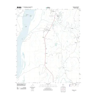
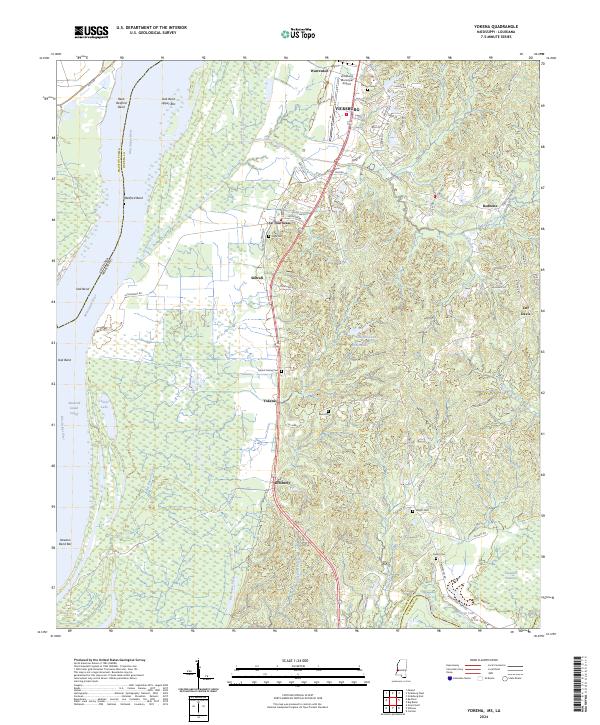 2024 Yokena2024 Print · USGSSouth of Vicksburg in the 2020s, the landscape follows the high ground above the Mississippi River floodplains. Genealogists and local historians can trace family locations near Mount Giving Cem, the small community of Yokena, or the historic crossing at Hankerson Ferry Rd.
End of results
Showing maps 1-12 of 12
Top cities near Redbone
Frequently asked questions
- What are the different types of historical maps available for Redbone?
- What is the oldest map of Redbone?
- Where can I purchase historical maps of Redbone for my home or office?
- Where can I download high-res historical maps of Redbone?
- Are there historical topographic maps available for Redbone?
- Is there historical aerial imagery available for Redbone?
- Where are historical maps of Redbone sourced from?