Old Maps of Fort Adams, Mississippi for Academic Research
Study the evolution of Fort Adams with 17 high-resolution historic maps. Whether you're teaching, researching, or modeling changes in land use, these maps provide essential visual documentation of urban, environmental, and geographic change.
- Analyze long-term change: Track patterns in development, transportation, and natural features.
- Ideal for environmental or urban studies: Support academic projects with primary historical map data.
- Use in the classroom or lab: Educators and researchers rely on these maps to bring historical context to life.
These maps are a powerful tool for teaching, research, and visualizing how Fort Adams has changed over the decades.
Fort Adams, MS maps
(17)- 1939 Map of Artonish, 1945 Print
 1939 Artonish1945 Print · USGSThe river-and-rail economy of the Louisiana-Mississippi border is frozen in time just before the mid-century, showing the dense settlement of the bottomlands. Genealogists can trace family roots through numerous local landmarks like Fort Adams, Singleton Chapel & Cem, and the Black Hawk Plantation.
 - 1953 Map of Natchez, 1966 Print
 1953 Natchez1966 Print · USGSSouthwest Mississippi and the Louisiana border country come alive in this mid-century survey of the river valley and forest lands. Researchers can trace the rail lines of the Illinois Central RR and locate rural hubs like Gloster and Ferriday.3 unique versions available
 - 1954 Map of Artonish, 1966 Print
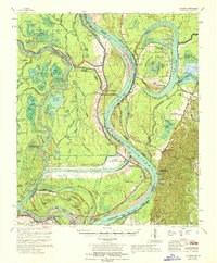
 1954 Artonish1966 Print · USGSThe riverfronts of Concordia Parish and Wilkinson County are captured here in the mid-fifties, during a period of significant hydraulic engineering and transition. Genealogists and historians can trace family-named sites like Shaw Plantation, Singleton Cem, and the old military outpost at Fort Adams.
 - 1955 Map of Artonish
 1955 Artonish1955 Print · USGSWilkinson County and Concordia Parish in the mid-fifties are defined here by the massive plantations and river landings along the winding Mississippi River. Genealogists can trace local roots through numerous sites like Royal Oak Ch & Cem, Fort Adams, and the Torras Community Sch.
 - 1956 Map of Natchez
 1956 Natchez1956 Print · USGSThe Mississippi River borderlands and the Pine Hills come alive in this mid-fifties study of the Natchez region. Genealogists and historians can trace rail-era towns along the Illinois Central RR and explore the oxbows of Lake Bruin and Lake Concordia.
 - 1958 Map of Artonish
 1958 Artonish1958 Print · USGSThe river bluffs of Mississippi and the bottomlands of Louisiana meet here in the late fifties as massive engineering projects began to reshape the landscape. Local historians can trace family-named sites like Stamps Plantation or locate rural landmarks such as Royal Oak Ch & Cem and the Texas and Pacific RR.
 - 1959 Map of Natchez
 1959 Natchez1959 Print · USGSSouthwestern Mississippi and eastern Louisiana are captured in the late fifties, showing a landscape defined by the winding Mississippi River and the timbered Homochitto National Forest. Researchers can trace the sprawling Illinois Central RR and find rural landmarks like Union Church and Camp Van Dorn (Abandoned).
 - 1965 Map of Fort Adams, 1966 Print
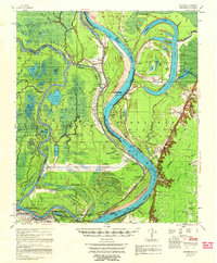
 1965 Fort Adams1966 Print · USGSWilkinson County and Concordia Parish meet along the shifting bends of the Mississippi in the mid-sixties. Researchers can locate historic burial grounds like Clarksville Cem and Moss Ridge Cem or trace the early engineering of the Old River Control Structure.2 unique versions available
 - 1967 Map of Artonish, 1968 Print
 1967 Artonish1968 Print · USGSThe river country of the Mississippi-Louisiana border is captured here during a period of massive hydraulic engineering. Genealogists and researchers can locate historic sites like Fort Adams, the Lake Mary Oil Field, and family burial grounds such as Good Hope Cem and Ward Cem.
 - 1984 Map of Woodville
 1984 Woodville1984 Print · USGSThe Mississippi-Louisiana borderlands in the mid-eighties show a landscape defined by the shifting MISSISSIPPI RIVER and sprawling timberlands. Researchers can trace the ILLINOIS CENTRAL GULF railroad through Gloster or locate historic river points like Fort Adams and Point Breeze.
 - 1991 Map of Woodville
 1991 Woodville1991 Print · USGSWilkinson County and the Louisiana borderlands appear here in the early nineties, where the bluffs meet the Mississippi River floodplain. Trace the sites of old river landings and rural outposts like Fort Adams, Pinckneyville, and the remote Larto Lake community.
 - 1996 Map of Fort Adams, 2000 Print
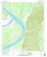
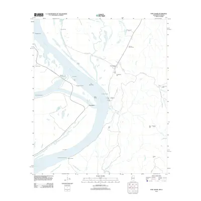
 1996 Fort Adams2000 Print · USGSThe bluffs of Wilkinson County meet the Mississippi River floodplain in the late nineties, documenting a landscape shaped by water and history. Researchers can locate the historic Fort Adams settlement, trace river controls, and find Riverside Cem or Clarksville Cem.
 - 2012 Map of Fort Adams, 2012 Print
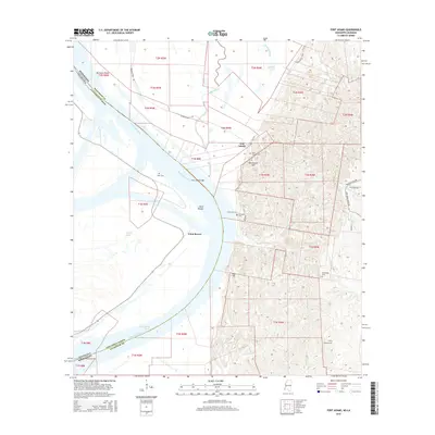
 2012 Fort Adams2012 Print · USGSCovers Fort Adams, including Point Breeze, Concordia Parish, and other nearby areas
 - 2015 Map of Fort Adams, 2015 Print
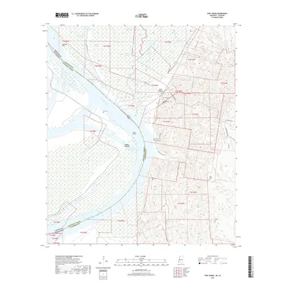
 2015 Fort Adams2015 Print · USGSCovers Fort Adams, including Point Breeze, Concordia Parish, and other nearby areas
 - 2018 Map of Fort Adams, 2018 Print
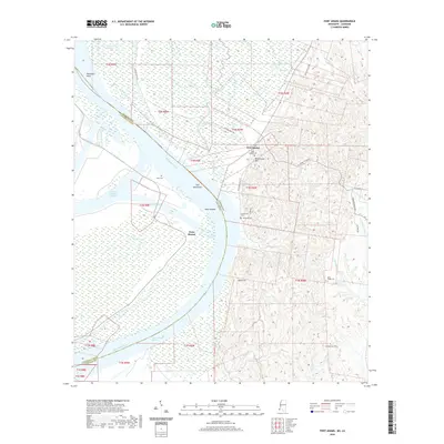
 2018 Fort Adams2018 Print · USGSCovers Fort Adams, including Point Breeze, Concordia Parish, and other nearby areas
 - 2020 Map of Fort Adams, 2020 Print
 2020 Fort Adams2020 Print · USGSCovers Fort Adams, including Point Breeze, Concordia Parish, and other nearby areas
 - 2024 Map of Fort Adams, 2024 Print
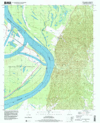
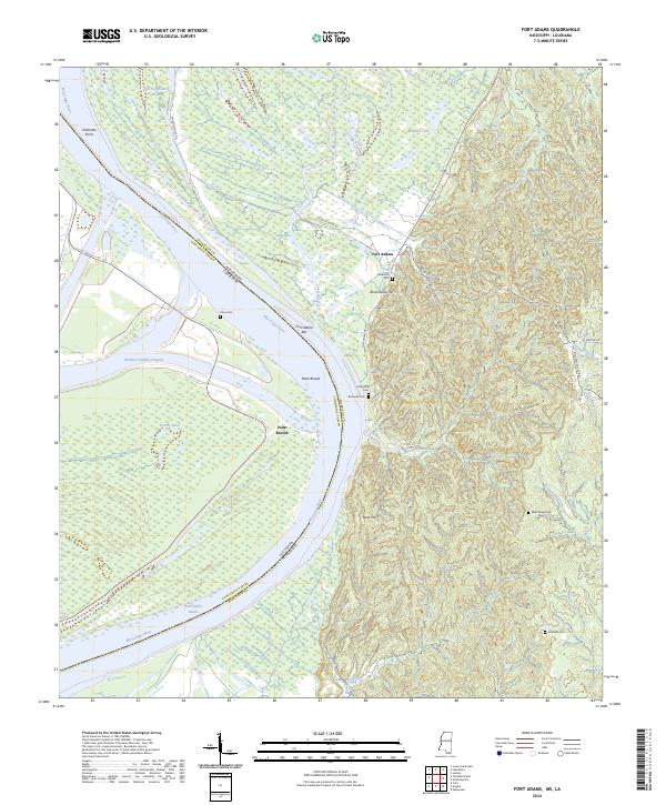 2024 Fort Adams2024 Print · USGSThe Mississippi-Louisiana border comes alive in this study of the river's bends and backwaters. Genealogists can trace family sites at Riverside and Linwood, while historians can locate Fort Adams and the strategic heights of Blockhouse Hill.
End of results
Showing maps 1-17 of 17
Frequently asked questions
- What are the different types of historical maps available for Fort Adams?
- What is the oldest map of Fort Adams?
- Where can I purchase historical maps of Fort Adams for my home or office?
- Where can I download high-res historical maps of Fort Adams?
- Are there historical topographic maps available for Fort Adams?
- Is there historical aerial imagery available for Fort Adams?
- Where are historical maps of Fort Adams sourced from?