Old Maps of Laneheart, Mississippi for Metal Detecting
Plan your next treasure hunt with 13 historic maps of Laneheart. Find old homesites, ghost towns, trails, and gathering spots that may be lost to time — perfect for identifying promising metal detecting locations.
- Locate forgotten sites: Uncover places like long-lost settlements, abandoned rail lines, or gathering spots.
- Plan better hunts: Use map overlays combined with LiDAR or satellite views to narrow in on historically rich areas.
- Made for detectorists: Thousands of hobbyists use these maps to discover relics, coins, and hidden history.
Use these historic maps to boost your research and find new opportunities beneath the surface of Laneheart.
Laneheart, MS maps
(13)- 1936 Map of Woodville, 1944 Print
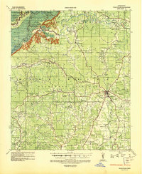 1936 Woodville1944 Print · USGSWilkinson County was a land of sprawling estates and quiet country crossroads in the mid-1930s. Genealogists can trace hundreds of family landmarks and community centers, from La Grange Plantation and Bells Store to Peach Grove Ch & Cem.
 - 1953 Map of Natchez, 1966 Print
 1953 Natchez1966 Print · USGSSouthwest Mississippi and the Louisiana border country come alive in this mid-century survey of the river valley and forest lands. Researchers can trace the rail lines of the Illinois Central RR and locate rural hubs like Gloster and Ferriday.3 unique versions available
 - 1956 Map of Natchez
 1956 Natchez1956 Print · USGSThe Mississippi River borderlands and the Pine Hills come alive in this mid-fifties study of the Natchez region. Genealogists and historians can trace rail-era towns along the Illinois Central RR and explore the oxbows of Lake Bruin and Lake Concordia.
 - 1958 Map of Woodville, 1960 Print
 1958 Woodville1960 Print · USGSWoodville and the surrounding Wilkinson County countryside are captured here in the late fifties. Genealogists can trace family roots through numerous rural landmarks like St James Ch, Pickneyville, and the Bowling Green Cem.4 unique versions available
 - 1959 Map of Natchez
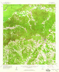
 1959 Natchez1959 Print · USGSSouthwestern Mississippi and eastern Louisiana are captured in the late fifties, showing a landscape defined by the winding Mississippi River and the timbered Homochitto National Forest. Researchers can trace the sprawling Illinois Central RR and find rural landmarks like Union Church and Camp Van Dorn (Abandoned).
 - 1984 Map of Woodville
 1984 Woodville1984 Print · USGSThe Mississippi-Louisiana borderlands in the mid-eighties show a landscape defined by the shifting MISSISSIPPI RIVER and sprawling timberlands. Researchers can trace the ILLINOIS CENTRAL GULF railroad through Gloster or locate historic river points like Fort Adams and Point Breeze.
 - 1988 Map of Laneheart
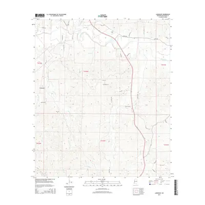
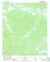 1988 Laneheart1988 Print · USGSWilkinson County in the late eighties is defined here by the winding Buffalo River and its quiet rural interior. Researchers can trace old watercourses near Horseshoe Lake or locate the settlement of Laneheart among a network of drainages like Fords Creek.
 - 1991 Map of Woodville
 1991 Woodville1991 Print · USGSWilkinson County and the Louisiana borderlands appear here in the early nineties, where the bluffs meet the Mississippi River floodplain. Trace the sites of old river landings and rural outposts like Fort Adams, Pinckneyville, and the remote Larto Lake community.
 - 2012 Map of Laneheart, 2012 Print
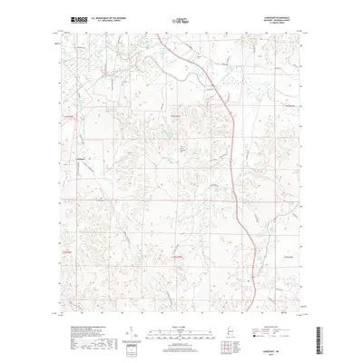
 2012 Laneheart2012 Print · USGSCovers Laneheart, including Wilkinson County, United States, and other nearby areas
 - 2015 Map of Laneheart, 2015 Print
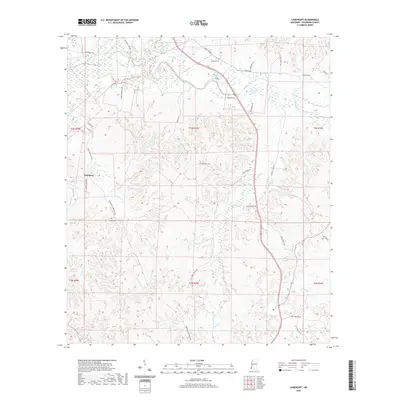
 2015 Laneheart2015 Print · USGSCovers Laneheart, including Wilkinson County, United States, and other nearby areas
 - 2018 Map of Laneheart, 2018 Print
 2018 Laneheart2018 Print · USGSCovers Laneheart, including Wilkinson County, United States, and other nearby areas
 - 2020 Map of Laneheart, 2020 Print
 2020 Laneheart2020 Print · USGSCovers Laneheart, including Wilkinson County, United States, and other nearby areas
 - 2024 Map of Laneheart, 2024 Print
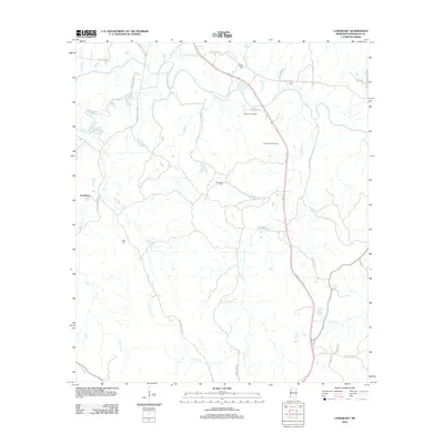
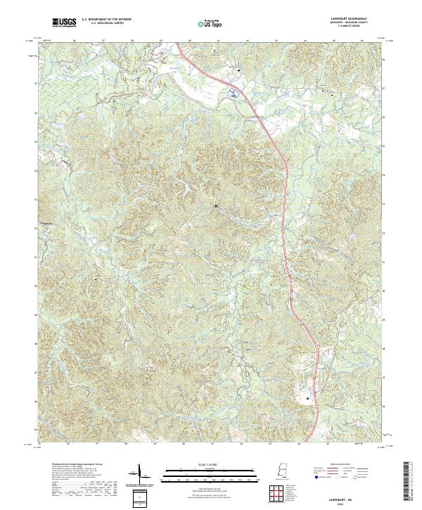 2024 Laneheart2024 Print · USGSWilkinson County in the modern era remains a landscape of river bends and quiet family legacies. Genealogists can trace ancestral sites like Pioneer Cem and Westberry Cem or follow the winding Buffalo River past Horseshoe Lake.
End of results
Showing maps 1-13 of 13
Top cities near Laneheart
Frequently asked questions
- What are the different types of historical maps available for Laneheart?
- What is the oldest map of Laneheart?
- Where can I purchase historical maps of Laneheart for my home or office?
- Where can I download high-res historical maps of Laneheart?
- Are there historical topographic maps available for Laneheart?
- Is there historical aerial imagery available for Laneheart?
- Where are historical maps of Laneheart sourced from?