1980s Maps of Tarkio, Missouri
Explore 3 historic maps of Tarkio from the 1980s. These maps offer a rare glimpse into what life looked like during the 1980s — showing old roads, neighborhoods, homes, and landmarks that have changed or disappeared over time.
Whether you're researching your family's past, planning a metal detecting trip, or studying how Tarkio's landscape evolved across the 1980s, these high-resolution maps are a powerful tool for exploring the history of this region.
- Focus on a specific era: All maps on this page are from the 1980s, giving you a focused view of this time period.
- See what’s changed: Compare century-old streets, trails, and buildings to today's modern landscape using overlays and satellite layers.
- Research with precision: Use these maps for genealogy, historical research, land use analysis, or educational projects.
- View, download, or print: Maps are fully viewable online in high resolution, and can be downloaded or printed for your own records.
Start exploring Tarkio's history through authentic maps from the 1980s. This is your window into the past.
Tarkio, MO maps
(3)- 1981 Map of Tarkio West, 1982 Print
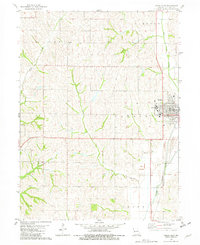 1981 Tarkio West1982 Print · USGSThe Atchison County prairie in the early eighties is captured here, centered on the campus and rail lines of the local hub. Researchers can locate Tarkio College, the Home Cemetery, and the Burlington Northern corridor as they appeared decades ago.
 - 1981 Map of Tarkio East, 1982 Print
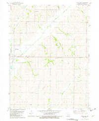 1981 Tarkio East1982 Print · USGSAtchison County at the start of the 1980s showcases a rural landscape defined by the winding Tarkio River and its rail connections. Researchers can trace family history at Center Grove Cem or locate the local Oil Field and Community Hall.
 - 1986 Map of Falls City
 1986 Falls City1986 Print · USGSThe Missouri River borderlands of Nebraska and Missouri were a landscape of established colleges and river-bound railroads in the mid-1980s. Researchers can locate long-standing landmarks like Peru State College, the Iowa Indian Reservation, and St Johns Cem.2 unique versions available
End of results
Showing maps 1-3 of 3
Top cities near Tarkio
- Rock Port historical maps
- Fairfax historical maps
- Coin historical maps
- Westboro historical maps
- Northboro historical maps
- Blanchard historical maps
See more
Frequently asked questions
- What are the different types of historical maps available for Tarkio?
- What is the oldest map of Tarkio?
- Where can I purchase historical maps of Tarkio for my home or office?
- Where can I download high-res historical maps of Tarkio?
- Are there historical topographic maps available for Tarkio?
- Is there historical aerial imagery available for Tarkio?
- Where are historical maps of Tarkio sourced from?