Old Maps of Seligman, Missouri for Academic Research
Study the evolution of Seligman with 15 high-resolution historic maps. Whether you're teaching, researching, or modeling changes in land use, these maps provide essential visual documentation of urban, environmental, and geographic change.
- Analyze long-term change: Track patterns in development, transportation, and natural features.
- Ideal for environmental or urban studies: Support academic projects with primary historical map data.
- Use in the classroom or lab: Educators and researchers rely on these maps to bring historical context to life.
These maps are a powerful tool for teaching, research, and visualizing how Seligman has changed over the decades.
Seligman, MO maps
(15)- 1937 Map of Cassville
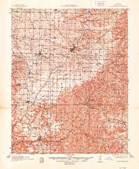 1937 Cassville1937 Print · USGSBarry County in the late thirties shows a landscape of deep Ozark valleys and tightly knit rural communities. Genealogists and historians can trace family roots through numerous local landmarks like Maplewood Cem, Eagle Rock, and Independence Sch.2 unique versions available
 - 1944 Map of Cassville
 1944 Cassville1944 Print · USGSBarry County and the Missouri Ozarks come alive in the late 1930s, showing the early development of Roaring River State Park. Researchers can trace old family names and sites at True Love Cem, Pender Switch, and the CCC Camp near Cassville.2 unique versions available
 - 1945 Map of Harrison
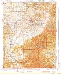
 1945 Harrison1945 Print · USGSThe Ozark and Boston Mountains straddle the Missouri-Arkansas border during the mid-forties, showing a landscape of forest ridges and river valleys. Genealogists and historians can trace rail-connected towns like Monett and West Plains or early lake developments at Bull Shoals Res and Norfork Lake.
 - 1949 Map of Harrison
 1949 Harrison1949 Print · USGSThe Ozark highlands of northern Arkansas and southern Missouri are shown just after the war, when the White River still followed its original course. Genealogists and historians can trace rail lines like the Missouri & Arkansas RR and locate rural hubs like Harrison, Eureka Springs, and Mountain Home.
 - 1954 Map of Harrison
 1954 Harrison1954 Print · USGSThe Ozarks and Boston Mountains meet during a period of massive river engineering in the mid-fifties. Researchers can trace the early shorelines of Bull Shoals Lake and Table Rock Reservoir or locate inland towns like Berryville and Harrison.
 - 1958 Map of Harrison, 1973 Print
 1958 Harrison1973 Print · USGSThe Ozark and Boston Mountains appear in this mid-century survey as the great White River impoundments were reshaping the region. Researchers can trace the rail lines of the St Louis-San Francisco Ry and locate early settlements like Berryville and Gainesville.
 - 1964 Map of Harrison
 1964 Harrison1964 Print · USGSThe Ozark and Boston Mountains of Arkansas and Missouri are captured here in the mid-sixties, showing the rugged highlands before extensive modern development. Genealogists and historians can trace family-named peaks like Gaither Mountain and follow the St Louis-San Francisco RR through Monett and Purdy.
 - 1974 Map of Seligman, 1977 Print
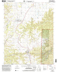
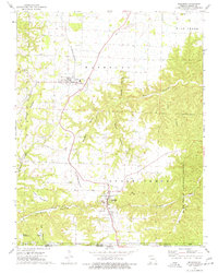 1974 Seligman1977 Print · USGSBarry County, Missouri, is captured in the mid-seventies just as the St Louis-San Francisco rail line connected the hill towns of Washburn and Seligman. Researchers can trace rural lineages through sites like the Washburn Prairie Cem, Rock Springs Ch, and McCann Cave.
 - 1985 Map of Table Rock Lake
 1985 Table Rock Lake1985 Print · USGSSouthwest Missouri in the mid-1980s shows a landscape transformed by the waters of the White River and its reservoirs. Genealogists and local historians can trace the intricate shorelines of Table Rock Lake, locate rural crossroads like Jenkins and Madry, and explore the grounds of Roaring River State Park.
 - 1985 Map of Harrison
 1985 Harrison1985 Print · USGSThe Ozark highlands and the White River valley are seen here in the mid-1980s, showcasing a region defined by its massive reservoirs and protected wilderness. You can trace the rugged corridors of the Missouri & North Arkansas RR or locate historic settlements like Eureka Springs and Jasper.
 - 1999 Map of Seligman, 2002 Print
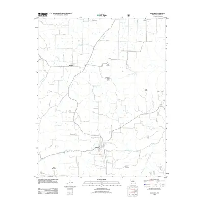
 1999 Seligman2002 Print · USGSBarry County and the Missouri-Arkansas border appear in the late 1990s as a landscape of timbered ridges and family cemeteries. Researchers can trace land ties at Washburn Prairie Cemetery or locate landmarks like McCann Cave and Rock Springs Church.
 - 2012 Map of Seligman, 2012 Print
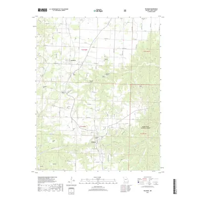
 2012 Seligman2012 Print · USGSCovers Seligman, including Washburn, Barry County, and other nearby areas
 - 2015 Map of Seligman, 2015 Print
 2015 Seligman2015 Print · USGSCovers Seligman, including Washburn, Barry County, and other nearby areas
 - 2017 Map of Seligman, 2017 Print
 2017 Seligman2017 Print · USGSCovers Seligman, including Washburn, Barry County, and other nearby areas
 - 2021 Map of Seligman, 2021 Print
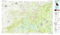
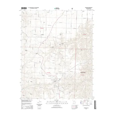
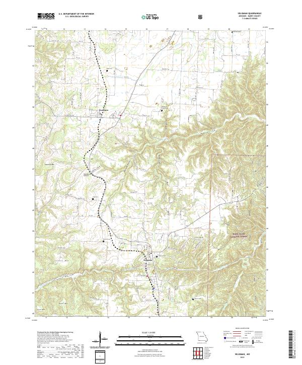 2021 Seligman2021 Print · USGSSouthwest Missouri's Ozark plateau is captured here in the early twenty-first century, centered on the settlements of Seligman and Washburn. Genealogists can trace local roots across numerous burial sites like Washburn Prairie Cem and Seligman Cem set among the heights of Lennox Mtn.
End of results
Showing maps 1-15 of 15
Top cities near Seligman
- Rogers historical maps
- Bentonville historical maps
- Bella Vista historical maps
- Pea Ridge historical maps
- Cassville historical maps
- Little Flock historical maps
See more
Frequently asked questions
- What are the different types of historical maps available for Seligman?
- What is the oldest map of Seligman?
- Where can I purchase historical maps of Seligman for my home or office?
- Where can I download high-res historical maps of Seligman?
- Are there historical topographic maps available for Seligman?
- Is there historical aerial imagery available for Seligman?
- Where are historical maps of Seligman sourced from?