1900s (20th Century) Maps of Edwards, Missouri
Explore 10 historic maps of Edwards from the 1900s (20th Century). These maps offer a rare glimpse into what life looked like during the 1900s — showing old roads, neighborhoods, homes, and landmarks that have changed or disappeared over time.
Whether you're researching your family's past, planning a metal detecting trip, or studying how Edwards's landscape evolved across the 1900s, these high-resolution maps are a powerful tool for exploring the history of this region.
- Focus on a specific era: All maps on this page are from the 1900s, giving you a focused view of this time period.
- See what’s changed: Compare century-old streets, trails, and buildings to today's modern landscape using overlays and satellite layers.
- Research with precision: Use these maps for genealogy, historical research, land use analysis, or educational projects.
- View, download, or print: Maps are fully viewable online in high resolution, and can be downloaded or printed for your own records.
Start exploring Edwards's history through authentic maps from the 1900s. This is your window into the past.
Edwards, MO maps
(10)- 1935 Map of Edwards
 1935 Edwards1935 Print · USGSBenton County was adjusting to a transformed landscape in the mid-1930s following the creation of the Lake of the Ozarks. Local historians and genealogists can trace the early shoreline at Duckworths Camp or locate rural landmarks like Rock Spring School and Hastain Ch.
 - 1947 Map of Jefferson City, 1949 Print
 1947 Jefferson City1949 Print · USGSCentral Missouri and the northern Ozarks come into focus in this late 1940s survey of the river-and-rail landscape. Genealogists and historians can trace the growth of Jefferson City and Sedalia or locate family roots near Bagnell Dam and the Lake of the Ozarks.
 - 1954 Map of Jefferson City
 1954 Jefferson City1954 Print · USGSCentral Missouri in the early postwar years showcases a landscape defined by the winding Lake of the Ozarks and the state capital at Jefferson City. Researchers can trace the mid-century rail networks of the Missouri Pacific RR and locate rural communities like Tuscumbia, St Elizabeth, and St Anthony.2 unique versions available
 - 1955 Map of Jefferson City, 1967 Print
 1955 Jefferson City1967 Print · USGSCentral Missouri in the mid-fifties is defined by the winding Missouri River and the expanding reach of Lake of the Ozarks. Researchers can trace the rail corridors of the Missouri Pacific or locate the early footprint of Whiteman AFB and Jefferson City.4 unique versions available
 - 1957 Map of Edwards
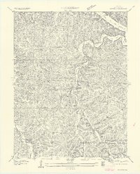 1957 Edwards1957 Print · USGSBenton County in the mid-1930s reveals a landscape of deep hollows and the newly established Lake of the Ozarks shoreline. Researchers can trace the locations of rural schoolhouses like Pleasant Green School and Rock Spring School or follow the path of the original Warsaw Road.
 - 1958 Map of Jefferson City
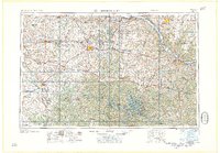 1958 Jefferson City1958 Print · USGSCentral Missouri in the late fifties shows a region transforming through the growth of Whiteman Air Force Base and the Lake of the Ozarks. Researchers can trace rail lines like the Missouri Pacific or find family roots at Enloe Cemetery and Mount Pleasant Cem.
 - 1959 Map of Jefferson City
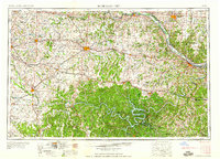 1959 Jefferson City1959 Print · USGSCentral Missouri is captured during the mid-fifties as the river economy and rail networks like the Missouri Pacific met the rise of the automobile. Local researchers can trace family landmarks and rural infrastructure from the Lake of the Ozarks up to Providence Cemetery and Knob Noster State Park.
 - 1959 Map of Edwards, 1960 Print
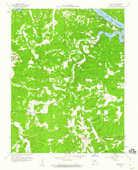 1959 Edwards1960 Print · USGSBenton County's rugged ridge country and the northern inlets of the Lake of the Ozarks are captured here in the late fifties. Local historians can trace family land and community hubs through the Short School, Belleview Cem, and the settlement of Edwards.2 unique versions available
 - 1983 Map of Edwards
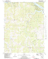 1983 Edwards1983 Print · USGSBenton County's timbered ridges and deep hollows are captured here in the early 1980s, just south of the winding LAKE OF THE OZARKS. Genealogists and historians can trace family roots through landmarks like Jockey City Corners, Belleview Cem, and the community at Edwards.
 - 1983 Map of Harry S Truman Reservoir, 1984 Print
 1983 Harry S Truman Reservoir1984 Print · USGSBenton and Henry counties center on the vast Harry S Truman Reservoir in the early 1980s as the landscape adapted to its new shoreline. Genealogists and historians can trace old river crossings like Bledsoe Ferry, local landmarks like Mt Zion Ch, and unique settlements such as Tightwad.
End of results
Showing maps 1-10 of 10
Top cities near Edwards
- Warsaw historical maps
- Hermitage historical maps
- Macks Creek historical maps
- Cross Timbers historical maps
- Preston historical maps
- Climax Springs historical maps
Frequently asked questions
- What are the different types of historical maps available for Edwards?
- What is the oldest map of Edwards?
- Where can I purchase historical maps of Edwards for my home or office?
- Where can I download high-res historical maps of Edwards?
- Are there historical topographic maps available for Edwards?
- Is there historical aerial imagery available for Edwards?
- Where are historical maps of Edwards sourced from?