1960s Maps of Columbia Township, Missouri
Explore 5 historic maps of Columbia Township from the 1960s. These maps offer a rare glimpse into what life looked like during the 1960s — showing old roads, neighborhoods, homes, and landmarks that have changed or disappeared over time.
Whether you're researching your family's past, planning a metal detecting trip, or studying how Columbia Township's landscape evolved across the 1960s, these high-resolution maps are a powerful tool for exploring the history of this region.
- Focus on a specific era: All maps on this page are from the 1960s, giving you a focused view of this time period.
- See what’s changed: Compare century-old streets, trails, and buildings to today's modern landscape using overlays and satellite layers.
- Research with precision: Use these maps for genealogy, historical research, land use analysis, or educational projects.
- View, download, or print: Maps are fully viewable online in high resolution, and can be downloaded or printed for your own records.
Start exploring Columbia Township's history through authentic maps from the 1960s. This is your window into the past.
Columbia Township, MO maps
(5)- 1960 Map of Moberly
 1960 Moberly1960 Print · USGSCentral Missouri comes alive in the mid-twentieth century as a bustling network of river towns and significant rail corridors. Genealogists and historians can trace the paths of the Wabash RR through Moberly or explore the riverfronts of Lexington and Brunswick.
 - 1967 Map of Columbia, 1968 Print
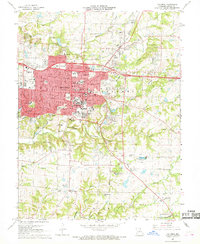 1967 Columbia1968 Print · USGSColumbia in the late sixties is a thriving academic and transit hub defined by its historic colleges and expanding rail networks. Researchers can trace the mid-century layout of the University of Missouri or locate local landmarks like Antioch Cem and Christian College.4 unique versions available
 - 1969 Map of Millersburg, 1971 Print
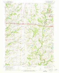 1969 Millersburg1971 Print · USGSThe interface between growing suburbs and rural Boone County comes into focus in the late sixties as the new interstate highway reshapes the land. Genealogists and local historians can locate Prairie Grove Ch, Millersburg, and the Allen Cem near Little Dixie Lake.3 unique versions available
 - 1969 Map of Hallsville, 1971 Print
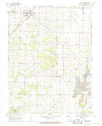 1969 Hallsville1971 Print · USGSNorthern Boone County's rural landscape is captured here in the late sixties, centered on the railroad town of Hallsville. Genealogists and historians can locate family landmarks like Stephens Cem, Mt Hope Ch, and the Twomile Prairie Sch.2 unique versions available
 - 1969 Map of Browns, 1971 Print
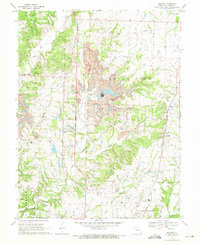 1969 Browns1971 Print · USGSNorthern Boone County is captured here in the late sixties as industrial mining and traditional rural life converged. Genealogists and historians can trace the Norfolk and Western rail line through settlements like Browns, Stephens, and Prathersville.2 unique versions available
End of results
Showing maps 1-5 of 5
Top cities near Columbia Township
- Columbia historical maps
- Ashland historical maps
- Hallsville historical maps
- New Bloomfield historical maps
- Harrisburg historical maps
- Pierpont historical maps
See more
Top neighborhoods of Columbia Township
Frequently asked questions
- What are the different types of historical maps available for Columbia Township?
- What is the oldest map of Columbia Township?
- Where can I purchase historical maps of Columbia Township for my home or office?
- Where can I download high-res historical maps of Columbia Township?
- Are there historical topographic maps available for Columbia Township?
- Is there historical aerial imagery available for Columbia Township?
- Where are historical maps of Columbia Township sourced from?