Old Maps of Hamilton, Missouri
Explore 18 old maps of Hamilton, spanning from 1922 to today. These high-resolution historic maps reveal how streets, neighborhoods, landmarks, and natural features evolved over time — perfect for genealogy, metal detecting, research, and local history exploration.
What you can do with these maps:
- See how Hamilton changed over time: Compare historical maps to modern-day views to trace roads, homesites, rail lines & more.
- View detailed metadata: Each map includes creators, publishers, year, scale, and archive source.
- Overlay maps with satellite & LiDAR: Visualize the past alongside modern tools to explore terrain & human change.
- Trusted historical sources: Maps sourced from the USGS, Library of Congress, and other archives.
- Access maps your way: View online, download high-res files, or order prints for personal or research use.
Start exploring old maps of Hamilton to uncover forgotten places, hidden landmarks, and the deep history beneath your feet.
Hamilton, MO maps
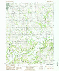
(18)- 1922 Map of Gallatin
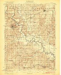 1922 Gallatin1922 Print · USGSCovers Hamilton, including Gallatin, Jamesport, and other nearby areas2 unique versions available
 - 1924 Map of Polo
 1924 Polo1924 Print · USGSCovers Hamilton, including Cameron, Polo, and other nearby areas2 unique versions available
 - 1924 Map of Braymer
 1924 Braymer1924 Print · USGSCovers Hamilton, including Braymer, New York, and other nearby areas3 unique versions available
 - 1924 Map of Winston
 1924 Winston1924 Print · USGSCovers Hamilton, including Cameron, Kidder, and other nearby areas3 unique versions available
 - 1950 Map of Kansas City
 1950 Kansas City1950 Print · USGSCovers Hamilton, including Kansas City, Overland Park, and other nearby areas
 - 1953 Map of Moberly
 1953 Moberly1953 Print · USGSCovers Hamilton, including Columbia, Moberly, and other nearby areas
 - 1954 Map of Kansas City
 1954 Kansas City1954 Print · USGSCovers Hamilton, including Kansas City, Overland Park, and other nearby areas
 - 1954 Map of Moberly, 1969 Print
 1954 Moberly1969 Print · USGSCovers Hamilton, including Columbia, Moberly, and other nearby areas3 unique versions available
 - 1956 Map of Kansas City, 1967 Print
 1956 Kansas City1967 Print · USGSCovers Hamilton, including Kansas City, Overland Park, and other nearby areas4 unique versions available
 - 1957 Map of Moberly
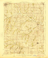
 1957 Moberly1957 Print · USGSCovers Hamilton, including Columbia, Moberly, and other nearby areas
 - 1960 Map of Kansas City
 1960 Kansas City1960 Print · USGSCovers Hamilton, including Kansas City, Overland Park, and other nearby areas3 unique versions available
 - 1960 Map of Moberly
 1960 Moberly1960 Print · USGSCovers Hamilton, including Columbia, Moberly, and other nearby areas
 - 1981 Map of Chillicothe
 1981 Chillicothe1981 Print · USGSCovers Hamilton, including Chillicothe, Brookfield, and other nearby areas
 - 1984 Map of Nettleton
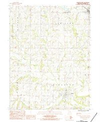
 1984 Nettleton1984 Print · USGSCovers Hamilton, including Nettleton, Daviess County, and other nearby areas
 - 1984 Map of Kidder
 1984 Kidder1984 Print · USGSCovers Hamilton, including Kidder, Daviess County, and other nearby areas
 - 1984 Map of Hamilton East, 1985 Print
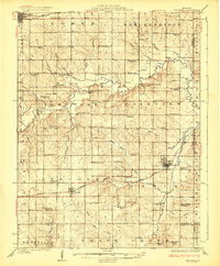
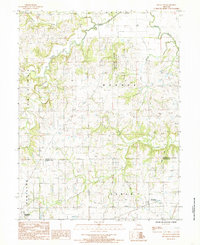
 1984 Hamilton East1985 Print · USGSCovers Hamilton, including New York, Easterville, and other nearby areas
 - 1984 Map of Hamilton West, 1985 Print
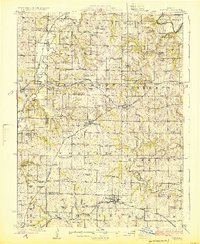
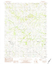
 1984 Hamilton West1985 Print · USGSCovers Hamilton, including Kingston, Barwick, and other nearby areas
 - 1986 Map of Saint Joseph
 1986 Saint Joseph1986 Print · USGSCovers Hamilton, including Saint Joseph, Cameron, and other nearby areas2 unique versions available
End of results
Showing maps 1-18 of 18
Top cities near Hamilton
- Cameron historical maps
- Gallatin historical maps
- Braymer historical maps
- Polo historical maps
- Breckenridge historical maps
- Mirabile historical maps
See more
Frequently asked questions
- What are the different types of historical maps available for Hamilton?
- What is the oldest map of Hamilton?
- Where can I purchase historical maps of Hamilton for my home or office?
- Where can I download high-res historical maps of Hamilton?
- Are there historical topographic maps available for Hamilton?
- Is there historical aerial imagery available for Hamilton?
- Where are historical maps of Hamilton sourced from?