1900s (20th Century) Maps of Hamilton, Missouri
Explore 18 historic maps of Hamilton from the 1900s (20th Century). These maps offer a rare glimpse into what life looked like during the 1900s — showing old roads, neighborhoods, homes, and landmarks that have changed or disappeared over time.
Whether you're researching your family's past, planning a metal detecting trip, or studying how Hamilton's landscape evolved across the 1900s, these high-resolution maps are a powerful tool for exploring the history of this region.
- Focus on a specific era: All maps on this page are from the 1900s, giving you a focused view of this time period.
- See what’s changed: Compare century-old streets, trails, and buildings to today's modern landscape using overlays and satellite layers.
- Research with precision: Use these maps for genealogy, historical research, land use analysis, or educational projects.
- View, download, or print: Maps are fully viewable online in high resolution, and can be downloaded or printed for your own records.
Start exploring Hamilton's history through authentic maps from the 1900s. This is your window into the past.
Hamilton, MO maps
(18)- 1922 Map of Gallatin
 1922 Gallatin1922 Print · USGSDaviess and Caldwell Counties are shown here during the early twenties, when the Grand River and major railroads drove the local economy. Genealogists can trace hundreds of rural family sites anchored by Everly Cemetery, Centenary Church, and schools like Calfpen School.2 unique versions available
 - 1924 Map of Polo
 1924 Polo1924 Print · USGSCaldwell County rural life in the early twenties is centered around a dense network of school districts and small rail towns. Genealogists can trace family roots through dozens of local landmarks like Kendall Church, Yankee Ridge School, and the Stoner Bridge.2 unique versions available
 - 1924 Map of Braymer
 1924 Braymer1924 Print · USGSNorthwest Missouri's agricultural heartland is documented here in the early twenties, showing a landscape defined by the railroad and a dense grid of rural schoolhouses. Genealogists can locate specific family landmarks like Brown Jug School, Hopewell Church, and the Gould Farm Bridge.3 unique versions available
 - 1924 Map of Winston
 1924 Winston1924 Print · USGSDaviess and Caldwell counties are shown here in the 1920s, featuring a dense network of rural schools and multiple railroad junctions. Researchers can trace family history through landmarks like Roasting Ear School, Wamsley Church, and the town of Winston.3 unique versions available
 - 1950 Map of Kansas City
 1950 Kansas City1950 Print · USGSMid-century Kansas and Missouri are captured here during a period of industrial growth and shifting transportation. Genealogists and historians can trace rail lines like the Wabash RR or locate ancestral homes near the Potawatomi Indian Reservation and Horton.
 - 1953 Map of Moberly
 1953 Moberly1953 Print · USGSMid-century north-central Missouri is documented here as a bustling intersection of river commerce and heavy rail. Researchers can trace historic family-named landmarks and transport hubs from the Missouri River corridor to the rail yards of Moberly, Chillicothe, and Macon.
 - 1954 Map of Kansas City
 1954 Kansas City1954 Print · USGSThe Missouri-Kansas borderlands flourished in the post-war era as river commerce and rail networks converged at the Missouri River. Genealogists and historians can trace the foundations of Kansas City and smaller rural hubs like Hiawatha or Sabetha.
 - 1954 Map of Moberly, 1969 Print
 1954 Moberly1969 Print · USGSMid-century Missouri is captured here during a period of transition for its river towns and rail hubs. Genealogists and historians can trace the paths of the Wabash railroad through Moberly or explore the riverside layout of Lexington and Brunswick.3 unique versions available
 - 1956 Map of Kansas City, 1967 Print
 1956 Kansas City1967 Print · USGSThe Kansas-Missouri border region thrived during the mid-fifties, centered on the growing metropolitan cores and the busy river valleys. Researchers can trace the layout of significant government sites like Fort Leavenworth and the Lake City Army Ammunition Plant.4 unique versions available
 - 1957 Map of Moberly
 1957 Moberly1957 Print · USGSNorth-central Missouri in the late nineteen-forties and fifties remains a landscape defined by its great rivers and a dense network of steam and diesel rail lines. Genealogists and historians can trace the paths of the Wabash RR and Santa Fe RR through historic junctions like Moberly, Brookfield, and Macon.
 - 1960 Map of Kansas City
 1960 Kansas City1960 Print · USGSMid-century Kansas and Missouri meet at the river forks, showing a sprawling rail-and-river economy during the 1950s growth era. Genealogists and researchers can trace tribal lands like the Kickapoo Indian Reservation or follow the early interstate corridors through Saint Joseph and Independence.3 unique versions available
 - 1960 Map of Moberly
 1960 Moberly1960 Print · USGSCentral Missouri comes alive in the mid-twentieth century as a bustling network of river towns and significant rail corridors. Genealogists and historians can trace the paths of the Wabash RR through Moberly or explore the riverfronts of Lexington and Brunswick.
 - 1981 Map of Chillicothe
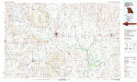 1981 Chillicothe1981 Print · USGSNorth Missouri's Grand River basin comes into focus during the early 1980s, showcasing a network of vital rail lines and river settlements. Genealogists and historians can trace rail-town development from Gallatin to Brookfield and explore extensive conservation lands like Swan Lake National Wildlife Refuge.
 - 1984 Map of Nettleton
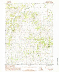 1984 Nettleton1984 Print · USGSDaviess and Caldwell Counties in the mid-1980s are captured here as a landscape of rural townships and winding creek branches. Local researchers can locate the small community of Nettleton or trace the waterways of the Grand River and Marrowbone Creek.
 - 1984 Map of Kidder
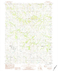 1984 Kidder1984 Print · USGSKidder and Hamilton are captured in the early 1980s as the rail-and-creek geography of the Missouri plains remained largely intact. Researchers can trace the Burlington Northern line or find family names at Wooderson Cem and Wesley Chapel.
 - 1984 Map of Hamilton East, 1985 Print
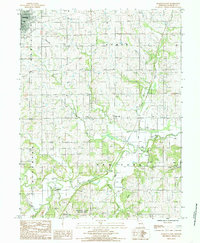 1984 Hamilton East1985 Print · USGSCaldwell County in the mid-1980s shows a landscape of established townships and winding prairie streams. Genealogists and local historians can trace family roots near the settlements of New York and Bonanza or locate rural landmarks like the Landing Strip and Cem sites.
 - 1984 Map of Hamilton West, 1985 Print
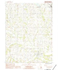 1984 Hamilton West1985 Print · USGSCaldwell County in the early 1980s is captured here, showing the rural landscape between Hamilton and Kingston. Genealogists and historians can trace the locations of several small burial grounds like Morris Cem and Dustin Cem along the banks of Shoal Creek.
 - 1986 Map of Saint Joseph
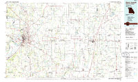 1986 Saint Joseph1986 Print · USGSNorthwest Missouri thrived as a regional transportation and educational hub during the mid-eighties, centered on the historic river city of Saint Joseph. Researchers can locate specific local landmarks like Burlington Cemetery, Pigeon Hill Church, and the winding Pony Express Trail.2 unique versions available
End of results
Showing maps 1-18 of 18
Top cities near Hamilton
- Cameron historical maps
- Gallatin historical maps
- Braymer historical maps
- Polo historical maps
- Breckenridge historical maps
- Mirabile historical maps
See more
Frequently asked questions
- What are the different types of historical maps available for Hamilton?
- What is the oldest map of Hamilton?
- Where can I purchase historical maps of Hamilton for my home or office?
- Where can I download high-res historical maps of Hamilton?
- Are there historical topographic maps available for Hamilton?
- Is there historical aerial imagery available for Hamilton?
- Where are historical maps of Hamilton sourced from?