1970s Maps of Fulton, Missouri
Explore 2 historic maps of Fulton from the 1970s. These maps offer a rare glimpse into what life looked like during the 1970s — showing old roads, neighborhoods, homes, and landmarks that have changed or disappeared over time.
Whether you're researching your family's past, planning a metal detecting trip, or studying how Fulton's landscape evolved across the 1970s, these high-resolution maps are a powerful tool for exploring the history of this region.
- Focus on a specific era: All maps on this page are from the 1970s, giving you a focused view of this time period.
- See what’s changed: Compare century-old streets, trails, and buildings to today's modern landscape using overlays and satellite layers.
- Research with precision: Use these maps for genealogy, historical research, land use analysis, or educational projects.
- View, download, or print: Maps are fully viewable online in high resolution, and can be downloaded or printed for your own records.
Start exploring Fulton's history through authentic maps from the 1970s. This is your window into the past.
Fulton, MO maps
(2)- 1973 Map of Kingdom City, 1975 Print
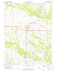 1973 Kingdom City1975 Print · USGSKingdom City and its rural Callaway County surroundings are captured in the early 1970s, showing a landscape defined by creek branches and the Illinois Central Gulf rail line. Genealogists and local historians can locate the Richland Cem, Richland Ch, and landmarks like the Drive-in Theater.2 unique versions available
 - 1975 Map of Fulton, 1977 Print
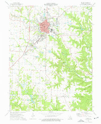 1975 Fulton1977 Print · USGSMid-Missouri's regional center of education and industry is captured in the mid-seventies, showing the growth of its colleges and clay mining operations. Researchers can locate family landmarks like Hillcrest Cem and Muir Cem, or trace the historical campus footprints of Westminster College and the School for the Deaf.2 unique versions available
End of results
Showing maps 1-2 of 2
Top cities near Fulton
- Holts Summit historical maps
- Auxvasse historical maps
- New Bloomfield historical maps
- Chamois historical maps
- Lake Mykee Town historical maps
- Mokane historical maps
See more
Frequently asked questions
- What are the different types of historical maps available for Fulton?
- What is the oldest map of Fulton?
- Where can I purchase historical maps of Fulton for my home or office?
- Where can I download high-res historical maps of Fulton?
- Are there historical topographic maps available for Fulton?
- Is there historical aerial imagery available for Fulton?
- Where are historical maps of Fulton sourced from?