Old Maps of Peculiar, Missouri for Genealogy
Trace your family roots with 35 historic maps of Peculiar. These high-res maps reveal old neighborhoods, homesites, landmarks, and streets — helping you uncover where your ancestors lived and how the area evolved over time.
- Explore historic neighborhoods: Identify where your relatives may have lived in the 1800s or 1900s.
- Compare maps over time: Trace the changes in streets, buildings, and landmarks for multi-generational research.
- Perfect for genealogy & ancestry research: Used by family historians and researchers to map out lineage and migration.
These maps are an incredible resource for exploring your personal connection to Peculiar's past.
Peculiar, MO maps
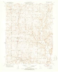
(35)- 1887 Map of Harrisonville
 1887 Harrisonville1887 Print · USGSMissouri's western borderlands are seen here during the rail boom of the late nineteenth century. Genealogists and historians can trace the early development of Harrisonville and Lees Summit, alongside smaller settlements like Lone Jack, Peculiar, and Garden City.
 - 1887 Map of Olathe
 1887 Olathe1887 Print · USGSEastern Kansas and the Missouri borderlands were being transformed by rail during the 1880s. Genealogists and historians can trace early town sites and railroad corridors like the Kansas City Clinton and Springfield Railroad and settlements from Lenexa to Osawatomie.
 - 1892 Map of Harrisonville, 1902 Print
 1892 Harrisonville1902 Print · USGSWestern Missouri comes into focus during the late nineteenth-century rail boom as new townships and post offices began to dot the prairie. Trace the development of early rail hubs like Harrisonville and Pleasant Hill or locate old community centers such as Chapel Hill and Daugherty (Eight Mile P. O.).2 unique versions available
 - 1893 Map of Olathe
 1893 Olathe1893 Print · USGSThe Kansas-Missouri border thrived during the late nineteenth century as a hub for expanding railroads and prairie commerce. Genealogists and historians can trace the early rail networks and locate frontier settlements like New Santa Fe, Olathe, and Paola.6 unique versions available
 - 1894 Map of Harrisonville
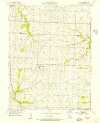
 1894 Harrisonville1894 Print · USGSCass and Jackson counties come to life in the 1890s as a burgeoning rail network links remote prairie outposts. Genealogists can trace early homesteads and mail stops like Daugherty (Eight Mile P. O.), Peculiar, and Lone Jack.
 - 1947 Map of Lawrence, 1954 Print
 1947 Lawrence1954 Print · USGSEastern Kansas and western Missouri thrive in the late 1940s, showing a landscape defined by major river valleys and a dense railway network. Genealogists can trace family settlements from Lawrence to Greenwood and locate landmarks like Olathe Navy and Lake Lotawana.
 - 1950 Map of Lawrence
 1950 Lawrence1950 Print · USGSMid-century Kansas and Missouri come alive in this map of the river-valley corridors just as the interstate era was beginning. Researchers can trace the legacy of major rail lines like the Union Pacific RR and locate ancestral roots in towns from Lawrence to Harrisonville.
 - 1953 Map of Belton, 1954 Print
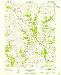
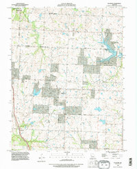
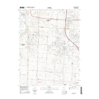
 1953 Belton1954 Print · USGSThe Missouri-Kansas borderlands in the early fifties show a landscape of rural schoolhouses and burgeoning military infrastructure. Trace family roots at Belton Cem or explore the mid-century operations of Knoche Oil Field and Lamar Airport.5 unique versions available
 - 1953 Map of West Line, 1954 Print
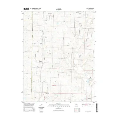
 1953 West Line1954 Print · USGSAlong the Kansas-Missouri border in the early fifties, this area shows a landscape of small rail-side towns and rural school districts. Researchers can find many family landmarks, from Glenwild Cem and Corinth Cem to the tracks of the Kansas City Southern.4 unique versions available
 - 1954 Map of Raymore, 1955 Print
 1954 Raymore1955 Print · USGSMid-century Cass County, Missouri, is revealed here just as the rural agricultural landscape began to meet the expanding influence of the Kansas City region. Genealogists and local historians can trace family locations near Raymore, find the Raymore Cem, or follow the St Louis San Francisco tracks through Harrelson.3 unique versions available
 - 1954 Map of Peculiar, 1955 Print
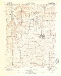
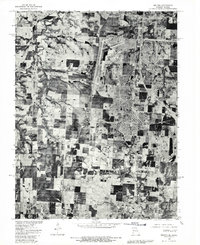
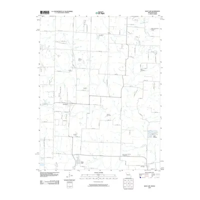
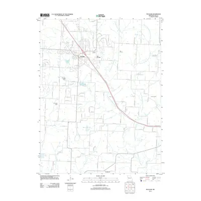
 1954 Peculiar1955 Print · USGSPeculiar and its rural Cass County surroundings are seen here in the mid-fifties, structured by the crossing of major rail lines and local streams. Genealogists can trace family landmarks and school districts like Rockford Sch, Wills Cem, and the village of Prettyman.2 unique versions available
 - 1956 Map of Lawrence, 1967 Print
 1956 Lawrence1967 Print · USGSEastern Kansas and the Missouri border country are captured here during the mid-century transition to the interstate era. Genealogists and local historians can trace family-named terrain like Summers Mound and the footprint of Sunflower Ordnance Works near Baldwin City.4 unique versions available
 - 1961 Map of Lawrence
 1961 Lawrence1961 Print · USGSThe Kansas-Missouri borderland shows its mid-century transition from a rail-dependent agricultural region to a suburbanizing landscape. Genealogists can trace family footprints through numerous Cem sites and distinctive terrain landmarks like Graves Mound and Summers Mound.
 - 1980 Map of Belton, 1981 Print
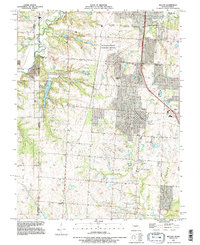
 1980 Belton1981 Print · USGSThe Missouri-Kansas borderlands in the 1980s are captured here during a period of significant military and suburban expansion. Genealogists and historians can trace the development of Belton and Grandview alongside the massive Richards-Gebaur Air Force Base.
 - 1983 Map of Olathe, 1984 Print
 1983 Olathe1984 Print · USGSThe Kansas-Missouri borderlands hum with suburban growth and historic transit routes in the early eighties. Researchers can trace the Santa Fe Trail across a landscape featuring Richards-Gebaur Air Force Base and Hillsdale Lake.
 - 1990 Map of Raymore, 1996 Print
 1990 Raymore1996 Print · USGSThe borderlands of Jackson and Cass Counties are shown in the early nineties as residential growth begins to reshape the landscape. Trace local developments around Lake Winnebago and Raintree Lake, or locate family history sites near Raymore and Harrelson.
 - 1991 Map of Belton, 1996 Print
 1991 Belton1996 Print · USGSThe Missouri-Kansas borderlands south of Kansas City are captured here in the early nineties as residential growth meets long-standing industrial sites. Researchers can trace family history through sites like Woodland Cem and the Richards-Gebaur Memorial Airport.
 - 2009 Map of Belton, 2009 Print
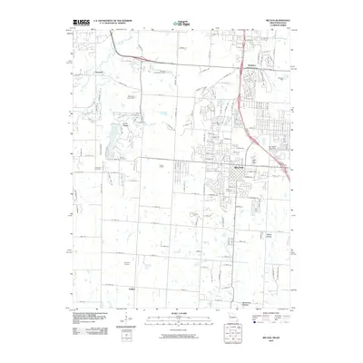 2009 Belton2009 Print · USGSCovers Peculiar, including Kansas City, Overland Park, and other nearby areas
 - 2009 Map of West Line, 2009 Print
 2009 West Line2009 Print · USGSCovers Peculiar, including Cleveland, Freeman, and other nearby areas
 - 2011 Map of Raymore, 2011 Print
 2011 Raymore2011 Print · USGSCovers Peculiar, including Kansas City, Lee's Summit, and other nearby areas
 - 2011 Map of Belton, 2011 Print
 2011 Belton2011 Print · USGSCovers Peculiar, including Kansas City, Overland Park, and other nearby areas
 - 2011 Map of West Line, 2011 Print
 2011 West Line2011 Print · USGSCovers Peculiar, including Cleveland, Freeman, and other nearby areas
 - 2012 Map of Peculiar, 2012 Print
 2012 Peculiar2012 Print · USGSCovers Peculiar, including Raymore, Harrisonville, and other nearby areas
 - 2015 Map of Belton, 2015 Print
 2015 Belton2015 Print · USGSCovers Peculiar, including Kansas City, Overland Park, and other nearby areas
 - 2015 Map of West Line, 2015 Print
 2015 West Line2015 Print · USGSCovers Peculiar, including Cleveland, Freeman, and other nearby areas
Showing maps 1-25 of 35
Top cities near Peculiar
- Kansas City historical maps
- Overland Park historical maps
- Lee's Summit historical maps
- Blue Springs historical maps
- Leawood historical maps
- Grandview historical maps
See more
Frequently asked questions
- What are the different types of historical maps available for Peculiar?
- What is the oldest map of Peculiar?
- Where can I purchase historical maps of Peculiar for my home or office?
- Where can I download high-res historical maps of Peculiar?
- Are there historical topographic maps available for Peculiar?
- Is there historical aerial imagery available for Peculiar?
- Where are historical maps of Peculiar sourced from?