Old Maps of Clay County, Missouri for Metal Detecting
Plan your next treasure hunt with 122 historic maps of Clay County. Find old homesites, ghost towns, trails, and gathering spots that may be lost to time — perfect for identifying promising metal detecting locations.
- Locate forgotten sites: Uncover places like long-lost settlements, abandoned rail lines, or gathering spots.
- Plan better hunts: Use map overlays combined with LiDAR or satellite views to narrow in on historically rich areas.
- Made for detectorists: Thousands of hobbyists use these maps to discover relics, coins, and hidden history.
Use these historic maps to boost your research and find new opportunities beneath the surface of Clay County.
Clay County, MO maps
(122)- 1890 Map of Kansas City
 1890 Kansas City1890 Print · USGSThe Missouri River valley at the turn of the decade shows a booming rail-and-river economy centered on KANSAS CITY. Researchers can trace the early footprints of settlements like White Church, Lansing, and Smithville before modern expansion.2 unique versions available
 - 1894 Map of Kansas City
 1894 Kansas City1894 Print · USGSThe Missouri River valley at the close of the nineteenth century was a bustling intersection of military life and frontier commerce. Genealogists can trace family roots through river towns like Weston and Parkville or locate early railroad hubs at Settles Station and Beverly Junction.14 unique versions available
 - 1894 Map of Independence
 1894 Independence1894 Print · USGSThe river valley and rail corridors of western Missouri are captured in detail during the late nineteenth century. Researchers can trace the early layouts of Liberty and Independence alongside lost river features like Liberty Landing and Cooley Lake.5 unique versions available
 - 1914 Map of Smithville
 1914 Smithville1914 Print · USGSMissouri's northern river valleys are depicted here just before the Great War, showing a landscape of rail-dependent small towns and rural school districts. Genealogists can trace family footprints through numerous community landmarks like Paradise, Hixson Mill, and Mt. Zion School.4 unique versions available
 - 1934 Map of Independence
 1934 Independence1934 Print · USGSIn Jackson County during the mid-1930s, the landscape around Independence shows a bustling network of river commerce and early highways. Researchers can trace the heritage of local institutions like the Jackson County Girls Home and historic sites such as Mt Washington Cem.2 unique versions available
 - 1935 Map of Buckner
 1935 Buckner1935 Print · USGSThe Missouri River bottoms and Fort Osage bluffs are captured here in the mid-1930s during a period of heavy rail and river activity. Genealogists and historians can trace the locations of numerous rural landmarks like Union Ch, Egypt Sch, and the Hossenflow Duck Camp.2 unique versions available
 - 1935 Map of Kansas City
 1935 Kansas City1935 Print · USGSKansas City and its surrounding Missouri and Kansas neighborhoods are captured here during a period of significant civic expansion in the mid-1930s. Researchers can trace the layout of early aviation at the Municipal Landing Field or locate family history through many landmarks like Elmwood Cem and Wyandotte High Sch.2 unique versions available
 - 1935 Map of Missouri City
 1935 Missouri City1935 Print · USGSMissouri River communities in the mid-1930s are captured here during a period of heavy reliance on rail and river geography. Genealogists can trace a network of rural schools like Hunt Sch and Academy Sch or locate the historic McCune Home near the Atchison Topeka and Santa Fe line.
 - 1935 Map of North Kansas City
 1935 North Kansas City1935 Print · USGSNorth Kansas City and the Missouri River bluffs appear here in the mid-1930s as industrial development begins to reshape the river valley. You can trace early aviation sites like Fairfax Landing Field and community anchors like Gashland Sch and Winnwood Lake.
 - 1935 Map of Liberty, 1955 Print
 1935 Liberty1955 Print · USGSThe Missouri River bluffs and river bottoms near Liberty were a hub of rail commerce and education in the mid-thirties. Genealogists and researchers can locate several rural schools and sites like the Odd Fellows Home, Crollie Cem, and Claycomo Mill.2 unique versions available
 - 1936 Map of Kearney
 1936 Kearney1936 Print · USGSClay County at the height of the mid-thirties rural school era reveals a landscape of interconnected family farms and rail-stop towns. Researchers can trace ancestral locations through dozens of named landmarks like Mt Gilead Sch, Watkins Ch, and the original street grid of Kearney.
 - 1940 Map of Kansas City
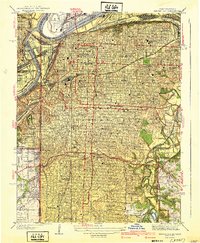 1940 Kansas City1940 Print · USGSKansas City's urban landscape is shown in remarkable detail just before the war, highlighting its massive rail yards and industrial riverfront. Genealogists and historians can trace neighborhood schools like Longfellow Sch, Central High Schools, and the resting places at Calvary Cemetery.3 unique versions available
 - 1940 Map of Liberty
 1940 Liberty1940 Print · USGSClay County at the dawn of the 1940s shows a dense network of river-bottom railroads and hilltop college life. Genealogists can trace family landmarks like Withers Sch, the Odd Fellows Home, and the Depression-era Federal Transient Camp.2 unique versions available
 - 1940 Map of North Kansas City
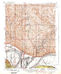 1940 North Kansas City1940 Print · USGSThe industrial riverfront and Clay County uplands are documented here during the mid-1930s as the regional transport network matured. Genealogists and researchers can locate family landmarks like New Stark Cem, Bethel Ch, and the many rural schoolhouses serving Gashland and Barry.2 unique versions available
 - 1940 Map of Independence
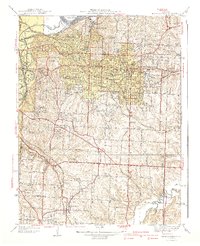 1940 Independence1940 Print · USGSIndependence and its eastern suburbs are shown here in the mid-1930s, caught between the industrial Missouri River bend and the rural ridges of Jackson County. Genealogists can trace family landmarks like Woodlawn Cemetery, the Sanitarium, and rural schools like Whiteoak Sch.2 unique versions available
 - 1942 Map of Kearney, 1965 Print
 1942 Kearney1965 Print · USGSClay County at the onset of the 1940s is a landscape of established rail hubs and rural schoolhouses. Genealogists can trace family roots through dozens of local landmarks like Antioch Cem, Mt Gilead Sch, and the County Home.2 unique versions available
 - 1945 Map of Kearney
 1945 Kearney1945 Print · USGSClay County farming communities thrive in the mid-1940s as rail lines connect rural outposts to the wider region. Genealogists can trace family footprints through dozens of local schools like Bodoc Sch and country churches such as Antioch Ch.2 unique versions available
 - 1945 Map of Missouri City, 1955 Print
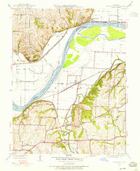 1945 Missouri City1955 Print · USGSMissouri City and the river bottomlands are captured here in the mid-1940s, showing a landscape defined by rail lines and rural school districts. Genealogists can trace family footprints at Blue Mills, New Salem Ch, and numerous country schools like Lynch Sch.
 - 1947 Map of Missouri City
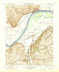 1947 Missouri City1947 Print · USGSThe Missouri River bottoms and surrounding bluffs appear here in the mid-1940s, showing a rural landscape defined by heavy rail and river crossings. Genealogists can locate family-named landmarks and institutions like New Salem Ch, Blue Mills, and the McCune Home.2 unique versions available
 - 1948 Map of Nashua, 1956 Print
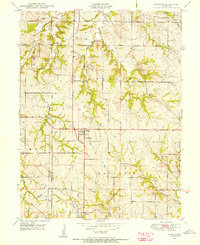 1948 Nashua1956 Print · USGSThe rural uplands of Clay and Platte counties are captured here shortly after the Second World War. Genealogists can trace family farmsteads and find local landmarks like Lone Star School, Mt Olivet Church, and the settlement at Gashland.
 - 1948 Map of North Kansas City, 1958 Print
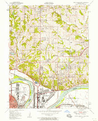 1948 North Kansas City1958 Print · USGSNorth Kansas City and the Missouri River corridor show a bustling mid-century mix of aviation, industry, and early suburban growth. Trace the development of Quindaro, the operations at Fairfax Airport, and local roots at Faubion Cemetery.
 - 1950 Map of Kansas City
 1950 Kansas City1950 Print · USGSMid-century Kansas and Missouri are captured here during a period of industrial growth and shifting transportation. Genealogists and historians can trace rail lines like the Wabash RR or locate ancestral homes near the Potawatomi Indian Reservation and Horton.
 - 1950 Map of Nashua
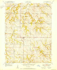 1950 Nashua1950 Print · USGSClay and Platte Counties are captured here in the late 1940s, showing a landscape of rural school districts and small crossroads towns. Researchers can trace family ties through community hubs like Nashua, Mt Olivet Church, and the Lone Star School.
 - 1950 Map of Smithville
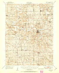 1950 Smithville1950 Print · USGSThe rural borderlands of Platte, Clay, and Clinton counties are shown here just after the war, defined by the winding Platte River and a network of small farm towns. Researchers can trace the locations of dozens of vanished schools and cemeteries, from the Masonic Cemetery to the South Gale School and the historic Covered Bridge.2 unique versions available
 - 1951 Map of Smithville
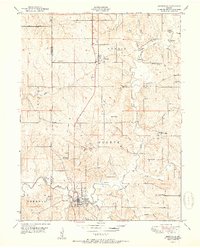 1951 Smithville1951 Print · USGSNorth of Kansas City in the early 1950s, this area shows a landscape of river-valley farms and small rural settlements. Researchers can locate numerous one-room schoolhouses like Rocky Point School and trace family-named landmarks such as Reed Cemetery and Rice Bridge.2 unique versions available
Showing maps 1-25 of 122
Top cities of Clay County
- Liberty historical maps
- Gladstone historical maps
- Excelsior Springs historical maps
- Kearney historical maps
- Smithville historical maps
- North Kansas City historical maps
See more
Frequently asked questions
- What are the different types of historical maps available for Clay County?
- What is the oldest map of Clay County?
- Where can I purchase historical maps of Clay County for my home or office?
- Where can I download high-res historical maps of Clay County?
- Are there historical topographic maps available for Clay County?
- Is there historical aerial imagery available for Clay County?
- Where are historical maps of Clay County sourced from?