Old Maps of Boonville, Missouri for Metal Detecting
Plan your next treasure hunt with 17 historic maps of Boonville. Find old homesites, ghost towns, trails, and gathering spots that may be lost to time — perfect for identifying promising metal detecting locations.
- Locate forgotten sites: Uncover places like long-lost settlements, abandoned rail lines, or gathering spots.
- Plan better hunts: Use map overlays combined with LiDAR or satellite views to narrow in on historically rich areas.
- Made for detectorists: Thousands of hobbyists use these maps to discover relics, coins, and hidden history.
Use these historic maps to boost your research and find new opportunities beneath the surface of Boonville.
Boonville, MO maps
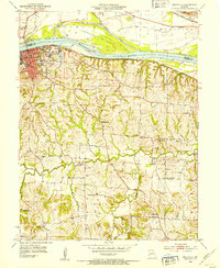
(17)- 1888 Map of Boonville
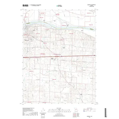
 1888 Boonville1888 Print · USGSCentral Missouri comes to life in the late nineteenth century as the river economy of Boonville meets the iron rails of the Missouri Pacific Railroad. Genealogists and historians can trace old community centers like Latham Store, Chouteau Springs, and the townships of Richland and Saline.5 unique versions available
 - 1947 Map of Jefferson City, 1949 Print
 1947 Jefferson City1949 Print · USGSCentral Missouri and the northern Ozarks come into focus in this late 1940s survey of the river-and-rail landscape. Genealogists and historians can trace the growth of Jefferson City and Sedalia or locate family roots near Bagnell Dam and the Lake of the Ozarks.
 - 1952 Map of Boonville, 1953 Print
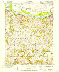
 1952 Boonville1953 Print · USGSBoonville and the Missouri River valley are captured here in the early fifties during a period of shifting rural school populations. Researchers can trace institutional footprints like the Kemper Military Sch or find family history at Walnut Grove Cem and Clarks Fork.3 unique versions available
 - 1953 Map of Billingsville, 1954 Print
 1953 Billingsville1954 Print · USGSMid-century Cooper County revolves around the convergence of the Missouri and Lamine rivers and a busy rail network. Genealogists can trace family footprints at Pheasant Hill Cem or locate rural landmarks like Billingsville Sch and Lamine.3 unique versions available
 - 1954 Map of Jefferson City
 1954 Jefferson City1954 Print · USGSCentral Missouri in the early postwar years showcases a landscape defined by the winding Lake of the Ozarks and the state capital at Jefferson City. Researchers can trace the mid-century rail networks of the Missouri Pacific RR and locate rural communities like Tuscumbia, St Elizabeth, and St Anthony.2 unique versions available
 - 1955 Map of Jefferson City, 1967 Print
 1955 Jefferson City1967 Print · USGSCentral Missouri in the mid-fifties is defined by the winding Missouri River and the expanding reach of Lake of the Ozarks. Researchers can trace the rail corridors of the Missouri Pacific or locate the early footprint of Whiteman AFB and Jefferson City.4 unique versions available
 - 1958 Map of Jefferson City
 1958 Jefferson City1958 Print · USGSCentral Missouri in the late fifties shows a region transforming through the growth of Whiteman Air Force Base and the Lake of the Ozarks. Researchers can trace rail lines like the Missouri Pacific or find family roots at Enloe Cemetery and Mount Pleasant Cem.
 - 1959 Map of Jefferson City
 1959 Jefferson City1959 Print · USGSCentral Missouri is captured during the mid-fifties as the river economy and rail networks like the Missouri Pacific met the rise of the automobile. Local researchers can trace family landmarks and rural infrastructure from the Lake of the Ozarks up to Providence Cemetery and Knob Noster State Park.
 - 1982 Map of Jefferson City, 1983 Print
 1982 Jefferson City1983 Print · USGSMid-Missouri in the early eighties shows the corridor between Columbia and Jefferson City during a period of modern growth. Genealogists and historians can trace the Missouri Pacific Railroad route, family plots at Memorial Park Cem, and landmarks like Osage City and Lupus.
 - 2011 Map of Boonville, 2011 Print
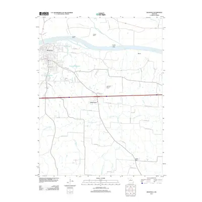 2011 Boonville2011 Print · USGSCovers Boonville, including Windsor Place, Clarks Fork, and other nearby areas
 - 2011 Map of Billingsville, 2011 Print
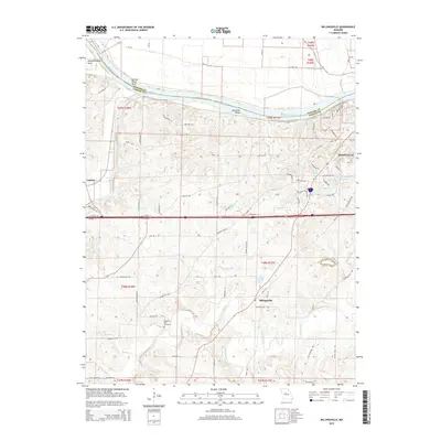
 2011 Billingsville2011 Print · USGSCovers Boonville, including Lamine, Billingsville, and other nearby areas
 - 2015 Map of Boonville, 2015 Print
 2015 Boonville2015 Print · USGSCovers Boonville, including Windsor Place, Clarks Fork, and other nearby areas
 - 2015 Map of Billingsville, 2015 Print
 2015 Billingsville2015 Print · USGSCovers Boonville, including Lamine, Billingsville, and other nearby areas
 - 2017 Map of Boonville, 2017 Print
 2017 Boonville2017 Print · USGSCovers Boonville, including Windsor Place, Clarks Fork, and other nearby areas
 - 2017 Map of Billingsville, 2017 Print
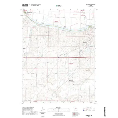 2017 Billingsville2017 Print · USGSCovers Boonville, including Lamine, Billingsville, and other nearby areas
 - 2021 Map of Billingsville, 2021 Print
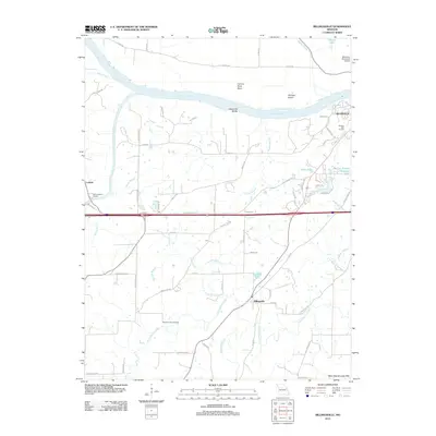
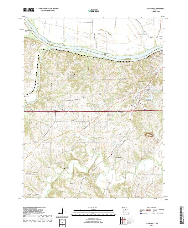 2021 Billingsville2021 Print · USGSThe Missouri River floodplain and the rolling hills of Cooper County are captured here in the early twenty-first century. Genealogists and local historians can locate the West Boonville Evangelical Church Cem, trace the Katy Trl, and explore the river bends near Boonville.
 - 2021 Map of Boonville, 2021 Print
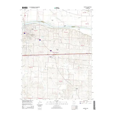
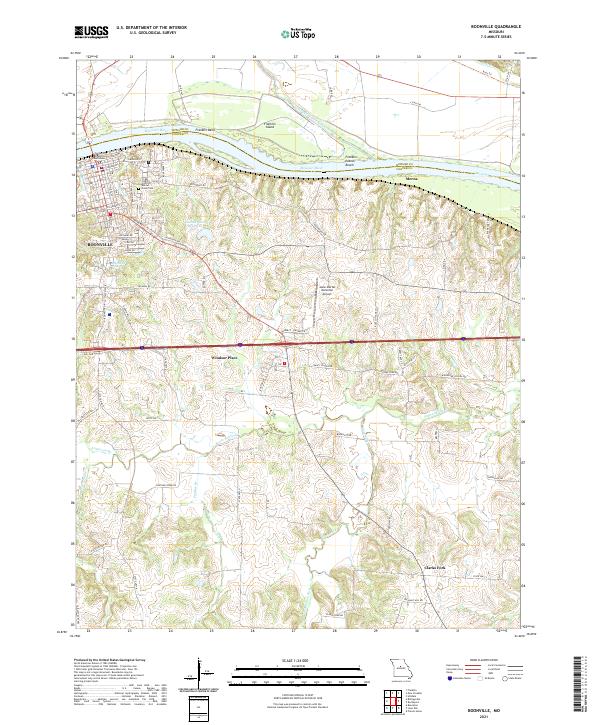 2021 Boonville2021 Print · USGSBoonville and the Missouri River bluffs appear here in the early twenty-first century, showing the intersection of riverfront history and modern transport. Genealogists and local historians can trace the Cooper County Courthouse, Walnut Grove Cem, and small outlying locales like Clarks Fork.
End of results
Showing maps 1-17 of 17
Top cities near Boonville
- Fayette historical maps
- New Franklin historical maps
- Pilot Grove historical maps
- Bunceton historical maps
- Windsor Place historical maps
- Prairie Home historical maps
See more
Frequently asked questions
- What are the different types of historical maps available for Boonville?
- What is the oldest map of Boonville?
- Where can I purchase historical maps of Boonville for my home or office?
- Where can I download high-res historical maps of Boonville?
- Are there historical topographic maps available for Boonville?
- Is there historical aerial imagery available for Boonville?
- Where are historical maps of Boonville sourced from?