Old Maps of Pilot Grove, Missouri for Genealogy
Trace your family roots with 17 historic maps of Pilot Grove. These high-res maps reveal old neighborhoods, homesites, landmarks, and streets — helping you uncover where your ancestors lived and how the area evolved over time.
- Explore historic neighborhoods: Identify where your relatives may have lived in the 1800s or 1900s.
- Compare maps over time: Trace the changes in streets, buildings, and landmarks for multi-generational research.
- Perfect for genealogy & ancestry research: Used by family historians and researchers to map out lineage and migration.
These maps are an incredible resource for exploring your personal connection to Pilot Grove's past.
Pilot Grove, MO maps
(17)- 1888 Map of Boonville
 1888 Boonville1888 Print · USGSCentral Missouri comes to life in the late nineteenth century as the river economy of Boonville meets the iron rails of the Missouri Pacific Railroad. Genealogists and historians can trace old community centers like Latham Store, Chouteau Springs, and the townships of Richland and Saline.5 unique versions available
 - 1947 Map of Jefferson City, 1949 Print
 1947 Jefferson City1949 Print · USGSCentral Missouri and the northern Ozarks come into focus in this late 1940s survey of the river-and-rail landscape. Genealogists and historians can trace the growth of Jefferson City and Sedalia or locate family roots near Bagnell Dam and the Lake of the Ozarks.
 - 1953 Map of Pilot Grove North, 1954 Print
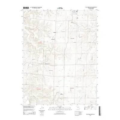
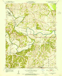 1953 Pilot Grove North1954 Print · USGSMid-century Cooper County centers on the convergence of the Lamine and Blackwater rivers during a time of rural transition. Genealogists can trace family sites like the Herndon Cem, St Martin Cem, and the now-abandoned Chouteau Sch (Abandoned).2 unique versions available
 - 1953 Map of Pilot Grove South, 1954 Print
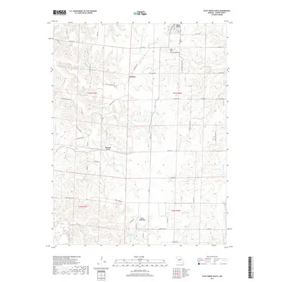
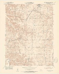 1953 Pilot Grove South1954 Print · USGSCooper County agriculture and rail life are captured here in the early fifties, centered on the KANSAS MISSOURI TEXAS line. Genealogists can locate family landmarks like St Pauls Ch, Pleasant Green, and the rural New Lebanon settlement.3 unique versions available
 - 1954 Map of Jefferson City
 1954 Jefferson City1954 Print · USGSCentral Missouri in the early postwar years showcases a landscape defined by the winding Lake of the Ozarks and the state capital at Jefferson City. Researchers can trace the mid-century rail networks of the Missouri Pacific RR and locate rural communities like Tuscumbia, St Elizabeth, and St Anthony.2 unique versions available
 - 1955 Map of Jefferson City, 1967 Print
 1955 Jefferson City1967 Print · USGSCentral Missouri in the mid-fifties is defined by the winding Missouri River and the expanding reach of Lake of the Ozarks. Researchers can trace the rail corridors of the Missouri Pacific or locate the early footprint of Whiteman AFB and Jefferson City.4 unique versions available
 - 1958 Map of Jefferson City
 1958 Jefferson City1958 Print · USGSCentral Missouri in the late fifties shows a region transforming through the growth of Whiteman Air Force Base and the Lake of the Ozarks. Researchers can trace rail lines like the Missouri Pacific or find family roots at Enloe Cemetery and Mount Pleasant Cem.
 - 1959 Map of Jefferson City
 1959 Jefferson City1959 Print · USGSCentral Missouri is captured during the mid-fifties as the river economy and rail networks like the Missouri Pacific met the rise of the automobile. Local researchers can trace family landmarks and rural infrastructure from the Lake of the Ozarks up to Providence Cemetery and Knob Noster State Park.
 - 1982 Map of Jefferson City, 1983 Print
 1982 Jefferson City1983 Print · USGSMid-Missouri in the early eighties shows the corridor between Columbia and Jefferson City during a period of modern growth. Genealogists and historians can trace the Missouri Pacific Railroad route, family plots at Memorial Park Cem, and landmarks like Osage City and Lupus.
 - 2011 Map of Pilot Grove South, 2011 Print
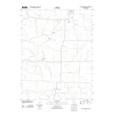 2011 Pilot Grove South2011 Print · USGSCovers Pilot Grove, including Pleasant Green, New Lebanon, and other nearby areas
 - 2011 Map of Pilot Grove North, 2011 Print
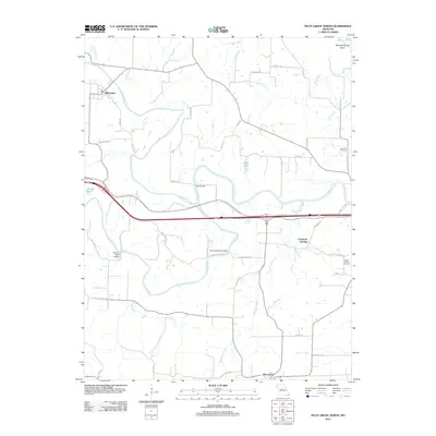 2011 Pilot Grove North2011 Print · USGSCovers Pilot Grove, including Blackwater, Chouteau Springs, and other nearby areas
 - 2015 Map of Pilot Grove South, 2015 Print
 2015 Pilot Grove South2015 Print · USGSCovers Pilot Grove, including Pleasant Green, New Lebanon, and other nearby areas
 - 2015 Map of Pilot Grove North, 2015 Print
 2015 Pilot Grove North2015 Print · USGSCovers Pilot Grove, including Blackwater, Chouteau Springs, and other nearby areas
 - 2017 Map of Pilot Grove South, 2017 Print
 2017 Pilot Grove South2017 Print · USGSCovers Pilot Grove, including Pleasant Green, New Lebanon, and other nearby areas
 - 2017 Map of Pilot Grove North, 2017 Print
 2017 Pilot Grove North2017 Print · USGSCovers Pilot Grove, including Blackwater, Chouteau Springs, and other nearby areas
 - 2021 Map of Pilot Grove North, 2021 Print
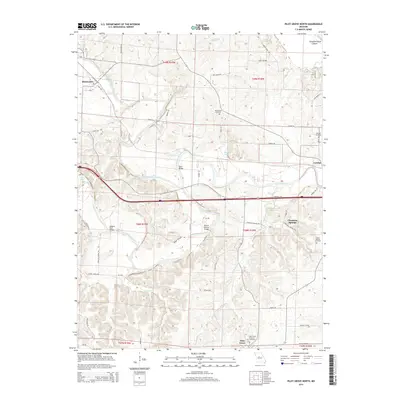
 2021 Pilot Grove North2021 Print · USGSCooper County's river valleys and rural settlements are preserved here in the early twenty-first century. Genealogists and local historians can trace the locations of Old Lamine Cem and Saint Martins Cem, or explore the area around Chouteau Springs and Dicks Bridge.
 - 2021 Map of Pilot Grove South, 2021 Print
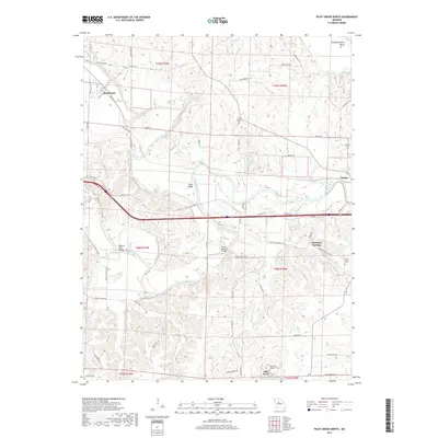
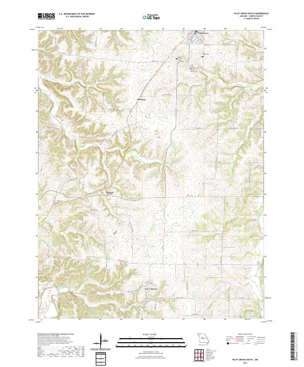 2021 Pilot Grove South2021 Print · USGSCooper County’s agricultural heartland is documented here in the early twenty-first century, showing the rural networks connecting Pilot Grove and Pleasant Green. Genealogists and historians can locate legacy sites like Saint Joseph Cem or trace the path of the Katy Trl.
End of results
Showing maps 1-17 of 17
Top cities near Pilot Grove
- Boonville historical maps
- Tipton historical maps
- New Franklin historical maps
- Smithton historical maps
- Otterville historical maps
- Bunceton historical maps
See more
Frequently asked questions
- What are the different types of historical maps available for Pilot Grove?
- What is the oldest map of Pilot Grove?
- Where can I purchase historical maps of Pilot Grove for my home or office?
- Where can I download high-res historical maps of Pilot Grove?
- Are there historical topographic maps available for Pilot Grove?
- Is there historical aerial imagery available for Pilot Grove?
- Where are historical maps of Pilot Grove sourced from?