2020s Maps of Daviess County, Missouri
Explore 16 historic maps of Daviess County from the 2020s. These maps offer a rare glimpse into what life looked like during the 2020s — showing old roads, neighborhoods, homes, and landmarks that have changed or disappeared over time.
Whether you're researching your family's past, planning a metal detecting trip, or studying how Daviess County's landscape evolved across the 2020s, these high-resolution maps are a powerful tool for exploring the history of this region.
- Focus on a specific era: All maps on this page are from the 2020s, giving you a focused view of this time period.
- See what’s changed: Compare century-old streets, trails, and buildings to today's modern landscape using overlays and satellite layers.
- Research with precision: Use these maps for genealogy, historical research, land use analysis, or educational projects.
- View, download, or print: Maps are fully viewable online in high resolution, and can be downloaded or printed for your own records.
Start exploring Daviess County's history through authentic maps from the 2020s. This is your window into the past.
Daviess County, MO maps
(16)- 2021 Map of Gilman City West, 2021 Print
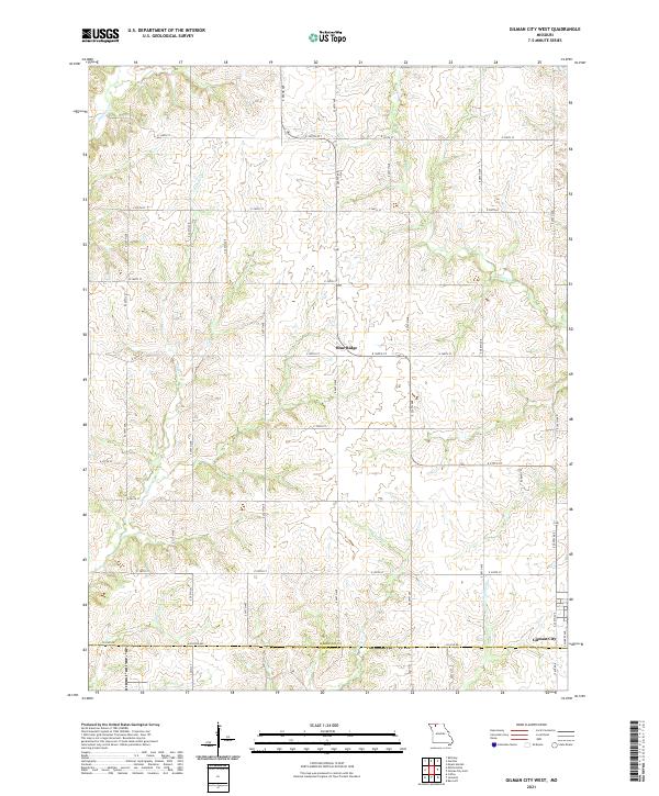 2021 Gilman City West2021 Print · USGSNorthwest Missouri farmland on the Harrison and Daviess County line remains defined by its namesake creeks and rural crossroads. Genealogists and local researchers can trace the landscape around Gilman City and Blue Ridge or follow the paths of Cypress Cr and Sugar Cr.
 - 2021 Map of Jameson, 2021 Print
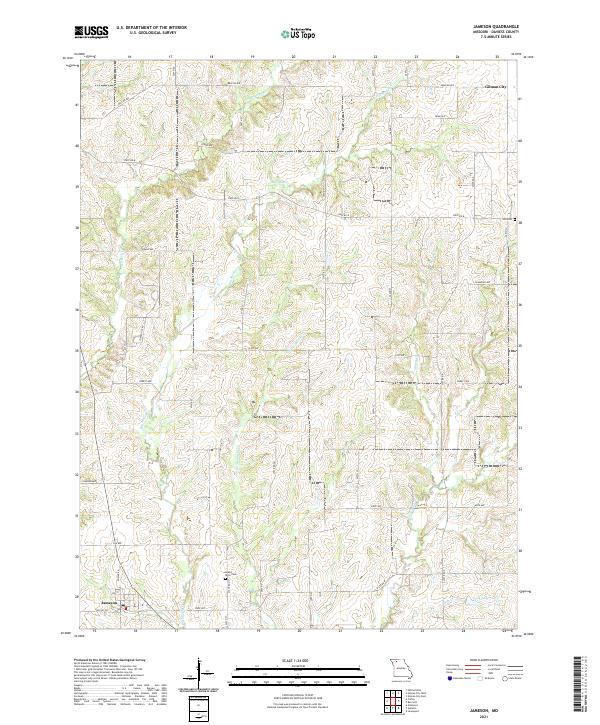 2021 Jameson2021 Print · USGSDaviess County farmland and small-town Missouri life are documented here as they appeared in the early 2020s. Genealogists can locate family landmarks like Grand River Cem and Hill Cem, or trace the winding waters of Big Muddy Cr near the village of Jameson.
 - 2021 Map of McFall, 2021 Print
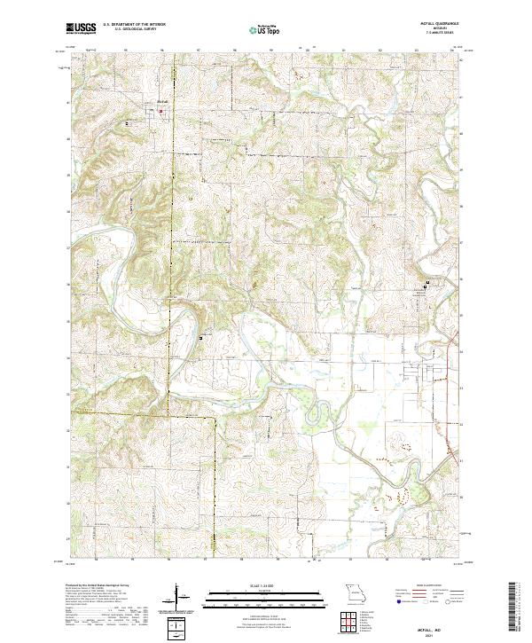 2021 McFall2021 Print · USGSMcFall and the surrounding tri-county rural lands are shown in this contemporary study of Gentry, Daviess, and DeKalb counties. Genealogists can locate family burial sites at McFall Cem, Savage Cem, and Old Town Cem near the banks of the Grand River.
 - 2021 Map of Bancroft, 2021 Print
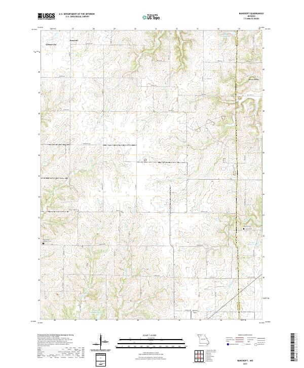 2021 Bancroft2021 Print · USGSThe rural landscapes of Daviess and Grundy counties are captured here in the early twenty-first century, showing a region defined by its water and small settlements. Trace local history at Antioch Cem, Bancroft, and the waters of Jamesport Community Lake and Billy Herrin Lake.
 - 2021 Map of Matkins, 2021 Print
 2021 Matkins2021 Print · USGSHarrison and Gentry Counties at the start of the 2020s remain a landscape of quiet prairie streams and historic family burial sites. Genealogists and local historians can trace the drainages of Sampson Cr and White Oak Cr alongside local landmarks like White Oak Cem and Lovers Ln.
 - 2021 Map of Mitchellville, 2021 Print
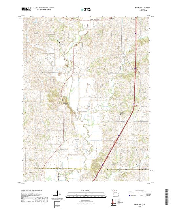 2021 Mitchellville2021 Print · USGSHarrison County farmland in the early 2020s shows a landscape still defined by its many winding creeks and rural road networks. Genealogists and local historians can trace family locations near Mount Olivet Cem, Wildwood, and the banks of Polecat Cr.
 - 2021 Map of Gilman City East, 2021 Print
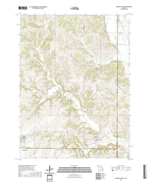 2021 Gilman City East2021 Print · USGSNorthward from the Daviess County line in the 2020s, this area maintains its traditional rural character shaped by the Thompson River. Researchers can locate several burial sites like Springer Chapel Cem and Mitchell Cem or trace the early settlement at Melbourne.
 - 2021 Map of Coffey, 2021 Print
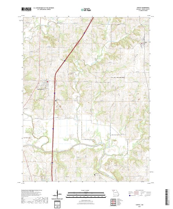 2021 Coffey2021 Print · USGSThe rural landscape of Daviess County in the early twenty-first century is defined by its small towns and intricate river valleys. Researchers can trace the local geography around Pattonsburg and Coffey, or locate family sites near Bethel Cem and Waters Cem.
 - 2021 Map of Kidder, 2021 Print
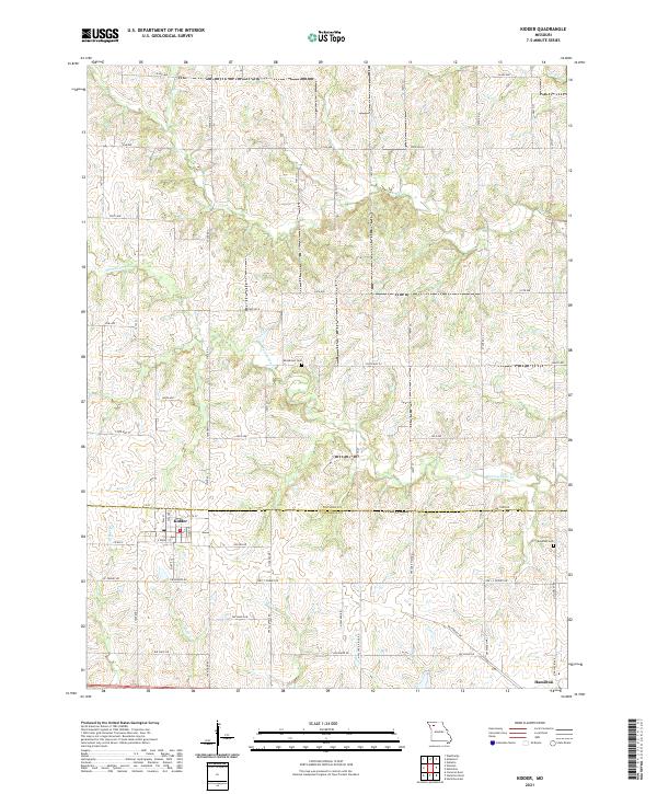 2021 Kidder2021 Print · USGSKidder and Hamilton sit at the meeting point of Daviess and Caldwell Counties in the early twenty-first century. Genealogists can locate family landmarks such as Wooderson Cemetery and Bowman Cemetery or trace the winding course of Marrowbone Creek.
 - 2021 Map of Altamont, 2021 Print
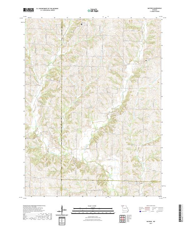
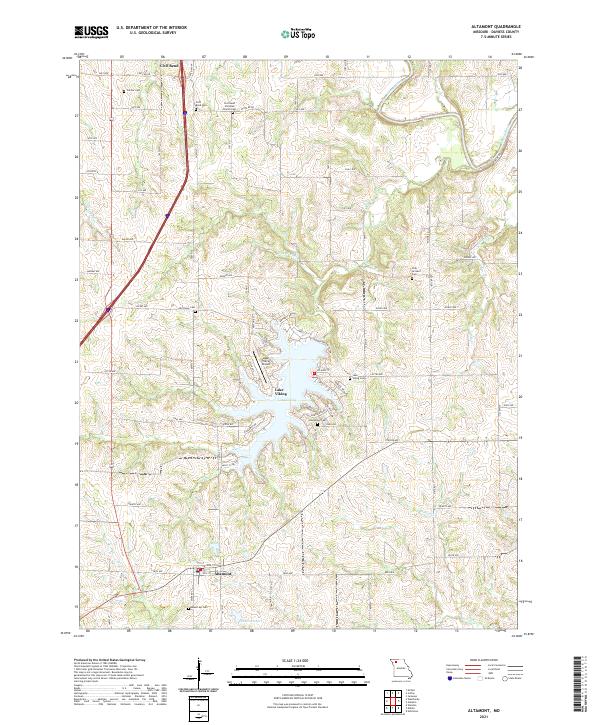 2021 Altamont2021 Print · USGSDaviess County showcases a mix of traditional townships and modern waterfront living in the early twenty-first century. Researchers can locate several historic burial sites like Frazier Cem and Old Union Cem while tracing the growth of Lake Viking and the village of Altamont.
 - 2021 Map of Nettleton, 2021 Print
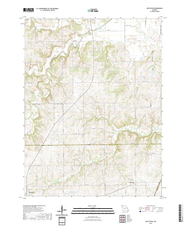 2021 Nettleton2021 Print · USGSDaviess and Caldwell counties are captured here in the early twenty-first century, showing a landscape of structured farm grids and winding waterways. Genealogists can trace family land via Nettleton and Hamilton or locate water features like Johnson Lake and Penny Lake.
 - 2021 Map of Winston, 2021 Print
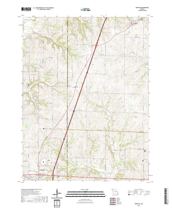 2021 Winston2021 Print · USGSThe tri-county border area of Daviess, DeKalb, and Caldwell counties comes into focus in this recent survey. Local researchers can trace family landmarks at Winston Cem and Kidder Cem or locate the rural crossroads of Mabel.
 - 2021 Map of Breckenridge, 2021 Print
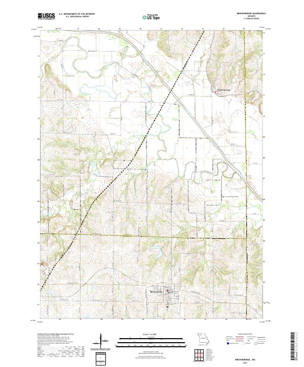 2021 Breckenridge2021 Print · USGSBreckenridge and the surrounding tri-county borderlands are documented here in the early twenty-first century as they maintain their rural character. Genealogists can locate Rose Hill Cem and trace family-named landmarks near Lock Springs or along the banks of the Grand River.
 - 2021 Map of Gallatin, 2021 Print
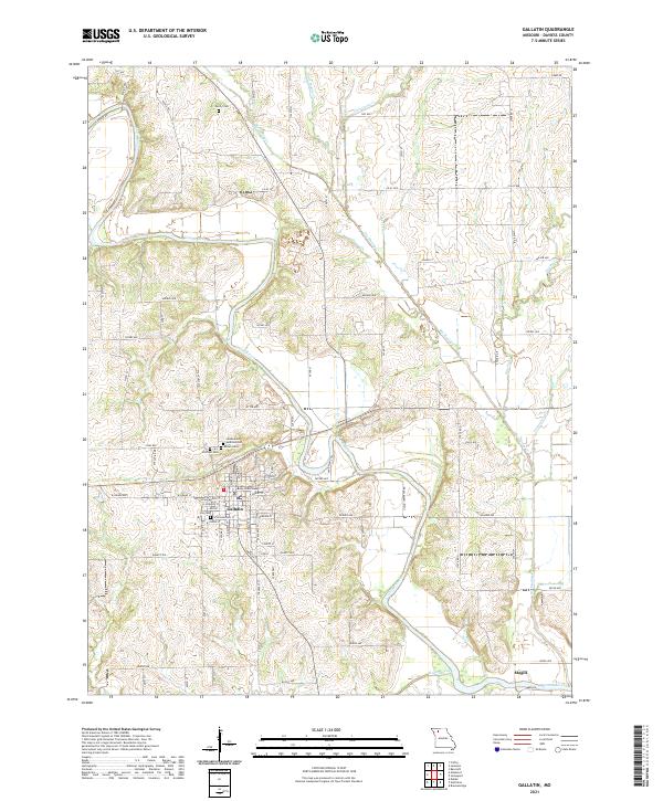 2021 Gallatin2021 Print · USGSGallatin and the surrounding Missouri river valleys are documented here at the start of the 2020s. Genealogists and local historians can trace the town's layout around the Daviess County Courthouse and locate several burial grounds including Greenwood Addition Cem and Everly Cem.
 - 2021 Map of Weatherby, 2021 Print
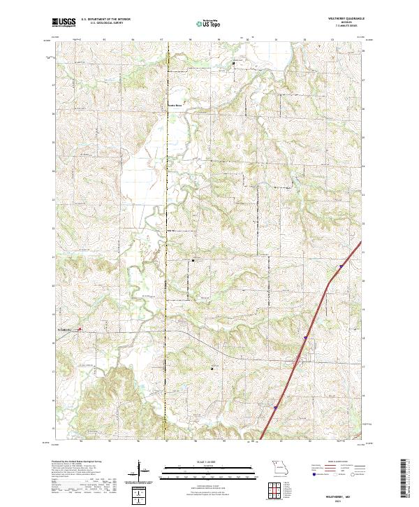 2021 Weatherby2021 Print · USGSDeKalb County and the Daviess County line appear in the modern era, showing a landscape defined by farm roads and winding creek beds. Researchers can locate family burial sites at Muddy Cem and Reid Cem or trace the flows of Grindstone Creek and Owl Cr.
 - 2021 Map of Jamesport, 2021 Print
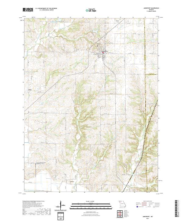 2021 Jamesport2021 Print · USGSThe rural agricultural landscapes of Daviess and Grundy counties come into focus in this contemporary survey of northwest Missouri. Researchers can trace family sites near the Jamesport Memorial Cem or follow the water courses of Hurricane Br and the Grand River near the settlement of Carlow.
End of results
Showing maps 1-16 of 16
Top cities of Daviess County
- Gallatin historical maps
- Jamesport historical maps
- Pattonsburg historical maps
- Winston historical maps
- Altamont historical maps
- Coffey historical maps
See more
Frequently asked questions
- What are the different types of historical maps available for Daviess County?
- What is the oldest map of Daviess County?
- Where can I purchase historical maps of Daviess County for my home or office?
- Where can I download high-res historical maps of Daviess County?
- Are there historical topographic maps available for Daviess County?
- Is there historical aerial imagery available for Daviess County?
- Where are historical maps of Daviess County sourced from?