1980s Maps of Daviess County, Missouri
Explore 20 historic maps of Daviess County from the 1980s. These maps offer a rare glimpse into what life looked like during the 1980s — showing old roads, neighborhoods, homes, and landmarks that have changed or disappeared over time.
Whether you're researching your family's past, planning a metal detecting trip, or studying how Daviess County's landscape evolved across the 1980s, these high-resolution maps are a powerful tool for exploring the history of this region.
- Focus on a specific era: All maps on this page are from the 1980s, giving you a focused view of this time period.
- See what’s changed: Compare century-old streets, trails, and buildings to today's modern landscape using overlays and satellite layers.
- Research with precision: Use these maps for genealogy, historical research, land use analysis, or educational projects.
- View, download, or print: Maps are fully viewable online in high resolution, and can be downloaded or printed for your own records.
Start exploring Daviess County's history through authentic maps from the 1980s. This is your window into the past.
Daviess County, MO maps
(20)- 1981 Map of Chillicothe
 1981 Chillicothe1981 Print · USGSNorth Missouri's Grand River basin comes into focus during the early 1980s, showcasing a network of vital rail lines and river settlements. Genealogists and historians can trace rail-town development from Gallatin to Brookfield and explore extensive conservation lands like Swan Lake National Wildlife Refuge.
 - 1981 Map of Trenton
 1981 Trenton1981 Print · USGSNorthern Missouri in the early eighties remains a landscape defined by its river valleys and intersecting rail lines. Genealogists and local historians can trace the development of riverside towns like Trenton and Princeton or locate smaller rural junctions such as Humphreys and Brimson.
 - 1983 Map of Weatherby, 1984 Print
 1983 Weatherby1984 Print · USGSNorthwestern Missouri's rolling farm country comes to life in the 1980s, centering on the rural community of Weatherby and the DeKalb and Daviess county line. Researchers can trace family sites like Muddy Cemetery and the Old Railroad Grade winding through the hills.
 - 1984 Map of Nettleton
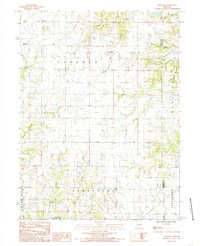
 1984 Nettleton1984 Print · USGSDaviess and Caldwell Counties in the mid-1980s are captured here as a landscape of rural townships and winding creek branches. Local researchers can locate the small community of Nettleton or trace the waterways of the Grand River and Marrowbone Creek.
 - 1984 Map of Kidder
 1984 Kidder1984 Print · USGSKidder and Hamilton are captured in the early 1980s as the rail-and-creek geography of the Missouri plains remained largely intact. Researchers can trace the Burlington Northern line or find family names at Wooderson Cem and Wesley Chapel.
 - 1984 Map of Altamont
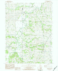
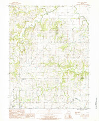
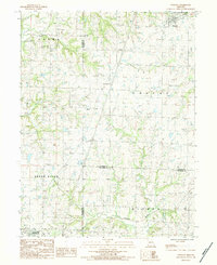
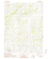
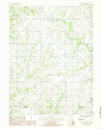
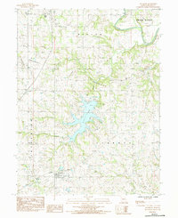 1984 Altamont1984 Print · USGSDaviess County in the mid-eighties shows a landscape of established rural settlements and the modern development around Lake Viking. Researchers can trace local lineage across numerous burial grounds like Civil Bend Christian Cem and the Old Union Cem.
 - 1984 Map of Winston
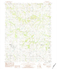
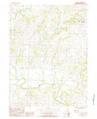
 1984 Winston1984 Print · USGSDaviess and Caldwell counties are captured in the early 1980s as the regional landscape transitions between the Grand River and northern prairie. Trace family history through numerous rural burial sites like Christian Chapel Cem, Delano Cem, and Jones Cem.
 - 1984 Map of Breckenridge, 1985 Print
 1984 Breckenridge1985 Print · USGSThe Caldwell County landscape in the 1980s is defined by the meandering waters and engineered levees of the Grand River. Researchers can trace the grid of Breckenridge, locate local Cem sites, and explore water bodies like Packwood Lake and S Lake.
 - 1984 Map of Matkins, 1985 Print
 1984 Matkins1985 Print · USGSHarrison County in the early eighties is captured here in a time of established rural life and family farming. Genealogists can trace property locations near Matkins or follow family landmarks along Sampson Creek, Goose Creek, and White Oak Creek.
 - 1984 Map of Gilman City East, 1985 Print
 1984 Gilman City East1985 Print · USGSNorthwest Missouri in the early 1980s reveals a rural landscape defined by the branching tributaries of Sugar Creek and the Thompson River. Researchers can trace the borders of Gilman City and Melbourne or explore the Wayne Helton Memorial State Wildlife Area.
 - 1984 Map of Jameson, 1985 Print
 1984 Jameson1985 Print · USGSNorthwestern Missouri in the early 1980s reveals a landscape of dispersed farms and winding waterways. Researchers can locate family homesteads near Jameson or trace the rural drainage of the Grand River, Big Muddy Creek, and Hickory Creek.
 - 1984 Map of Coffey, 1985 Print
 1984 Coffey1985 Print · USGSDaviess County in the early eighties centers on the river bends and creek confluences near the village of Coffey. Researchers can trace the winding course of the Grand River or locate local landmarks like the Sewage Lagoons and Hickory Creek.
 - 1984 Map of Bancroft, 1985 Print
 1984 Bancroft1985 Print · USGSDaviess and Grundy counties appear in the mid-1980s as a landscape of rural townships and winding creek valleys. Researchers can trace family history through several Cem locations and small settlements like Bancroft and Jamesport Community Lake.
 - 1984 Map of Pattonsburg, 1985 Print
 1984 Pattonsburg1985 Print · USGSNorthwest Missouri's river-bottom landscapes and rural rail history come alive in this mid-eighties survey of the Daviess County region. Researchers can trace the path of the Old Railroad Grade and explore the winding banks of the Grand River near Pattonsburg.
 - 1984 Map of Mitchellville, 1985 Print
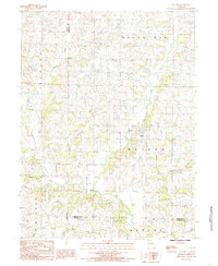
 1984 Mitchellville1985 Print · USGSHarrison and Daviess Counties appear in the early eighties as a network of small settlements and winding creek branches. Researchers can trace the rural landscape around Mitchellville and Bridgeport, locating sites like the local Cemetery and Wildwood.
 - 1984 Map of Jamesport, 1985 Print
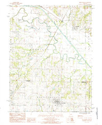
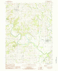
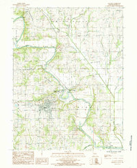
 1984 Jamesport1985 Print · USGSDaviess County farmland in the early 1980s centers on the town of Jamesport and its surrounding rural townships. Genealogists and local historians can trace the Old Railroad Grade and find family-named landmarks like Gees Creek or the small settlement of Blake.
 - 1984 Map of Gallatin, 1985 Print
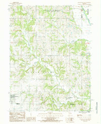
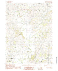
 1984 Gallatin1985 Print · USGSGallatin and the river loops of Daviess County are captured here in the mid-1980s as the regional landscape balanced historic rail routes with modern utility. Researchers can trace the Old Railroad Grade and locate old family burial sites at various Cem locations near Wabash Crossing.
 - 1984 Map of Gilman City West, 1985 Print
 1984 Gilman City West1985 Print · USGSHarrison County farmland in the early 1980s is defined by its winding creek valleys and quiet rural crossroads. Genealogists and researchers can trace the landscape between Blue Ridge and Gilman City, crossing through Sherman and Adams townships.
 - 1986 Map of Maryville
 1986 Maryville1986 Print · USGSNorthwest Missouri's agricultural heartland is documented here in the mid-1980s, from the campus at Northwest Missouri State University to the Grand River valley. Genealogists can trace family footprints across dozens of local burial grounds like Alanthus Grove Cem and Brooklyn Cem.2 unique versions available
 - 1986 Map of Saint Joseph
 1986 Saint Joseph1986 Print · USGSNorthwest Missouri thrived as a regional transportation and educational hub during the mid-eighties, centered on the historic river city of Saint Joseph. Researchers can locate specific local landmarks like Burlington Cemetery, Pigeon Hill Church, and the winding Pony Express Trail.2 unique versions available
End of results
Showing maps 1-20 of 20
Top cities of Daviess County
- Gallatin historical maps
- Jamesport historical maps
- Pattonsburg historical maps
- Winston historical maps
- Altamont historical maps
- Coffey historical maps
See more
Frequently asked questions
- What are the different types of historical maps available for Daviess County?
- What is the oldest map of Daviess County?
- Where can I purchase historical maps of Daviess County for my home or office?
- Where can I download high-res historical maps of Daviess County?
- Are there historical topographic maps available for Daviess County?
- Is there historical aerial imagery available for Daviess County?
- Where are historical maps of Daviess County sourced from?